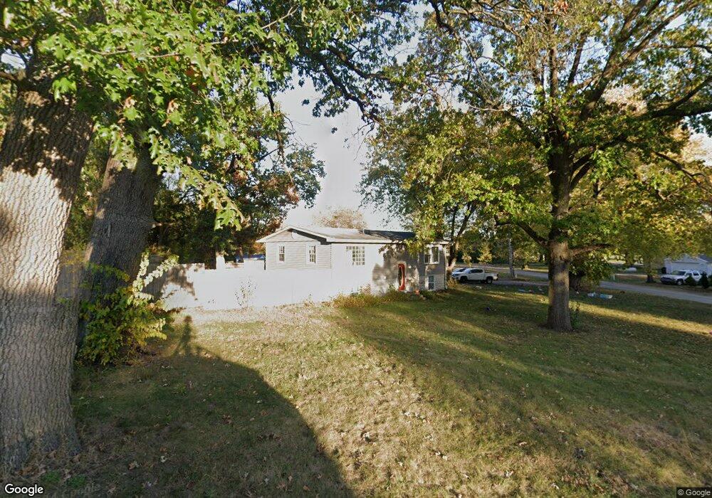
9045 Pheasant Trace West Dr Demotte, IN 46310
Keener NeighborhoodEstimated Value: $271,000 - $303,000
4
Beds
2
Baths
1,920
Sq Ft
$149/Sq Ft
Est. Value
About This Home
This home is located at 9045 Pheasant Trace West Dr, Demotte, IN 46310 and is currently estimated at $286,298, approximately $149 per square foot. 9045 Pheasant Trace West Dr is a home located in Jasper County with nearby schools including Kankakee Valley High School.
Ownership History
Date
Name
Owned For
Owner Type
Purchase Details
Closed on
Oct 18, 2021
Sold by
Stalbaum Julie and Stalbaum Matthew
Bought by
Buckmaster William A
Current Estimated Value
Home Financials for this Owner
Home Financials are based on the most recent Mortgage that was taken out on this home.
Original Mortgage
$215,916
Outstanding Balance
$196,895
Interest Rate
2.8%
Mortgage Type
FHA
Estimated Equity
$89,403
Purchase Details
Closed on
May 12, 2016
Sold by
Skrzekut Tammy
Bought by
Stalbaum Julie and Stalbaum Matthew
Home Financials for this Owner
Home Financials are based on the most recent Mortgage that was taken out on this home.
Original Mortgage
$154,138
Interest Rate
3.61%
Mortgage Type
New Conventional
Purchase Details
Closed on
May 29, 2015
Sold by
Fannie Mae
Bought by
Skrzekut Tanimy
Create a Home Valuation Report for This Property
The Home Valuation Report is an in-depth analysis detailing your home's value as well as a comparison with similar homes in the area
Home Values in the Area
Average Home Value in this Area
Purchase History
| Date | Buyer | Sale Price | Title Company |
|---|---|---|---|
| Buckmaster William A | -- | Fidelity National Title | |
| Stalbaum Julie | -- | Chicago Title Insurance Comp | |
| Skrzekut Tanimy | -- | None Available |
Source: Public Records
Mortgage History
| Date | Status | Borrower | Loan Amount |
|---|---|---|---|
| Open | Buckmaster William A | $215,916 | |
| Previous Owner | Stalbaum Julie | $154,138 |
Source: Public Records
Tax History Compared to Growth
Tax History
| Year | Tax Paid | Tax Assessment Tax Assessment Total Assessment is a certain percentage of the fair market value that is determined by local assessors to be the total taxable value of land and additions on the property. | Land | Improvement |
|---|---|---|---|---|
| 2024 | $1,006 | $212,300 | $30,300 | $182,000 |
| 2023 | $837 | $199,000 | $30,300 | $168,700 |
| 2022 | $776 | $169,600 | $26,800 | $142,800 |
| 2021 | $699 | $151,700 | $25,100 | $126,600 |
| 2020 | $731 | $150,100 | $25,100 | $125,000 |
| 2019 | $727 | $150,300 | $25,100 | $125,200 |
| 2018 | $661 | $142,800 | $25,100 | $117,700 |
| 2017 | $639 | $143,900 | $25,100 | $118,800 |
| 2016 | $495 | $124,200 | $25,100 | $99,100 |
| 2014 | $1,049 | $123,700 | $25,100 | $98,600 |
Source: Public Records
Map
Nearby Homes
- 9062 Pheasant Trace Dr W
- 9321 W 950 N
- 10603 Georgetown Dr
- 11546 Georgetown Dr
- 5826 E 1042 N
- 10792 N 600 E
- 11565 Sherwood Dr
- 10881 N 565 E
- 10901 N 555 E
- 5592 E 1100 N
- 29.029 Acres E 900 N
- 5338 E Lawler Ct Unit 67
- 11299 West Dr
- 5527 E 1146 N
- 9004 Estates Dr
- 10446 N 500 E
- 9508 Coral Ct
- 10307 N 477 E
- 10447 N 477 E
- 9858 W Rustic Dr
- 9045 Pheasant Trace Dr W
- 9045 Pheasant Dr W
- 9045 Pheasant Trace
- 9042 Pheasant Trace West Dr
- 9032 Pheasant Trace
- 9032 Pheasant Trace West Dr
- 9054 Holmes Terrace E
- 9055 Pheasant Trace Dr W
- 9055 Pheasant Trace West Dr
- 9052 Pheasant Trace West Dr
- 9022 Pheasant Trace West Dr
- 9025 Pheasant Trace West Dr
- 9064 Holmes Terrace E
- 10400 W State Road 10
- 9065 Pheasant Trace West Dr
- 9034 Holmes Terrace E
- 9015 Pheasant Trace West Dr
- 9047 Holmes Terrace E
- 9057 Holmes Terrace E
- 9012 Pheasant Trace West Dr