
Seller's Agent in 2025
Karmen Spears
POWER Realty Chicagoland,PLLC
(708) 466-9128
3 in this area
148 Total Sales
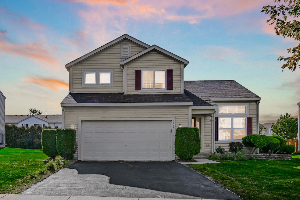
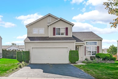
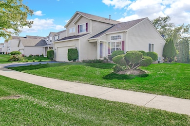

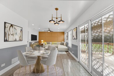
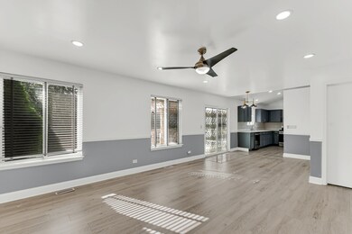
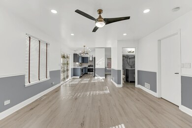
Move-in ready and freshly painted, this modern home offers 3 bedrooms, 2.5 bathrooms, and flexible living with both a separate living room and a family room. Recessed lighting and contemporary fixtures brighten the interior. An updated main-level powder room adds convenience for guests. Enjoy indoor-outdoor living from the family room to the deck overlooking the tranquil backyard. The spacious primary suite features an en-suite bath, a walk-in closet, and additional storage. A main-level laundry room with washer/dryer enhances everyday ease. Notable updates include a roof (approx. 5 years) and hot water tank (2019). Welcome home.
Last Agent to Sell the Property
POWER Realty Chicagoland,PLLC License #471020930 Listed on: 09/09/2025
| Date | Type | Sale Price | Title Company |
|---|---|---|---|
| Warranty Deed | $362,000 | None Listed On Document | |
| Warranty Deed | $199,500 | Cti |
| Date | Status | Loan Amount | Loan Type |
|---|---|---|---|
| Open | $362,000 | VA | |
| Previous Owner | $192,600 | Unknown |
| Date | Event | Price | List to Sale | Price per Sq Ft |
|---|---|---|---|---|
| 10/10/2025 10/10/25 | Sold | $362,000 | +2.0% | $194 / Sq Ft |
| 09/15/2025 09/15/25 | Pending | -- | -- | -- |
| 09/08/2025 09/08/25 | For Sale | $355,000 | -- | $190 / Sq Ft |
| Year | Tax Paid | Tax Assessment Tax Assessment Total Assessment is a certain percentage of the fair market value that is determined by local assessors to be the total taxable value of land and additions on the property. | Land | Improvement |
|---|---|---|---|---|
| 2025 | $9,372 | $25,924 | $5,626 | $20,298 |
| 2024 | $9,372 | $25,924 | $5,626 | $20,298 |
| 2023 | $5,553 | $25,924 | $5,626 | $20,298 |
| 2022 | $5,553 | $13,794 | $4,859 | $8,935 |
| 2021 | $5,654 | $13,792 | $4,858 | $8,934 |
| 2020 | $5,582 | $13,792 | $4,858 | $8,934 |
| 2019 | $8,182 | $18,405 | $4,347 | $14,058 |
| 2018 | $8,060 | $18,405 | $4,347 | $14,058 |
| 2017 | $7,869 | $18,405 | $4,347 | $14,058 |
| 2016 | $7,635 | $17,250 | $3,835 | $13,415 |
| 2015 | $7,432 | $17,250 | $3,835 | $13,415 |
| 2014 | $7,662 | $18,067 | $3,835 | $14,232 |
| 2013 | $6,926 | $17,684 | $3,835 | $13,849 |
Seller's Agent in 2025
Karmen Spears
POWER Realty Chicagoland,PLLC
(708) 466-9128
3 in this area
148 Total Sales
Buyer's Agent in 2025
Gabriel Misters
The McDonald Group
(708) 514-7937
3 in this area
23 Total Sales
Source: Midwest Real Estate Data (MRED)
MLS Number: 12464836
APN: 31-20-116-010-0000
Disclaimer: Certain information contained herein is derived from information provided by parties other than Homes.com. All information provided is deemed reliable, but is not guaranteed to be accurate and should be independently verified.
![]() Based on information submitted to the MLS GRID. All data is obtained from various sources and may not have been verified by broker or MLS GRID. Supplied Open House Information is subject to change without notice. All information should be independently reviewed and verified for accuracy. Properties may or may not be listed by the office/agent presenting the information. Some IDX listings have been excluded from this website.
Based on information submitted to the MLS GRID. All data is obtained from various sources and may not have been verified by broker or MLS GRID. Supplied Open House Information is subject to change without notice. All information should be independently reviewed and verified for accuracy. Properties may or may not be listed by the office/agent presenting the information. Some IDX listings have been excluded from this website.
Based on information submitted to the MLS GRID
Ask me questions while you tour the home.