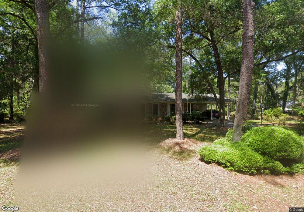
906 Forrest Ln Beaufort, SC 29902
Estimated Value: $476,351 - $606,000
3
Beds
2
Baths
1,949
Sq Ft
$278/Sq Ft
Est. Value
About This Home
This home is located at 906 Forrest Ln, Beaufort, SC 29902 and is currently estimated at $542,088, approximately $278 per square foot. 906 Forrest Ln is a home located in Beaufort County with nearby schools including Mossy Oaks Elementary School, Beaufort Middle School, and Beaufort High School.
Ownership History
Date
Name
Owned For
Owner Type
Purchase Details
Closed on
Oct 3, 2008
Sold by
Vail Joyce L
Bought by
Oquinn William E and Oquinn Nadine
Current Estimated Value
Home Financials for this Owner
Home Financials are based on the most recent Mortgage that was taken out on this home.
Original Mortgage
$260,100
Outstanding Balance
$168,840
Interest Rate
6.45%
Mortgage Type
Purchase Money Mortgage
Estimated Equity
$373,248
Purchase Details
Closed on
Jul 5, 2005
Sold by
Estate Of Louise T Anders and Thompson William P
Bought by
Vail Joyce L
Home Financials for this Owner
Home Financials are based on the most recent Mortgage that was taken out on this home.
Original Mortgage
$188,000
Interest Rate
6.77%
Mortgage Type
Fannie Mae Freddie Mac
Create a Home Valuation Report for This Property
The Home Valuation Report is an in-depth analysis detailing your home's value as well as a comparison with similar homes in the area
Purchase History
| Date | Buyer | Sale Price | Title Company |
|---|---|---|---|
| Oquinn William E | $289,000 | -- | |
| Vail Joyce L | $235,000 | -- |
Source: Public Records
Mortgage History
| Date | Status | Borrower | Loan Amount |
|---|---|---|---|
| Open | Oquinn William E | $260,100 | |
| Previous Owner | Vail Joyce L | $188,000 | |
| Closed | Vail Joyce L | $47,000 |
Source: Public Records
Tax History
| Year | Tax Paid | Tax Assessment Tax Assessment Total Assessment is a certain percentage of the fair market value that is determined by local assessors to be the total taxable value of land and additions on the property. | Land | Improvement |
|---|---|---|---|---|
| 2025 | $5,734 | $17,990 | $0 | $0 |
| 2024 | $5,734 | $20,736 | $1,400 | $19,336 |
| 2023 | $5,656 | $20,736 | $1,400 | $19,336 |
| 2022 | $4,911 | $11,676 | $1,400 | $10,276 |
| 2021 | $2,012 | $11,676 | $1,400 | $10,276 |
| 2020 | $2,017 | $11,676 | $1,400 | $10,276 |
| 2019 | $1,943 | $11,676 | $1,400 | $10,276 |
| 2018 | $1,905 | $10,430 | $0 | $0 |
| 2017 | $1,641 | $9,070 | $0 | $0 |
| 2016 | $1,622 | $6,360 | $0 | $0 |
| 2014 | $1,127 | $6,360 | $0 | $0 |
Source: Public Records
Map
Nearby Homes
- 1109 Old Trail Rd
- 115 Cedar Grove Cir
- 160 Cedar Grove Cir
- 1185 Brotherhood Way
- 900 Brotherhood Rd Unit D1
- 900 Brotherhood Rd Unit E-3
- 1110 Hookstra Ln
- 2677 Broad St
- 2608 Boyer St
- 2668 Broad St
- 2514 Acorn Hill Ave
- 1205 Duncan Dr
- 2504 Duncan Dr
- 2408 Langhorne Dr
- 2622 Joshua Cir
- Tbd Talbird Rd
- 256 de La Gaye Point
- 220 de La Gaye Point
- 324 de La Gaye Point
- 304 de La Gaye Point
- 908 Forrest Ln
- 905 Forrest Ln
- 902 Forrest Ln
- 907 Forrest Ln
- 909 Forrest Ln
- 901 Forrest Ln
- 1008 Battery Creek Rd
- 2806 Mossy Oaks Rd
- 2809 Broome Ln
- 910 Battery Creek Rd
- 2813 Broome Ln
- 2815 Broome Ln
- 2811 Broome Ln
- 2804 Broome Ln
- 2810 Mossy Oaks Rd
- 1010 Battery Creek Rd
- 2807 Broome Ln
- 2814 W Royal Oaks Dr
- 2812 W Royal Oaks Dr
- 1108 Old Trail Rd
Your Personal Tour Guide
Ask me questions while you tour the home.