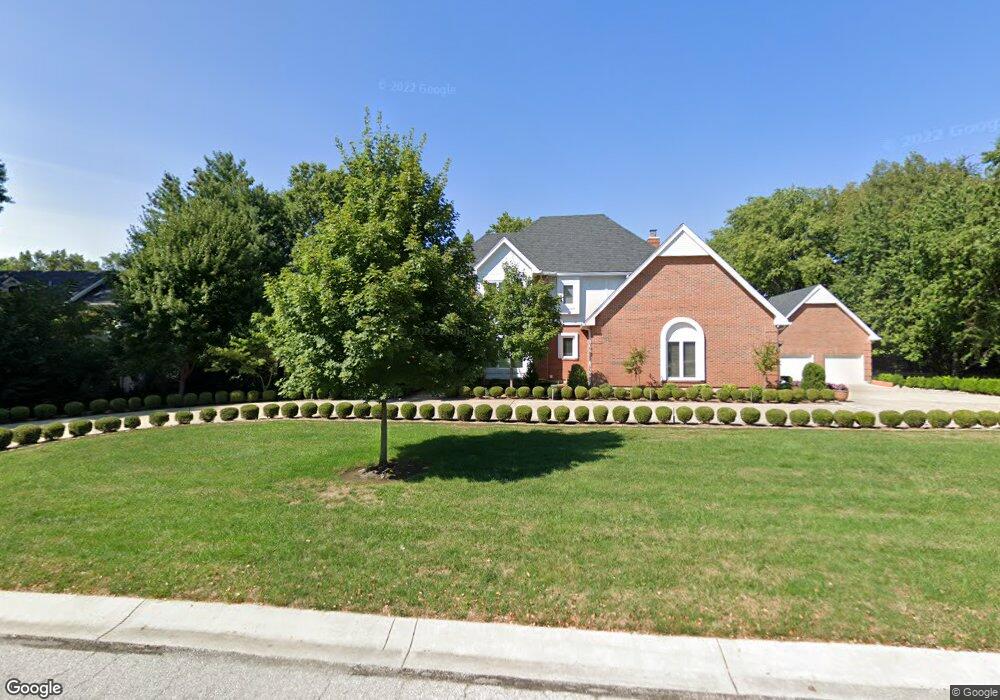
906 W Burning Tree Dr Kansas City, MO 64145
Blue Hills Estates NeighborhoodEstimated Value: $660,000 - $854,000
4
Beds
5
Baths
4,206
Sq Ft
$180/Sq Ft
Est. Value
About This Home
This home is located at 906 W Burning Tree Dr, Kansas City, MO 64145 and is currently estimated at $756,421, approximately $179 per square foot. 906 W Burning Tree Dr is a home located in Jackson County with nearby schools including Martin City Elementary School, Grandview High School, and Calvary Lutheran School.
Ownership History
Date
Name
Owned For
Owner Type
Purchase Details
Closed on
Oct 29, 2020
Sold by
Robert E Dearing Revocable Trust
Bought by
Dearing Robert E and Robert E Dearing Family Trust
Current Estimated Value
Purchase Details
Closed on
Mar 27, 2008
Sold by
Dearing Robert E and Dearing Marilyn
Bought by
Dearing Robert E and Robert E Dearing Revocable Trust
Purchase Details
Closed on
Aug 5, 2004
Sold by
Dearing Marilyn and Dearing Robert E
Bought by
Dearing Robert E and Dearing Marilyn
Home Financials for this Owner
Home Financials are based on the most recent Mortgage that was taken out on this home.
Original Mortgage
$200,000
Interest Rate
6.26%
Mortgage Type
Credit Line Revolving
Purchase Details
Closed on
Mar 31, 2000
Sold by
Dearing Dawn
Bought by
Dearing Robert E
Create a Home Valuation Report for This Property
The Home Valuation Report is an in-depth analysis detailing your home's value as well as a comparison with similar homes in the area
Home Values in the Area
Average Home Value in this Area
Purchase History
| Date | Buyer | Sale Price | Title Company |
|---|---|---|---|
| Dearing Robert E | -- | None Available | |
| Dearing Robert E | -- | None Available | |
| Dearing Robert E | -- | Ctic | |
| Dearing Robert E | -- | -- |
Source: Public Records
Mortgage History
| Date | Status | Borrower | Loan Amount |
|---|---|---|---|
| Previous Owner | Dearing Robert E | $200,000 |
Source: Public Records
Tax History Compared to Growth
Tax History
| Year | Tax Paid | Tax Assessment Tax Assessment Total Assessment is a certain percentage of the fair market value that is determined by local assessors to be the total taxable value of land and additions on the property. | Land | Improvement |
|---|---|---|---|---|
| 2025 | $11,933 | $147,668 | $11,888 | $135,780 |
| 2024 | $11,719 | $140,600 | $13,469 | $127,131 |
| 2023 | $11,719 | $143,549 | $10,353 | $133,196 |
| 2022 | $11,788 | $131,100 | $12,258 | $118,842 |
| 2021 | $11,786 | $131,100 | $12,258 | $118,842 |
| 2020 | $10,424 | $122,593 | $12,258 | $110,335 |
| 2019 | $9,943 | $122,593 | $12,258 | $110,335 |
| 2018 | $9,110 | $106,696 | $10,669 | $96,027 |
| 2017 | $9,110 | $106,696 | $10,669 | $96,027 |
| 2016 | $8,410 | $96,988 | $10,481 | $86,507 |
| 2014 | $8,360 | $95,086 | $10,275 | $84,811 |
Source: Public Records
Map
Nearby Homes
- 12716 Oakmont Dr
- 12380 Summit St
- 12763 Overbrook Rd
- 1985 W 123rd Place
- 12501 Sagamore Rd
- 905 W 122nd Terrace
- 12768 Overbrook Rd
- 2313 W 127th St
- 1013 W Santa fe Trail
- 703 Tam-O-shanter Dr
- 12208 Avila Dr
- 302 Duke Gibson Dr
- 2218 Condolea Terrace
- 2229 Condolea Terrace
- 12200 Avila Dr
- 12200 Grand Ave
- 9 E 127th Terrace
- 12854 Cambridge Terrace
- 1105 W Santa fe Trail
- 202 E 127th St
- 900 W Burning Tree Dr
- 901 W Burning Tree Dr
- 913 W Burning Tree Dr
- 912 W Burning Tree Dr
- 917 W Burning Tree Dr
- 901 W 125th Terrace
- 914 W Burning Tree Dr
- 809 W 125th Terrace
- 907 W 125th Terrace
- 801 W 125th Terrace
- 12617 Saint Andrews Dr
- 916 W Burning Tree Dr
- 904 W 125th Terrace
- 12617 Saint Andrew Dr
- 911 W 125th Terrace
- 12647 Oakmont Dr
- 12643 Oakmont Dr
- 908 W 125th Terrace
- 810 W 125th Terrace
- 12651 Oakmont Dr