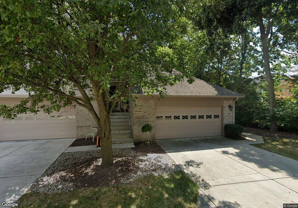
9069 Thoreau Ct Unit 43 Fishers, IN 46037
Estimated Value: $298,266 - $318,000
2
Beds
2
Baths
1,648
Sq Ft
$189/Sq Ft
Est. Value
About This Home
This home is located at 9069 Thoreau Ct Unit 43, Fishers, IN 46037 and is currently estimated at $311,317, approximately $188 per square foot. 9069 Thoreau Ct Unit 43 is a home located in Hamilton County with nearby schools including Lantern Road Elementary School, Riverside Junior High School, and Riverside Intermediate School.
Ownership History
Date
Name
Owned For
Owner Type
Purchase Details
Closed on
Jun 27, 2022
Sold by
Smith Jeffrey H and Smith Jeanne C
Bought by
Smith Jeffrey H
Current Estimated Value
Purchase Details
Closed on
Feb 28, 2006
Sold by
The Dorothea Eileen Stewart & Kay Stewar
Bought by
Smith Jeffrey H and Smith Jeanne C
Home Financials for this Owner
Home Financials are based on the most recent Mortgage that was taken out on this home.
Original Mortgage
$125,200
Interest Rate
6.34%
Mortgage Type
Fannie Mae Freddie Mac
Create a Home Valuation Report for This Property
The Home Valuation Report is an in-depth analysis detailing your home's value as well as a comparison with similar homes in the area
Home Values in the Area
Average Home Value in this Area
Purchase History
| Date | Buyer | Sale Price | Title Company |
|---|---|---|---|
| Smith Jeffrey H | -- | Devine-Ransom Carrie C | |
| Smith Jeffrey H | -- | None Available |
Source: Public Records
Mortgage History
| Date | Status | Borrower | Loan Amount |
|---|---|---|---|
| Previous Owner | Smith Jeffrey H | $125,200 |
Source: Public Records
Tax History Compared to Growth
Tax History
| Year | Tax Paid | Tax Assessment Tax Assessment Total Assessment is a certain percentage of the fair market value that is determined by local assessors to be the total taxable value of land and additions on the property. | Land | Improvement |
|---|---|---|---|---|
| 2024 | $3,145 | $277,200 | $84,000 | $193,200 |
| 2023 | $2,894 | $267,100 | $41,300 | $225,800 |
| 2022 | $2,463 | $217,100 | $41,300 | $175,800 |
| 2021 | $1,936 | $179,700 | $41,300 | $138,400 |
| 2020 | $1,769 | $165,000 | $41,300 | $123,700 |
| 2019 | $1,709 | $160,400 | $36,000 | $124,400 |
| 2018 | $1,728 | $161,800 | $36,000 | $125,800 |
| 2017 | $1,613 | $155,200 | $36,000 | $119,200 |
| 2016 | $1,577 | $153,400 | $36,000 | $117,400 |
| 2014 | $1,129 | $130,400 | $40,900 | $89,500 |
| 2013 | $1,129 | $131,400 | $40,900 | $90,500 |
Source: Public Records
Map
Nearby Homes
- 10414 Muir Ln
- 9275 Muir Ln
- 9825 Covington Blvd
- 9735 Logan Ln
- 9259 Oak Knoll Ln
- 8809 Haddington Dr N
- 9234 Crossing Dr
- 10747 Red Pine Dr
- 9237 Crossing Dr
- 9972 Woods Edge Dr
- 9362 Helmsdale Dr
- 8903 Buckhaven Dr
- 8533 Legacy Ct
- 9103 Sargent Rd
- 10132 Lauren Pass
- 10272 Whitetail Cir
- 10661 Burning Ridge Ln
- 10009 Northwind Cir
- 11359 Cumberland Rd
- 10518 Greenway Dr
- 9069 Thoreau Ct
- 9077 Thoreau Ct
- 9093 Thoreau Ct
- 9085 Thoreau Ct
- 9078 Thoreau Ct
- 9078 Thoreau Ct Unit 42
- 9086 Thoreau Ct
- 9086 Thoreau Ct Unit 9086
- 9086 Thoreau Ct Unit C
- 9070 Thoreau Ct
- 9068 Alcott Ct
- 9068 Alcott Ct Unit 51
- 9094 Thoreau Ct
- 9092 Alcott Ct
- 9109 Thoreau Ct
- 9101 Thoreau Ct
- 9102 Thoreau Ct
- 9076 Alcott Ct
- 9084 Alcott Ct
- 9125 Thoreau Ct