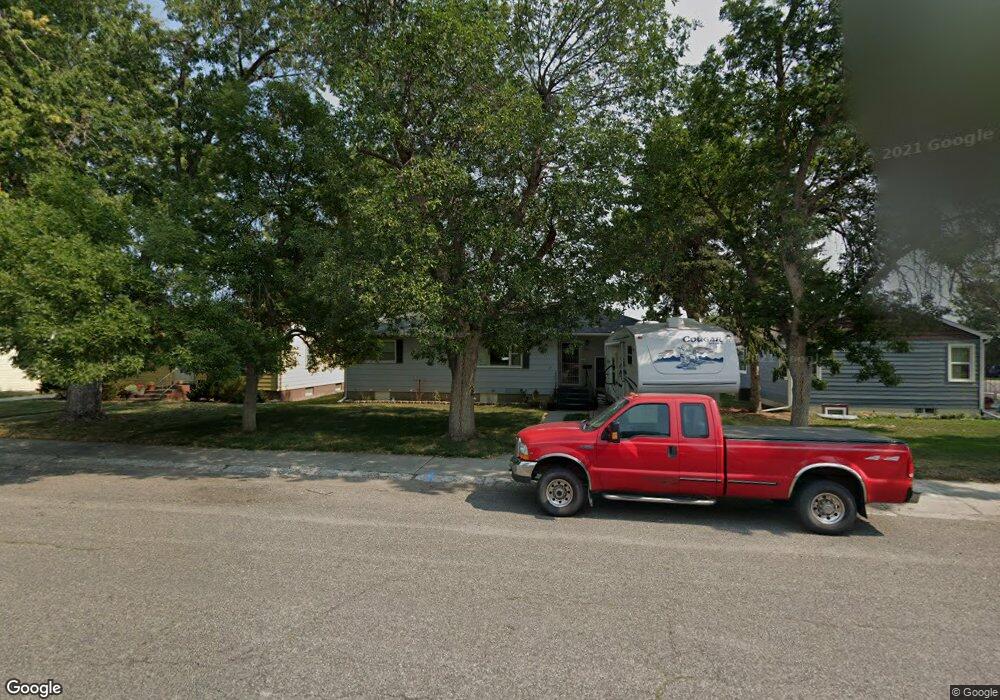
907 2nd Ave Laurel, MT 59044
Estimated Value: $286,000 - $315,000
4
Beds
2
Baths
1,744
Sq Ft
$176/Sq Ft
Est. Value
About This Home
This home is located at 907 2nd Ave, Laurel, MT 59044 and is currently estimated at $307,587, approximately $176 per square foot. 907 2nd Ave is a home located in Yellowstone County with nearby schools including Fred W. Graff School, West School, and Laurel Middle School.
Ownership History
Date
Name
Owned For
Owner Type
Purchase Details
Closed on
Jun 16, 2023
Sold by
Siring Michael
Bought by
Hull Halley Dawnn and Heil James
Current Estimated Value
Home Financials for this Owner
Home Financials are based on the most recent Mortgage that was taken out on this home.
Original Mortgage
$276,300
Outstanding Balance
$268,858
Interest Rate
6.35%
Mortgage Type
New Conventional
Estimated Equity
$38,729
Purchase Details
Closed on
May 19, 2011
Sold by
Tomljenovich Kimberlee R
Bought by
Siring Michael
Home Financials for this Owner
Home Financials are based on the most recent Mortgage that was taken out on this home.
Original Mortgage
$146,099
Interest Rate
4.75%
Mortgage Type
FHA
Purchase Details
Closed on
Jun 15, 2010
Sold by
Phillips Ted L and Phillips Lenora A
Bought by
Tomljenovich Kimberlee B
Create a Home Valuation Report for This Property
The Home Valuation Report is an in-depth analysis detailing your home's value as well as a comparison with similar homes in the area
Home Values in the Area
Average Home Value in this Area
Purchase History
| Date | Buyer | Sale Price | Title Company |
|---|---|---|---|
| Hull Halley Dawnn | $6,000 | Stewart Title Company | |
| Siring Michael | -- | St | |
| Tomljenovich Kimberlee B | -- | None Available |
Source: Public Records
Mortgage History
| Date | Status | Borrower | Loan Amount |
|---|---|---|---|
| Open | Hull Halley Dawnn | $276,300 | |
| Previous Owner | Siring Michael | $146,099 |
Source: Public Records
Tax History
| Year | Tax Paid | Tax Assessment Tax Assessment Total Assessment is a certain percentage of the fair market value that is determined by local assessors to be the total taxable value of land and additions on the property. | Land | Improvement |
|---|---|---|---|---|
| 2025 | $2,600 | $314,800 | $59,950 | $254,850 |
| 2024 | $2,600 | $262,300 | $39,017 | $223,283 |
| 2023 | $2,097 | $224,500 | $39,017 | $185,483 |
| 2022 | $1,569 | $188,000 | $0 | $0 |
| 2021 | $1,878 | $188,000 | $0 | $0 |
| 2020 | $1,662 | $163,100 | $0 | $0 |
| 2019 | $1,687 | $163,100 | $0 | $0 |
| 2018 | $1,645 | $153,700 | $0 | $0 |
| 2017 | $1,529 | $153,700 | $0 | $0 |
| 2016 | $1,468 | $148,900 | $0 | $0 |
| 2015 | $1,451 | $148,900 | $0 | $0 |
| 2014 | $1,395 | $74,942 | $0 | $0 |
Source: Public Records
Map
Nearby Homes
- 1003 Montana Ave
- 110 E 5th St
- 109 E 12th St
- 516 Pennsylvania Ave
- 601 E 5th St
- 1319 Valley Dr
- 1109 10th Ave
- 116 4th Ave
- 717 E 5th St
- 717 E 5th, 506 Alder Ave
- 310 (and 814 w 4) 8th Ave
- 801 E 4th St
- 1013 W 12th St
- 102 8th Ave Unit B
- 1104 E 8th St
- 1108 E 8th St
- 1106 Sunhaven Dr
- 605 Date Ave
- 611 Elm Ave
- 1031 Fir Ave
Your Personal Tour Guide
Ask me questions while you tour the home.