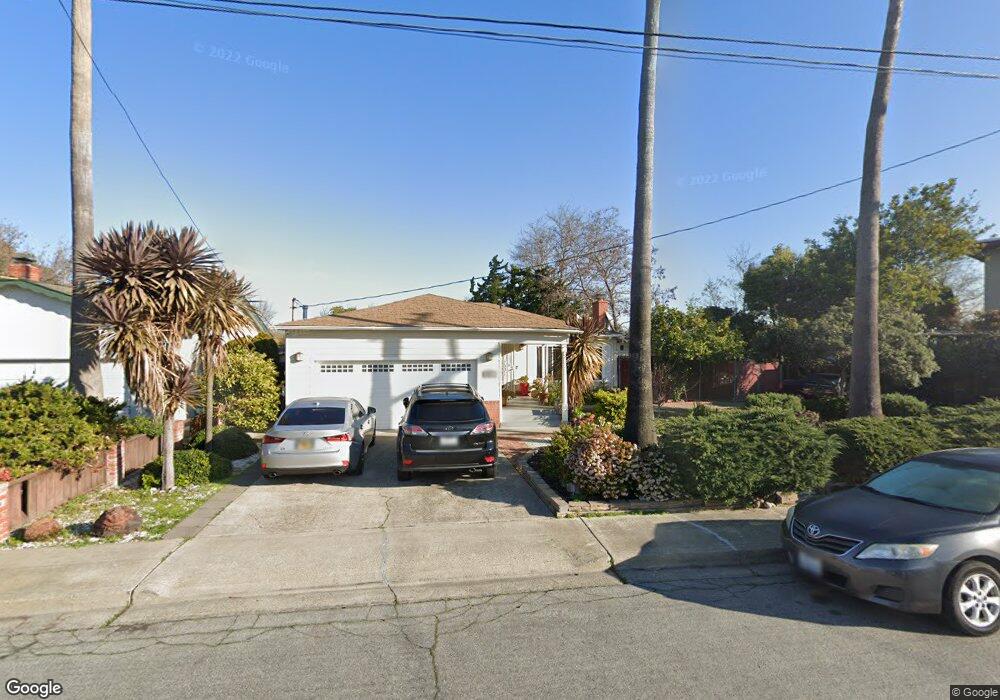
907 Burkhart Ave San Leandro, CA 94579
Washington Manor-Bonaire NeighborhoodEstimated Value: $824,000 - $892,816
3
Beds
2
Baths
1,246
Sq Ft
$691/Sq Ft
Est. Value
About This Home
This home is located at 907 Burkhart Ave, San Leandro, CA 94579 and is currently estimated at $861,204, approximately $691 per square foot. 907 Burkhart Ave is a home located in Alameda County with nearby schools including Dayton Elementary School, Washington Manor Middle School, and Arroyo High School.
Ownership History
Date
Name
Owned For
Owner Type
Purchase Details
Closed on
Nov 24, 2023
Sold by
Romero Rommel M and Romero Josefina F
Bought by
Rommel M Romero And Josefina F Romero Living and Romero
Current Estimated Value
Purchase Details
Closed on
Oct 28, 2013
Sold by
Hernandez Gloria
Bought by
Romero Josefina F and Romero Rommel M
Home Financials for this Owner
Home Financials are based on the most recent Mortgage that was taken out on this home.
Original Mortgage
$399,000
Interest Rate
4.46%
Mortgage Type
New Conventional
Create a Home Valuation Report for This Property
The Home Valuation Report is an in-depth analysis detailing your home's value as well as a comparison with similar homes in the area
Home Values in the Area
Average Home Value in this Area
Purchase History
| Date | Buyer | Sale Price | Title Company |
|---|---|---|---|
| Rommel M Romero And Josefina F Romero Living | -- | None Listed On Document | |
| Romero Josefina F | $420,000 | Chicago Title Company |
Source: Public Records
Mortgage History
| Date | Status | Borrower | Loan Amount |
|---|---|---|---|
| Previous Owner | Romero Josefina F | $399,000 |
Source: Public Records
Tax History
| Year | Tax Paid | Tax Assessment Tax Assessment Total Assessment is a certain percentage of the fair market value that is determined by local assessors to be the total taxable value of land and additions on the property. | Land | Improvement |
|---|---|---|---|---|
| 2025 | $6,533 | $507,840 | $154,452 | $360,388 |
| 2024 | $6,533 | $497,747 | $151,424 | $353,323 |
| 2023 | $6,503 | $487,851 | $148,455 | $346,396 |
| 2022 | $6,406 | $478,150 | $145,545 | $339,605 |
| 2021 | $6,228 | $468,641 | $142,692 | $332,949 |
| 2020 | $6,091 | $470,764 | $141,229 | $329,535 |
| 2019 | $6,100 | $461,537 | $138,461 | $323,076 |
| 2018 | $5,754 | $452,490 | $135,747 | $316,743 |
| 2017 | $5,487 | $443,620 | $133,086 | $310,534 |
| 2016 | $5,358 | $434,921 | $130,476 | $304,445 |
| 2015 | $5,240 | $428,391 | $128,517 | $299,874 |
| 2014 | $5,161 | $420,000 | $126,000 | $294,000 |
Source: Public Records
Map
Nearby Homes
- 874 Lewelling Blvd
- 690 Fargo Ave Unit 16
- 720 Fargo Ave Unit 14
- 759 Woodgate Dr
- 670 Fargo Ave Unit 5
- 15185 Norton St
- 15040 Fleming St
- 15016 Fleming St
- 1078 Via Enrico
- 15106 Edgemoor St
- 15090 Edgemoor St
- 15018 Edgemoor St
- 1343 Fargo Ave
- 1540 Sayre St
- 15781 Via Teresa
- 391 Anza Way
- 1250 Hubbard Ave
- 1647 Lanier Ave
- 0 E 14th St Unit 41122018
- 15524 Montreal St
- 915 Burkhart Ave
- 916 Burkhart Ave
- 908 Burkhart Ave
- 923 Burkhart Ave
- 941 Lewelling Blvd Unit 204
- 941 Lewelling Blvd Unit 312
- 941 Lewelling Blvd Unit 304
- 941 Lewelling Blvd
- 15320 Sullivan Ave
- 15326 Sullivan Ave
- 931 Burkhart Ave
- 15332 Sullivan Ave
- 15369 Bay Port Ct
- 939 Burkhart Ave
- 15338 Sullivan Ave
- 15367 Bay Port Ct
- 15365 Bay Port Ct
- 946 Burkhart Ave
- 947 Burkhart Ave
- 15344 Sullivan Ave
Your Personal Tour Guide
Ask me questions while you tour the home.