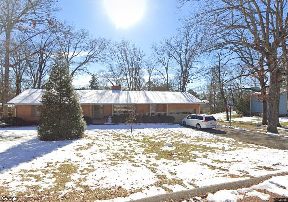
907 Crown Point Rd W Unit 2 Signal Mountain, TN 37377
Estimated Value: $504,000 - $585,000
3
Beds
2
Baths
2,579
Sq Ft
$207/Sq Ft
Est. Value
About This Home
This home is located at 907 Crown Point Rd W Unit 2, Signal Mountain, TN 37377 and is currently estimated at $533,386, approximately $206 per square foot. 907 Crown Point Rd W Unit 2 is a home located in Hamilton County with nearby schools including Thrasher Elementary School, Signal Mountain Middle/High School, and Signal Mountain Christian School.
Ownership History
Date
Name
Owned For
Owner Type
Purchase Details
Closed on
May 17, 2011
Sold by
Pharr Grace F and Harris Martha Pharr
Bought by
Dysinger Charles E and Dysinger Ingrid E
Current Estimated Value
Home Financials for this Owner
Home Financials are based on the most recent Mortgage that was taken out on this home.
Original Mortgage
$180,500
Outstanding Balance
$125,266
Interest Rate
4.85%
Mortgage Type
New Conventional
Estimated Equity
$408,120
Create a Home Valuation Report for This Property
The Home Valuation Report is an in-depth analysis detailing your home's value as well as a comparison with similar homes in the area
Home Values in the Area
Average Home Value in this Area
Purchase History
| Date | Buyer | Sale Price | Title Company |
|---|---|---|---|
| Dysinger Charles E | $190,000 | Title Guaranty & Trust Co |
Source: Public Records
Mortgage History
| Date | Status | Borrower | Loan Amount |
|---|---|---|---|
| Open | Dysinger Charles E | $180,500 |
Source: Public Records
Tax History Compared to Growth
Tax History
| Year | Tax Paid | Tax Assessment Tax Assessment Total Assessment is a certain percentage of the fair market value that is determined by local assessors to be the total taxable value of land and additions on the property. | Land | Improvement |
|---|---|---|---|---|
| 2024 | $1,651 | $73,800 | $0 | $0 |
| 2023 | $1,651 | $73,800 | $0 | $0 |
| 2022 | $1,651 | $73,800 | $0 | $0 |
| 2021 | $1,651 | $73,800 | $0 | $0 |
| 2020 | $1,646 | $59,525 | $0 | $0 |
| 2019 | $1,646 | $59,525 | $0 | $0 |
| 2018 | $1,646 | $59,525 | $0 | $0 |
| 2017 | $1,646 | $59,525 | $0 | $0 |
| 2016 | $1,490 | $0 | $0 | $0 |
| 2015 | $1,490 | $53,875 | $0 | $0 |
| 2014 | $1,490 | $0 | $0 | $0 |
Source: Public Records
Map
Nearby Homes
- 422 Timberlinks Dr
- 102 Sunnybrook Trail
- 421 Timberlinks Dr
- 5734 U S 127
- 907 Kentucky Ave
- 1018 Ridgeway Ave
- 853 Kentucky Ave
- 779 James Blvd
- 958 Signal Rd
- 928 Ridgeway Ave
- 905 Ridgeway Ave
- 533 Fern Trail
- 12 Mountain Orchard Path
- 185 Woodcliff Cir
- 714 Berry Spring Path
- 0 Majestic Oaks Dr Unit 24033570
- 10 Acres Majestic Oaks Dr
- 16 Northfield Rd
- 10 Majestic Oaks Dr
- 1301 E Brow Rd
- 905 Crown Point Rd W
- 911 Crown Point Rd W
- 910 Crown Point Rd E
- 908 Crown Point Rd W
- 912 Crown Point Rd E
- 908 Crown Point Rd E
- 906 Crown Point Rd W
- 910 Crown Point Rd W
- 903 Crown Point Rd W
- 202 Echo Way
- 914 Crown Point Rd E
- 914 Crown Point Rd E Unit 1
- 914 Crown Point Rd W
- 904 Crown Point Rd W
- 912 Crown Point Rd W
- 906 Crown Point Rd E
- 911 Crown Point Rd E
- 911 Glamis Cir
- 909 Glamis Cir
- 909 Glamis Cir Unit 2