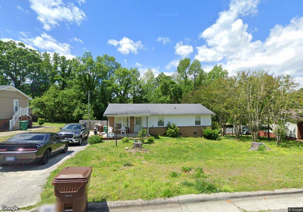
907 Enterprise Dr High Point, NC 27260
Greater High Point NeighborhoodEstimated Value: $181,761 - $264,000
4
Beds
3
Baths
1,728
Sq Ft
$133/Sq Ft
Est. Value
About This Home
This home is located at 907 Enterprise Dr, High Point, NC 27260 and is currently estimated at $229,254, approximately $132 per square foot. 907 Enterprise Dr is a home located in Guilford County with nearby schools including Jamestown Elementary School, Southwest Guilford Middle School, and Southwest Guilford High School.
Ownership History
Date
Name
Owned For
Owner Type
Purchase Details
Closed on
Mar 2, 2022
Sold by
Cain Barbara T and Cain Robert J
Bought by
Ingram John Christian and Ingram Cristine
Current Estimated Value
Home Financials for this Owner
Home Financials are based on the most recent Mortgage that was taken out on this home.
Original Mortgage
$101,000
Interest Rate
3.69%
Mortgage Type
VA
Purchase Details
Closed on
Mar 3, 2011
Sold by
Tyson Gwendolyn S
Bought by
Tyson Ellis Franklin and Tyson Gwendolyn S
Purchase Details
Closed on
Jan 23, 2008
Bought by
Tyson Gwendolyn S
Home Financials for this Owner
Home Financials are based on the most recent Mortgage that was taken out on this home.
Original Mortgage
$66,000
Interest Rate
6.17%
Mortgage Type
Purchase Money Mortgage
Purchase Details
Closed on
Oct 22, 2007
Sold by
Dunn Michael A and Dunn Sandra Hayes
Bought by
Tyson Gwendolyn S
Create a Home Valuation Report for This Property
The Home Valuation Report is an in-depth analysis detailing your home's value as well as a comparison with similar homes in the area
Home Values in the Area
Average Home Value in this Area
Purchase History
| Date | Buyer | Sale Price | Title Company |
|---|---|---|---|
| Ingram John Christian | $101,000 | Law Office Of Bruce Mayberry | |
| Tyson Ellis Franklin | -- | None Available | |
| Tyson Gwendolyn S | -- | -- | |
| Tyson Gwendolyn S | -- | None Available |
Source: Public Records
Mortgage History
| Date | Status | Borrower | Loan Amount |
|---|---|---|---|
| Previous Owner | Ingram John Christian | $101,000 | |
| Previous Owner | Tyson Gwendolyn S | $66,000 |
Source: Public Records
Tax History
| Year | Tax Paid | Tax Assessment Tax Assessment Total Assessment is a certain percentage of the fair market value that is determined by local assessors to be the total taxable value of land and additions on the property. | Land | Improvement |
|---|---|---|---|---|
| 2025 | $1,943 | $141,000 | $22,000 | $119,000 |
| 2024 | $1,943 | $141,000 | $22,000 | $119,000 |
| 2023 | $1,943 | $141,000 | $22,000 | $119,000 |
| 2022 | $1,901 | $141,000 | $22,000 | $119,000 |
| 2021 | $1,479 | $107,300 | $14,000 | $93,300 |
| 2020 | $1,479 | $107,300 | $14,000 | $93,300 |
| 2019 | $1,479 | $107,300 | $0 | $0 |
| 2018 | $1,471 | $107,300 | $0 | $0 |
| 2017 | $1,471 | $107,300 | $0 | $0 |
| 2016 | $1,562 | $111,400 | $0 | $0 |
| 2015 | $1,571 | $111,400 | $0 | $0 |
| 2014 | $1,597 | $111,400 | $0 | $0 |
Source: Public Records
Map
Nearby Homes
- 1451 Finsbury Ln
- 1456 London Dr
- 3206 Crestview Dr
- 3215 E Martin Luther King Junior Dr
- 1402 Darden St
- 210 Morgan Place
- 1707 Brockett Ave
- 1108 Dartmouth Ave
- 1702 Brockett Ave
- 120 Orville Dr
- 600 Hendrix St
- 2305 Delaware Place
- 122 Orville Dr
- 615 Hendrix St
- 1120 Carolina St
- 2507 Suffolk Ave
- 504 Ellwood Dr
- 206 Paramount St
- 1606 Boundary Ave
- 1604 Boundary Ave
- 905 Enterprise Dr
- 909 Enterprise Dr
- 903 Enterprise Dr
- 510 Birdwood Way
- 600 Birdwood Way
- 1001 Enterprise Dr
- 508 Birdwood Way
- 904 Enterprise Dr
- 602 Birdwood Way
- 506 Birdwood Way
- 902 Enterprise Dr
- 901 Enterprise Dr
- 1451 Kingsway Dr
- 504 Birdwood Way
- 604 Birdwood Way
- 1003 Enterprise Dr
- 502 Birdwood Way
- 900 Enterprise Dr
- 606 Birdwood Way
- 1454 Kingsway Dr
Your Personal Tour Guide
Ask me questions while you tour the home.