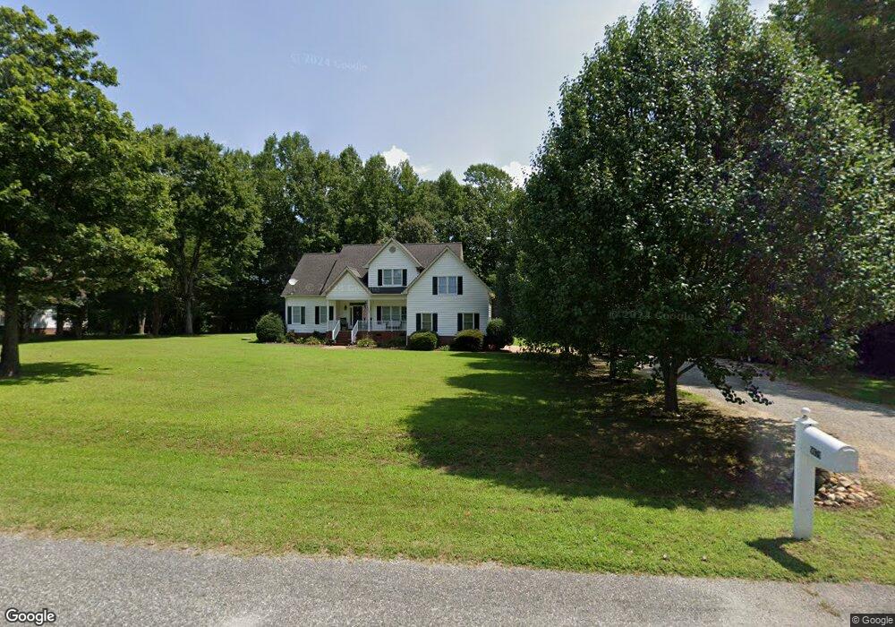
9079 Coles Landing Dr Unit DRIVE Gloucester, VA 23061
Ware Neck NeighborhoodEstimated Value: $371,000 - $568,000
3
Beds
3
Baths
2,028
Sq Ft
$243/Sq Ft
Est. Value
About This Home
This home is located at 9079 Coles Landing Dr Unit DRIVE, Gloucester, VA 23061 and is currently estimated at $492,889, approximately $243 per square foot. 9079 Coles Landing Dr Unit DRIVE is a home located in Gloucester County with nearby schools including Botetourt Elementary School, Peasley Middle School, and Gloucester High School.
Ownership History
Date
Name
Owned For
Owner Type
Purchase Details
Closed on
Aug 3, 2016
Sold by
Mcquillen Gary E
Bought by
St Clair Iii Robert K Beau and St Clair Megan F
Current Estimated Value
Home Financials for this Owner
Home Financials are based on the most recent Mortgage that was taken out on this home.
Original Mortgage
$302,421
Interest Rate
3.5%
Mortgage Type
FHA
Create a Home Valuation Report for This Property
The Home Valuation Report is an in-depth analysis detailing your home's value as well as a comparison with similar homes in the area
Home Values in the Area
Average Home Value in this Area
Purchase History
| Date | Buyer | Sale Price | Title Company |
|---|---|---|---|
| St Clair Iii Robert K Beau | $308,000 | Advance Title & Abstract |
Source: Public Records
Mortgage History
| Date | Status | Borrower | Loan Amount |
|---|---|---|---|
| Previous Owner | St Clair Iii Robert K Beau | $302,421 |
Source: Public Records
Tax History Compared to Growth
Tax History
| Year | Tax Paid | Tax Assessment Tax Assessment Total Assessment is a certain percentage of the fair market value that is determined by local assessors to be the total taxable value of land and additions on the property. | Land | Improvement |
|---|---|---|---|---|
| 2024 | $2,278 | $390,680 | $79,500 | $311,180 |
| 2023 | $2,278 | $390,680 | $79,500 | $311,180 |
| 2022 | $1,974 | $272,310 | $42,600 | $229,710 |
| 2021 | $1,893 | $272,310 | $42,600 | $229,710 |
| 2020 | $1,893 | $272,310 | $42,600 | $229,710 |
| 2019 | $2,000 | $287,840 | $81,840 | $206,000 |
| 2017 | $2,000 | $287,840 | $81,840 | $206,000 |
| 2016 | $1,820 | $261,930 | $81,840 | $180,090 |
| 2015 | $1,781 | $278,600 | $48,000 | $230,600 |
| 2014 | $1,811 | $278,600 | $48,000 | $230,600 |
Source: Public Records
Map
Nearby Homes
- 9079 Coles Landing Dr
- 985 Kingston Ln
- 9550 Gee Farm Rd
- Lot 8 Landing Rd
- 0011 Virginia 14
- 0014 Virginia 14
- 34AC Windsor Rd
- 13000 John Clayton Memorial Hwy
- 45 Little Cove Way
- 13178 John Clayton Memorial Hwy
- 1676 Windsor Rd
- 8685 Thomas Jefferson Way
- 34 Acres Windsor Rd
- Lot 2 Dixie Dr
- 9789 Honey Tree Ct
- 7793 Patriots E
- LOT138 Patriots Way
- 7785 Patriots Way E
- 9099 Coles Landing Dr
- 9039 Coles Landing Dr
- 0 Coles Landing Dr
- 20-1U Coles Landing Dr
- TM 20-1U Coles Landing Dr
- 9109 Coles Landing Dr
- 9015 Coles Landing Dr
- 9015 Coles Landing Dr
- 19 Cole's Landing Dr
- 00 Coles Landing Dr
- 17 Coles Landing Dr
- LOT 19 Coles Landing Dr
- LOT 24 Coles Landing Dr
- 19 Coles Landing
- 17 Coles Landing
- LOT 17 Coles Landing Rd
- 8975 Coles Landing Dr
- 57 Parkway Ln
- 79 Robins Ct
- 9205 Coles Landing Dr