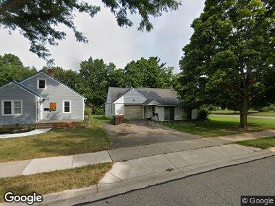
908 Kent St Portland, MI 48875
Estimated Value: $172,000 - $221,000
2
Beds
1
Bath
1,248
Sq Ft
$160/Sq Ft
Est. Value
About This Home
This home is located at 908 Kent St, Portland, MI 48875 and is currently estimated at $199,244, approximately $159 per square foot. 908 Kent St is a home located in Ionia County with nearby schools including Oakwood Elementary School, Westwood Elementary School, and Portland Middle School.
Ownership History
Date
Name
Owned For
Owner Type
Purchase Details
Closed on
Oct 12, 2011
Sold by
Anthony Brandi
Bought by
Platte Raymond
Current Estimated Value
Home Financials for this Owner
Home Financials are based on the most recent Mortgage that was taken out on this home.
Original Mortgage
$15,400
Interest Rate
4.09%
Mortgage Type
Unknown
Purchase Details
Closed on
Mar 11, 1998
Bought by
Platte Raymond A
Create a Home Valuation Report for This Property
The Home Valuation Report is an in-depth analysis detailing your home's value as well as a comparison with similar homes in the area
Home Values in the Area
Average Home Value in this Area
Purchase History
| Date | Buyer | Sale Price | Title Company |
|---|---|---|---|
| Platte Raymond | -- | -- | |
| Platte Raymond A | $70,000 | -- |
Source: Public Records
Mortgage History
| Date | Status | Borrower | Loan Amount |
|---|---|---|---|
| Closed | Platte Raymond A | $15,400 | |
| Previous Owner | Platte Raymond A | $21,500 | |
| Previous Owner | Platte Raymond A | $13,300 |
Source: Public Records
Tax History Compared to Growth
Tax History
| Year | Tax Paid | Tax Assessment Tax Assessment Total Assessment is a certain percentage of the fair market value that is determined by local assessors to be the total taxable value of land and additions on the property. | Land | Improvement |
|---|---|---|---|---|
| 2024 | $1,292 | $72,600 | $14,400 | $58,200 |
| 2023 | $1,236 | $61,300 | $10,100 | $51,200 |
| 2022 | $1,595 | $61,300 | $10,100 | $51,200 |
| 2021 | $1,553 | $51,300 | $8,500 | $42,800 |
| 2020 | $1,128 | $51,300 | $8,500 | $42,800 |
| 2019 | $1,508 | $50,500 | $8,500 | $42,000 |
| 2018 | $1,489 | $35,700 | $8,500 | $27,200 |
| 2017 | $1,049 | $35,700 | $8,500 | $27,200 |
| 2016 | $1,040 | $34,500 | $8,500 | $26,000 |
| 2015 | $1,260 | $34,500 | $8,500 | $26,000 |
| 2014 | $1,260 | $34,700 | $9,300 | $25,400 |
Source: Public Records
Map
Nearby Homes
- 250 Meadowlane Dr
- 320 Elm St
- 442 S East St
- 407 Kearney St
- 431 Academy St
- 325 Kearney St
- 414 Vessey St
- 7998 E Grand River Ave
- 507 E Grand River Ave
- 8661 Riverbend Dr
- 137 Albro St
- 112 Blossom Dr
- 716 James St
- 526 Detroit St
- 349 Bishop St
- 544 Lyons Rd
- 811 Ionia Rd
- 749 Lyons Rd
- 7204 E Grand River Ave Unit 241
- 298 Bristie St