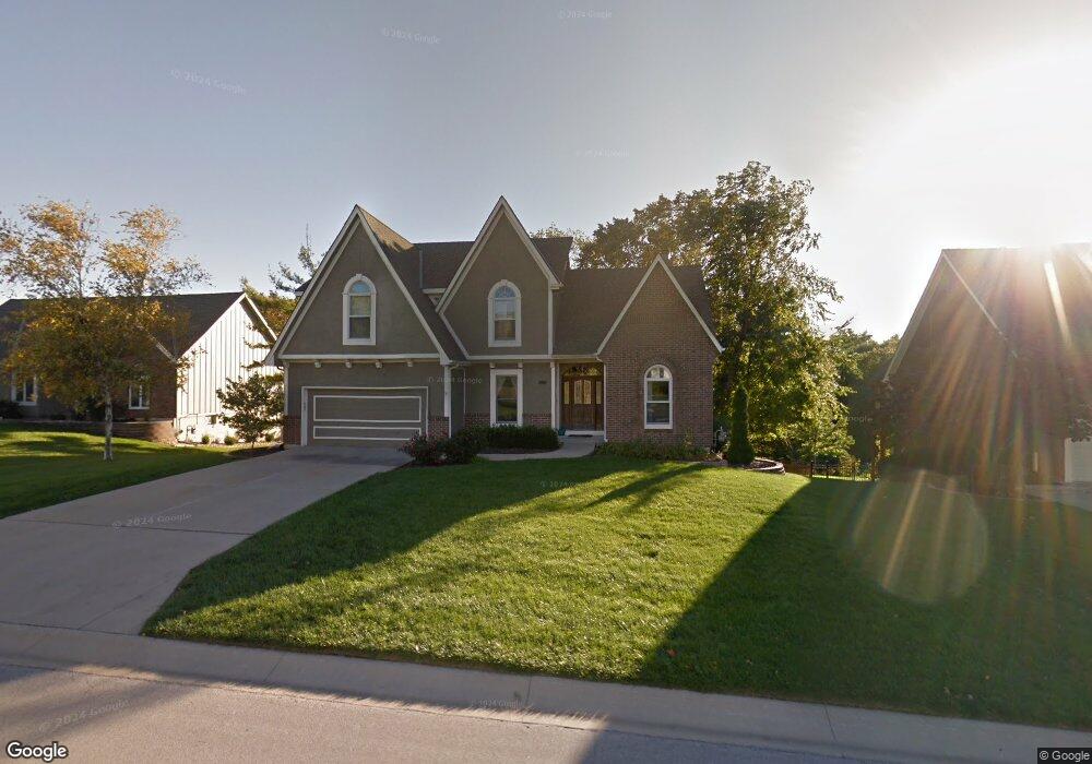
908 NW High Point Dr Lees Summit, MO 64081
Estimated Value: $408,923 - $442,000
4
Beds
3
Baths
2,169
Sq Ft
$198/Sq Ft
Est. Value
About This Home
This home is located at 908 NW High Point Dr, Lees Summit, MO 64081 and is currently estimated at $428,731, approximately $197 per square foot. 908 NW High Point Dr is a home located in Jackson County with nearby schools including Cedar Creek Elementary School, Bernard C. Campbell Middle School, and Lee's Summit North High School.
Ownership History
Date
Name
Owned For
Owner Type
Purchase Details
Closed on
Mar 15, 2004
Sold by
Bicknell Brian D and Bicknell Cynthia A
Bought by
Chapman Michael K and Chapman Denise M
Current Estimated Value
Home Financials for this Owner
Home Financials are based on the most recent Mortgage that was taken out on this home.
Original Mortgage
$212,000
Outstanding Balance
$99,357
Interest Rate
5.71%
Mortgage Type
Purchase Money Mortgage
Estimated Equity
$329,374
Purchase Details
Closed on
Nov 16, 2001
Sold by
Ellis Jon D and Ellis Julia M
Bought by
Bicknell Brian D and Bicknell Cynthia A
Home Financials for this Owner
Home Financials are based on the most recent Mortgage that was taken out on this home.
Original Mortgage
$190,000
Interest Rate
6.54%
Mortgage Type
Purchase Money Mortgage
Create a Home Valuation Report for This Property
The Home Valuation Report is an in-depth analysis detailing your home's value as well as a comparison with similar homes in the area
Home Values in the Area
Average Home Value in this Area
Purchase History
| Date | Buyer | Sale Price | Title Company |
|---|---|---|---|
| Chapman Michael K | -- | Assured Quality Title Co | |
| Bicknell Brian D | -- | Security Land Title Co |
Source: Public Records
Mortgage History
| Date | Status | Borrower | Loan Amount |
|---|---|---|---|
| Open | Chapman Michael K | $212,000 | |
| Previous Owner | Bicknell Brian D | $190,000 |
Source: Public Records
Tax History Compared to Growth
Tax History
| Year | Tax Paid | Tax Assessment Tax Assessment Total Assessment is a certain percentage of the fair market value that is determined by local assessors to be the total taxable value of land and additions on the property. | Land | Improvement |
|---|---|---|---|---|
| 2025 | $4,302 | $68,518 | $12,436 | $56,082 |
| 2024 | $4,271 | $59,582 | $7,363 | $52,219 |
| 2023 | $4,271 | $59,583 | $7,363 | $52,220 |
| 2022 | $4,463 | $55,290 | $8,199 | $47,091 |
| 2021 | $4,556 | $55,290 | $8,199 | $47,091 |
| 2020 | $4,605 | $55,339 | $8,199 | $47,140 |
| 2019 | $4,479 | $55,339 | $8,199 | $47,140 |
| 2018 | $4,135 | $47,415 | $5,547 | $41,868 |
| 2017 | $4,135 | $47,415 | $5,547 | $41,868 |
| 2016 | $4,073 | $46,227 | $7,315 | $38,912 |
| 2014 | $4,090 | $45,500 | $6,830 | $38,670 |
Source: Public Records
Map
Nearby Homes
- 2501 NW Shady Bend Ln
- 2536 NW Bent Tree Cir
- 2503 NW Windwood Dr
- 813 NW High Point Dr
- 2616 NW Lookout Ridge
- 2257 NW Summerfield Dr
- 2508 NW Bent Tree Cir
- 932 NW Bent Tree Dr
- 130 NW Ambersham Dr
- 505 NW Ambersham Dr
- 2007 NW Chipman Rd
- 13004 E 99th St
- 1031 NW Cedar Creek Ln
- 928 NW Cedar Creek Ln
- 2122 NW Ashurst Dr
- 2110 NW Ashurst Dr
- 2090 NW O'Brien Rd
- 361 NW Patch Ct
- 2082 NW O'Brien Rd
- 2086 NW O'Brien Rd
- 912 NW High Point Dr
- 904 NW High Point Dr
- 900 NW High Point Dr
- 905 NW High Point Dr
- 2447 NW Valley View Dr
- 916 NW High Point Dr
- 2460 NW Valley View Dr
- 2443 NW Valley View Dr
- 2439 NW Valley View Dr
- 853 NW High Point Dr
- 823 NW Game Creek
- 2456 NW Valley View Dr
- 1088 NW High Point Dr
- 924 NW High Point Dr
- 2500 NW Overbrook Dr
- 852 NW High Point Dr
- 2435 NW Valley View Dr
- 2452 NW Valley View Dr
- 815 NW Game Creek
- 2504 NW Overbrook Dr