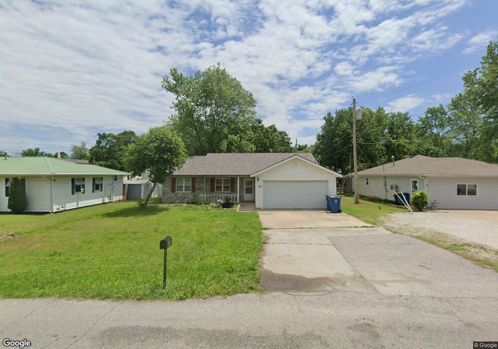
908 S Baker Blvd Carthage, MO 64836
Estimated Value: $197,172 - $206,000
3
Beds
2
Baths
1,420
Sq Ft
$142/Sq Ft
Est. Value
About This Home
This home is located at 908 S Baker Blvd, Carthage, MO 64836 and is currently estimated at $201,586, approximately $141 per square foot. 908 S Baker Blvd is a home located in Jasper County with nearby schools including Carthage High School, Victory Academy, and St. Ann's Catholic School.
Ownership History
Date
Name
Owned For
Owner Type
Purchase Details
Closed on
May 27, 2021
Sold by
Morris Michael W and Morris Blanca
Bought by
Charles Derek
Current Estimated Value
Home Financials for this Owner
Home Financials are based on the most recent Mortgage that was taken out on this home.
Original Mortgage
$146,464
Outstanding Balance
$132,026
Interest Rate
2.9%
Mortgage Type
Stand Alone Refi Refinance Of Original Loan
Estimated Equity
$69,560
Purchase Details
Closed on
May 28, 2014
Sold by
Farran Christopher D and Farran Hollie B
Bought by
Morris Michael W
Purchase Details
Closed on
Oct 6, 2010
Sold by
Farran Christopher D
Bought by
Farran Christopher D and Cooper Hollie B
Home Financials for this Owner
Home Financials are based on the most recent Mortgage that was taken out on this home.
Original Mortgage
$71,150
Interest Rate
4.39%
Mortgage Type
New Conventional
Create a Home Valuation Report for This Property
The Home Valuation Report is an in-depth analysis detailing your home's value as well as a comparison with similar homes in the area
Home Values in the Area
Average Home Value in this Area
Purchase History
| Date | Buyer | Sale Price | Title Company |
|---|---|---|---|
| Charles Derek | -- | None Available | |
| Morris Michael W | -- | None Available | |
| Farran Christopher D | -- | Abbey |
Source: Public Records
Mortgage History
| Date | Status | Borrower | Loan Amount |
|---|---|---|---|
| Open | Charles Derek | $146,464 | |
| Previous Owner | Farran Christopher D | $71,150 |
Source: Public Records
Tax History Compared to Growth
Tax History
| Year | Tax Paid | Tax Assessment Tax Assessment Total Assessment is a certain percentage of the fair market value that is determined by local assessors to be the total taxable value of land and additions on the property. | Land | Improvement |
|---|---|---|---|---|
| 2025 | $940 | $20,710 | $1,450 | $19,260 |
| 2024 | $940 | $18,260 | $1,450 | $16,810 |
| 2023 | $940 | $18,260 | $1,450 | $16,810 |
| 2022 | $822 | $16,030 | $1,450 | $14,580 |
| 2021 | $814 | $16,030 | $1,450 | $14,580 |
| 2020 | $780 | $14,730 | $1,450 | $13,280 |
| 2019 | $781 | $14,730 | $1,450 | $13,280 |
| 2018 | $810 | $15,300 | $0 | $0 |
| 2017 | $812 | $15,300 | $0 | $0 |
| 2016 | $876 | $16,560 | $0 | $0 |
| 2015 | $809 | $16,560 | $0 | $0 |
| 2014 | $809 | $16,560 | $0 | $0 |
Source: Public Records
Map
Nearby Homes
- 1015 Cedar St
- 1014 Sycamore St
- 1210 Walnut St
- 1121 Ash St
- 1422 W Macon St
- 1302 Robertson Ave
- 1324 W Central Ave
- 1615 W Budlong St
- 431 S Orner St
- 831 Rombauer Ave
- 510 Miller St
- 514 W Macon St
- 703 W Central Tract 2
- 424 Walnut St
- 527 Olive St
- Lot 3 2nd Addition (Piper)
- Lot 3 2nd Addition (Piper Dr) Unit 3
- 1112 S Garrison Ave
- 504 Cooper St
- 1160 S Maple St
- 912 S Baker Blvd
- 902 S Baker Blvd
- 1216 Poplar St
- 920 S Baker Blvd
- 1217 Cedar St
- 1208 Poplar St
- 1211 Cedar St
- 1204 Poplar St
- 1224 Cedar St
- 1205 Cedar St
- 1134 Poplar St
- 1135 Cedar St
- 1210 Cedar St
- 1204 Cedar St
- 1128 Poplar St
- 1129 Cedar St
- 1134 Cedar St
- 1014 S Baker Blvd
- 1219 W Chestnut St
- 1121 Cedar St