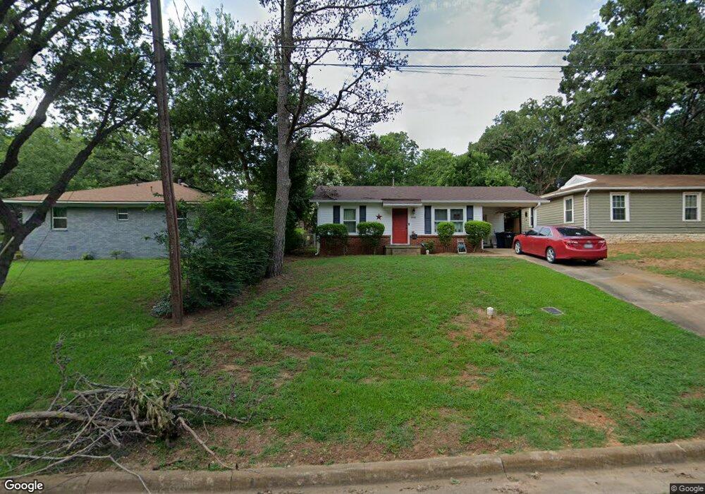
908 Thatcher St Denison, TX 75020
Estimated Value: $130,097 - $158,000
2
Beds
1
Bath
926
Sq Ft
$156/Sq Ft
Est. Value
About This Home
This home is located at 908 Thatcher St, Denison, TX 75020 and is currently estimated at $144,049, approximately $155 per square foot. 908 Thatcher St is a home located in Grayson County with nearby schools including Scott Middle School, Denison High School, and St. Luke's Parish Day School.
Ownership History
Date
Name
Owned For
Owner Type
Purchase Details
Closed on
Mar 23, 2017
Sold by
Owen Joan
Bought by
Dollarhide Angela
Current Estimated Value
Home Financials for this Owner
Home Financials are based on the most recent Mortgage that was taken out on this home.
Original Mortgage
$60,385
Outstanding Balance
$50,074
Interest Rate
4.17%
Mortgage Type
FHA
Estimated Equity
$93,975
Purchase Details
Closed on
Apr 1, 2016
Sold by
Petroski Eileen
Bought by
Greer Shirley D
Purchase Details
Closed on
Oct 21, 2015
Sold by
Nationstar Realty Llc
Bought by
Peterson Brenda
Purchase Details
Closed on
Sep 4, 2015
Sold by
Crews Iris Etta
Bought by
Nationstar Mortgage Llc and Champion Mortgage Co
Create a Home Valuation Report for This Property
The Home Valuation Report is an in-depth analysis detailing your home's value as well as a comparison with similar homes in the area
Home Values in the Area
Average Home Value in this Area
Purchase History
| Date | Buyer | Sale Price | Title Company |
|---|---|---|---|
| Dollarhide Angela | -- | Red River Title Co | |
| Greer Shirley D | -- | None Available | |
| Peterson Brenda | $20,000 | Carrington Title Svcs Llc | |
| Nationstar Mortgage Llc | $18,000 | None Available |
Source: Public Records
Mortgage History
| Date | Status | Borrower | Loan Amount |
|---|---|---|---|
| Open | Dollarhide Angela | $60,385 |
Source: Public Records
Tax History Compared to Growth
Tax History
| Year | Tax Paid | Tax Assessment Tax Assessment Total Assessment is a certain percentage of the fair market value that is determined by local assessors to be the total taxable value of land and additions on the property. | Land | Improvement |
|---|---|---|---|---|
| 2025 | $970 | $98,007 | -- | -- |
| 2024 | $2,070 | $89,097 | $0 | $0 |
| 2023 | $827 | $80,997 | $0 | $0 |
| 2022 | $1,749 | $73,634 | $0 | $0 |
| 2021 | $1,688 | $66,940 | $15,470 | $51,470 |
| 2020 | $1,726 | $65,420 | $11,661 | $53,759 |
| 2019 | $1,763 | $64,085 | $11,661 | $52,424 |
| 2018 | $1,703 | $61,402 | $10,184 | $51,218 |
| 2017 | $1,520 | $54,342 | $3,265 | $51,077 |
| 2016 | $576 | $20,578 | $3,265 | $17,313 |
| 2015 | $670 | $23,721 | $3,265 | $20,456 |
| 2014 | $144 | $27,490 | $3,265 | $24,225 |
Source: Public Records
Map
Nearby Homes
- 923 Dubois St
- 938 Amsden St
- 905 Seymore Cir
- 903 Seymore Cir
- 603 W Star St
- 711 Dubois St
- 3101 S College Blvd
- 700 Dubois St
- 916 W Collins St
- 923 W Collins St
- 921 W Collins St
- 701 W Star St
- 919 W Collins St
- 1130 Amsden Cir
- 601 Dubois St
- 608 W Baker St
- 611 W Baker St
- 607 W Baker St
- 614 W Collins St
- 616 & 618 Rice St
- 3001 S Scullin Ave
- 912 Thatcher St
- 909 Amsden St
- 901 Amsden St
- 913 Amsden St
- 901 Thatcher St
- 905 Thatcher St
- 915 Amsden St
- 920 Thatcher St
- 831 Amsden St
- 907 Thatcher St
- 919 Amsden St
- 909 Thatcher St
- 2930 S Scullin Ave
- 2909 S Scullin Ave
- 825 Amsden St
- 908 Amsden St
- 900 Amsden St
- 900 Dubois St
- 914 Amsden St