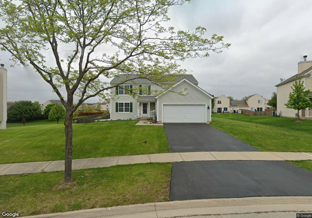
909 Briarcliff Dr Minooka, IL 60447
North Minooka NeighborhoodEstimated Value: $361,000 - $421,000
4
Beds
3
Baths
2,620
Sq Ft
$149/Sq Ft
Est. Value
About This Home
This home is located at 909 Briarcliff Dr, Minooka, IL 60447 and is currently estimated at $390,999, approximately $149 per square foot. 909 Briarcliff Dr is a home located in Kendall County with nearby schools including Jones Elementary School, Minooka Junior High School, and Minooka Intermediate School.
Ownership History
Date
Name
Owned For
Owner Type
Purchase Details
Closed on
Nov 22, 2006
Sold by
Summerfield Venture Llc
Bought by
Glisson Rebecca
Current Estimated Value
Home Financials for this Owner
Home Financials are based on the most recent Mortgage that was taken out on this home.
Original Mortgage
$140,000
Outstanding Balance
$84,016
Interest Rate
6.47%
Mortgage Type
Purchase Money Mortgage
Estimated Equity
$306,983
Create a Home Valuation Report for This Property
The Home Valuation Report is an in-depth analysis detailing your home's value as well as a comparison with similar homes in the area
Home Values in the Area
Average Home Value in this Area
Purchase History
| Date | Buyer | Sale Price | Title Company |
|---|---|---|---|
| Glisson Rebecca | $242,500 | North American Title Co |
Source: Public Records
Mortgage History
| Date | Status | Borrower | Loan Amount |
|---|---|---|---|
| Open | Glisson Rebecca | $140,000 |
Source: Public Records
Tax History Compared to Growth
Tax History
| Year | Tax Paid | Tax Assessment Tax Assessment Total Assessment is a certain percentage of the fair market value that is determined by local assessors to be the total taxable value of land and additions on the property. | Land | Improvement |
|---|---|---|---|---|
| 2024 | $9,017 | $114,437 | $15,425 | $99,012 |
| 2023 | $7,245 | $104,602 | $14,690 | $89,912 |
| 2022 | $7,245 | $91,216 | $13,990 | $77,226 |
| 2021 | $7,094 | $87,094 | $14,203 | $72,891 |
| 2020 | $7,029 | $83,187 | $13,566 | $69,621 |
| 2019 | $7,079 | $81,668 | $13,318 | $68,350 |
| 2018 | $6,838 | $79,886 | $13,027 | $66,859 |
| 2017 | $6,704 | $75,175 | $13,027 | $62,148 |
| 2016 | $6,232 | $69,774 | $12,866 | $56,908 |
| 2015 | $5,935 | $66,218 | $12,210 | $54,008 |
| 2014 | -- | $64,126 | $12,210 | $51,916 |
| 2013 | -- | $64,126 | $12,210 | $51,916 |
Source: Public Records
Map
Nearby Homes
- 1510 Balboa Dr
- 819 Daniel Dr
- 2050 Isabella Ln
- 194 acres W Holt Rd
- 2041 Isabella Ln
- Lot 1 Minooka Ridge & Jones Rd
- LOT 1 Bob Blair Rd
- 201 W Church St
- 405 W Mondamin St
- 104 S Osceola St
- 2037 Isabella Ln
- 6010-6060 E Minooka Rd
- 1133 Coneflower Ct
- 225 Sibley Dr
- LOT 28 O Toole Dr
- 817 Casey Dr
- 103 Northfield Dr
- 105 Northfield Dr
- 921 Casey Dr
- 515 Edgewater Dr
- 905 Briarcliff Dr
- 913 Briarcliff Dr
- 1507 Kettleson Dr
- 1509 Kettleson Dr
- 1511 Kettleson Dr
- 1505 Kettleson Dr
- 1505 Kettleson Dr Unit 1505
- 1513 Kettleson Dr
- 1503 Kettleson Dr
- 917 Briarcliff Dr
- 901 Briarcliff Dr
- 904 Briarcliff Dr
- 1429 Kettleson Dr
- 1429 Kettleson Dr Unit 1429
- 1431 Kettleson Dr
- 1427 Kettleson Dr
- 921 Briarcliff Dr
- 623 Gallant Dr
- 837 Briarcliff Dr
- 709 Avalon Way