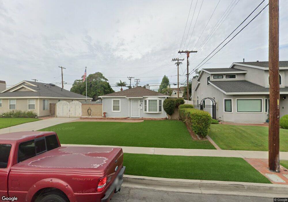
909 Pruitt Dr Redondo Beach, CA 90278
North Redondo Beach NeighborhoodEstimated Value: $1,085,000 - $1,609,000
5
Beds
2
Baths
1,176
Sq Ft
$1,058/Sq Ft
Est. Value
About This Home
This home is located at 909 Pruitt Dr, Redondo Beach, CA 90278 and is currently estimated at $1,244,792, approximately $1,058 per square foot. 909 Pruitt Dr is a home located in Los Angeles County with nearby schools including Washington Elementary School, Adams Middle School, and Redondo Union High School.
Ownership History
Date
Name
Owned For
Owner Type
Purchase Details
Closed on
Jun 27, 2025
Sold by
Frushon Florey A and Frushon Mary Sue
Bought by
Frushon Florey A and Frushon Mary Sue
Current Estimated Value
Home Financials for this Owner
Home Financials are based on the most recent Mortgage that was taken out on this home.
Original Mortgage
$1,605,000
Outstanding Balance
$1,602,303
Interest Rate
6.89%
Mortgage Type
Reverse Mortgage Home Equity Conversion Mortgage
Estimated Equity
-$357,511
Create a Home Valuation Report for This Property
The Home Valuation Report is an in-depth analysis detailing your home's value as well as a comparison with similar homes in the area
Home Values in the Area
Average Home Value in this Area
Purchase History
| Date | Buyer | Sale Price | Title Company |
|---|---|---|---|
| Frushon Florey A | -- | Fnc Title |
Source: Public Records
Mortgage History
| Date | Status | Borrower | Loan Amount |
|---|---|---|---|
| Open | Frushon Florey A | $1,605,000 | |
| Closed | Frushon Florey A | $1,605,000 |
Source: Public Records
Tax History Compared to Growth
Tax History
| Year | Tax Paid | Tax Assessment Tax Assessment Total Assessment is a certain percentage of the fair market value that is determined by local assessors to be the total taxable value of land and additions on the property. | Land | Improvement |
|---|---|---|---|---|
| 2025 | $1,917 | $91,461 | $54,882 | $36,579 |
| 2024 | $1,917 | $89,668 | $53,806 | $35,862 |
| 2023 | $1,893 | $87,910 | $52,751 | $35,159 |
| 2022 | $1,829 | $86,187 | $51,717 | $34,470 |
| 2021 | $1,766 | $84,498 | $50,703 | $33,795 |
| 2019 | $1,693 | $81,994 | $49,200 | $32,794 |
| 2018 | $1,594 | $80,387 | $48,236 | $32,151 |
| 2016 | $1,529 | $77,267 | $46,364 | $30,903 |
| 2015 | $1,509 | $76,107 | $45,668 | $30,439 |
| 2014 | $1,492 | $74,617 | $44,774 | $29,843 |
Source: Public Records
Map
Nearby Homes
- 907 Lilienthal Ln
- 2420 Ives Ln Unit B
- 2420 Ives Ln Unit A
- 2407 Ripley Ave
- 2600 Alvord Ln
- 2400 Marshallfield Ln
- 2617 Alvord Ln
- 2708 184th St
- 2617 182nd St
- 2708 183rd St
- 2345 190th St Unit 42
- 2345 190th St Unit 24
- 2321 Clark Ln Unit B
- 2321 Clark Ln Unit A
- 2345 W 190th St Unit 77
- 2221 Pullman Ln Unit B
- 2301 Marshallfield Ln Unit A
- 2517 Huntington Ln Unit B
- 1300 Firmona Ave
- 2420 Grant Ave
- 907 Pruitt Dr
- 1001 Pruitt Dr
- 1003 Pruitt Dr
- 905 Pruitt Dr
- 2501 185th St
- 2500 184th St
- 1005 Pruitt Dr
- 2422 Hill Ln
- 2423 Hill Ln
- 2423 Hill Ln Unit 3
- 2423 Hill Ln Unit 2
- 2423 Hill Ln Unit 1
- 903 Pruitt Dr
- 2503 185th St
- 901 Pruitt Dr
- 2502 184th St
- 2500 185th St
- 2420 Hill Ln
- 2421 Hill Ln Unit 3
- 2421 Hill Ln Unit 2