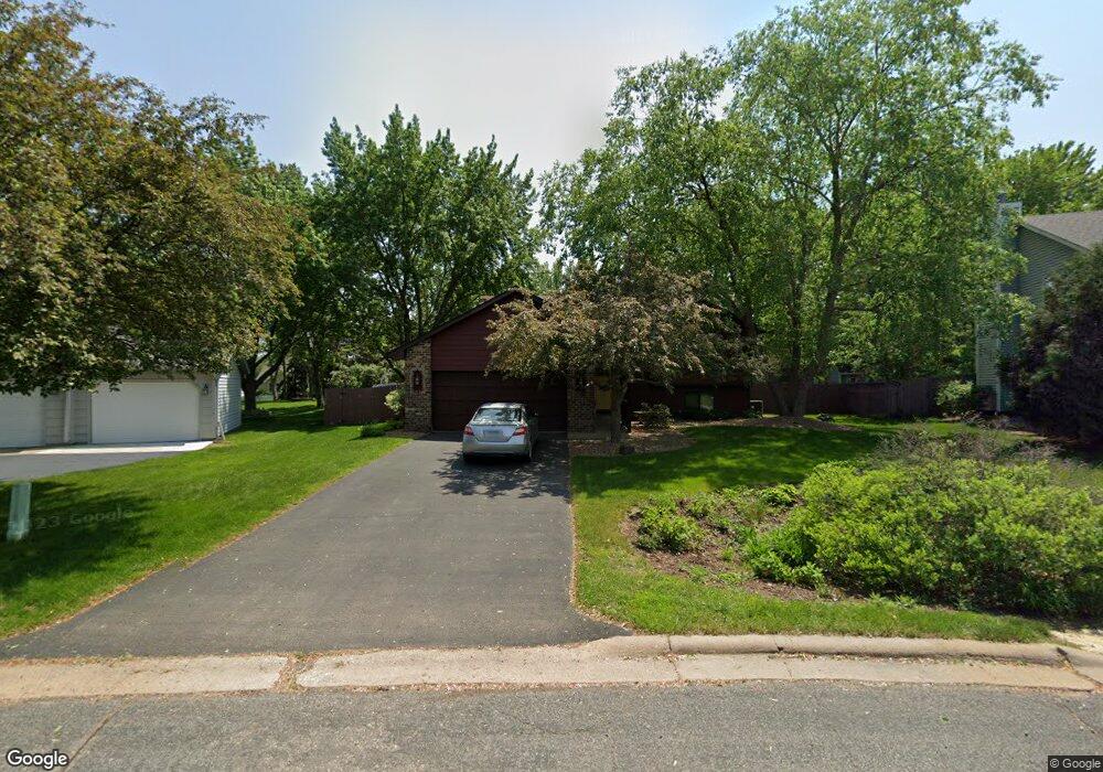
909 Rushmore Dr Burnsville, MN 55306
Estimated Value: $409,000 - $438,000
4
Beds
3
Baths
1,139
Sq Ft
$371/Sq Ft
Est. Value
About This Home
This home is located at 909 Rushmore Dr, Burnsville, MN 55306 and is currently estimated at $422,080, approximately $370 per square foot. 909 Rushmore Dr is a home located in Dakota County with nearby schools including Southview Elementary School, Valley Middle School, and Apple Valley Senior High School.
Ownership History
Date
Name
Owned For
Owner Type
Purchase Details
Closed on
May 1, 2019
Sold by
Abramowski Jeffrey L and Abramowski Sue E
Bought by
Reye Robin R and Reye Brittany
Current Estimated Value
Home Financials for this Owner
Home Financials are based on the most recent Mortgage that was taken out on this home.
Original Mortgage
$306,375
Outstanding Balance
$268,266
Interest Rate
4%
Mortgage Type
New Conventional
Estimated Equity
$153,814
Purchase Details
Closed on
Oct 17, 1997
Sold by
Fredricks Delmont R and Fredricks Laurie R
Bought by
Abramowski Jeffrey L and Abramowski Sue E
Create a Home Valuation Report for This Property
The Home Valuation Report is an in-depth analysis detailing your home's value as well as a comparison with similar homes in the area
Home Values in the Area
Average Home Value in this Area
Purchase History
| Date | Buyer | Sale Price | Title Company |
|---|---|---|---|
| Reye Robin R | $322,500 | Liberty Title | |
| Abramowski Jeffrey L | $133,000 | -- |
Source: Public Records
Mortgage History
| Date | Status | Borrower | Loan Amount |
|---|---|---|---|
| Open | Reye Robin R | $306,375 |
Source: Public Records
Tax History Compared to Growth
Tax History
| Year | Tax Paid | Tax Assessment Tax Assessment Total Assessment is a certain percentage of the fair market value that is determined by local assessors to be the total taxable value of land and additions on the property. | Land | Improvement |
|---|---|---|---|---|
| 2024 | $4,324 | $351,900 | $95,300 | $256,600 |
| 2023 | $4,324 | $367,700 | $95,400 | $272,300 |
| 2022 | $3,522 | $348,800 | $99,100 | $249,700 |
| 2021 | $3,422 | $301,700 | $86,200 | $215,500 |
| 2020 | $3,402 | $288,700 | $82,100 | $206,600 |
| 2019 | $3,124 | $280,300 | $78,200 | $202,100 |
| 2018 | $2,945 | $269,400 | $74,400 | $195,000 |
| 2017 | $2,900 | $250,900 | $70,900 | $180,000 |
| 2016 | $2,715 | $234,700 | $67,500 | $167,200 |
| 2015 | $2,582 | $202,233 | $60,292 | $141,941 |
| 2014 | -- | $197,219 | $58,955 | $138,264 |
| 2013 | -- | $177,381 | $53,061 | $124,320 |
Source: Public Records
Map
Nearby Homes
- 1101 Lavon Ln
- 801 Southcross Dr E
- 1516 Rushmore Dr
- 1629 Keller Lake Dr
- 15505 Logarto Ln
- 15020 Tyacke Dr
- 333 Maple Island Rd
- 300 Butternut Ln
- 14659 Sherwood Place
- 1010 E 157th St
- 15250 Stevens Ave
- 313 Maple Island Rd
- 14764 Oak Run Ln
- 1312 Summit Oaks Dr
- 1023 E 145th St
- 14733 Innsbrook Cir
- 230 Maple Island Rd
- 15100 Eileen Cir
- 14709 White Oak Dr
- 212 Geneva Blvd
- 905 Rushmore Dr
- 913 Rushmore Dr
- 924 Crystal Lake Rd E
- 1000 Crystal Lake Rd E
- 912 Crystal Lake Rd E
- 901 Rushmore Dr
- 917 Rushmore Dr
- 1012 Crystal Lake Rd E
- 908 Rushmore Dr
- 904 Rushmore Dr
- 1024 Crystal Lake Rd E
- 921 Rushmore Dr
- 813 Rushmore Dr
- 900 Rushmore Dr
- 917 Southwind Dr
- 1100 Crystal Lake Rd E
- 1005 Southwind Dr
- 913 Southwind Dr
- 1104 Crystal Lake Rd E
- 809 Rushmore Dr