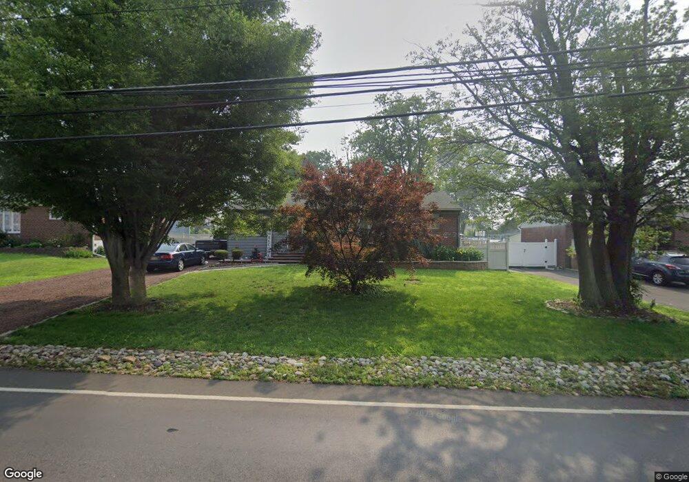
909 Station Ave Bensalem, PA 19020
Estimated Value: $292,000 - $419,000
3
Beds
1
Bath
1,050
Sq Ft
$338/Sq Ft
Est. Value
About This Home
This home is located at 909 Station Ave, Bensalem, PA 19020 and is currently estimated at $355,394, approximately $338 per square foot. 909 Station Ave is a home located in Bucks County with nearby schools including Robert K. Shafer Middle School, School Lane Charter School, and St Charles Borromeo School.
Ownership History
Date
Name
Owned For
Owner Type
Purchase Details
Closed on
May 20, 1999
Sold by
Rooney Scott J and Rooney Nicole K
Bought by
Rooney Scott J and Rooney Nicole K
Current Estimated Value
Home Financials for this Owner
Home Financials are based on the most recent Mortgage that was taken out on this home.
Original Mortgage
$70,000
Outstanding Balance
$17,802
Interest Rate
6.85%
Estimated Equity
$337,592
Purchase Details
Closed on
Nov 9, 1998
Sold by
Hud
Bought by
Lippolis Nicole K
Home Financials for this Owner
Home Financials are based on the most recent Mortgage that was taken out on this home.
Original Mortgage
$60,690
Interest Rate
11%
Purchase Details
Closed on
Sep 30, 1997
Sold by
Burella Charles F and Burella Stella D
Bought by
Key Bank Of New York
Purchase Details
Closed on
Sep 25, 1997
Sold by
Key Bank Of New York
Bought by
Hud
Create a Home Valuation Report for This Property
The Home Valuation Report is an in-depth analysis detailing your home's value as well as a comparison with similar homes in the area
Home Values in the Area
Average Home Value in this Area
Purchase History
| Date | Buyer | Sale Price | Title Company |
|---|---|---|---|
| Rooney Scott J | -- | -- | |
| Lippolis Nicole K | $70,578 | -- | |
| Key Bank Of New York | $724 | -- | |
| Hud | -- | -- |
Source: Public Records
Mortgage History
| Date | Status | Borrower | Loan Amount |
|---|---|---|---|
| Open | Rooney Scott J | $70,000 | |
| Closed | Lippolis Nicole K | $60,690 |
Source: Public Records
Tax History Compared to Growth
Tax History
| Year | Tax Paid | Tax Assessment Tax Assessment Total Assessment is a certain percentage of the fair market value that is determined by local assessors to be the total taxable value of land and additions on the property. | Land | Improvement |
|---|---|---|---|---|
| 2025 | $3,667 | $16,800 | $4,320 | $12,480 |
| 2024 | $3,667 | $16,800 | $4,320 | $12,480 |
| 2023 | $3,564 | $16,800 | $4,320 | $12,480 |
| 2022 | $3,543 | $16,800 | $4,320 | $12,480 |
| 2021 | $3,543 | $16,800 | $4,320 | $12,480 |
| 2020 | $3,508 | $16,800 | $4,320 | $12,480 |
| 2019 | $3,429 | $16,800 | $4,320 | $12,480 |
| 2018 | $3,350 | $16,800 | $4,320 | $12,480 |
| 2017 | $3,329 | $16,800 | $4,320 | $12,480 |
| 2016 | $3,329 | $16,800 | $4,320 | $12,480 |
| 2015 | -- | $16,800 | $4,320 | $12,480 |
| 2014 | -- | $16,800 | $4,320 | $12,480 |
Source: Public Records
Map
Nearby Homes
- 943 Cornwells Ave
- 833 Simons Ave
- 2209 Dungan Ave
- 1032 Sunset Ln
- 1155 Regina Ave
- 2025 State Rd
- 2387 Forrest Ave
- 1742 Paradise Ln
- 126B Royal Mews
- 2498 Ogden Ave
- 113 Royal Mews
- 106A Prince George St Unit A
- 106 Dock St
- 136b Alexandria St
- 120B Dock St
- 116B King St
- 114B King St
- 204A Dock St
- 104B King St
- 4471 Ernie Davis Cir
- 919 Station Ave
- 897 Station Ave
- 929 Station Ave
- 889 Station Ave
- 882 Cornwells Ave
- 918 Station Ave
- 890 Station Ave
- 941 Station Ave
- 854 Cornwells Ave
- 873 Station Ave
- 864 Cornwells Ave
- 912 Cornwells Ave
- 880 Station Ave
- 842 Cornwells Ave
- 898 Station Ave
- 922 Cornwells Ave
- 957 Station Ave
- 944 Station Ave
- 944 Station Ave
- 963 Station Ave