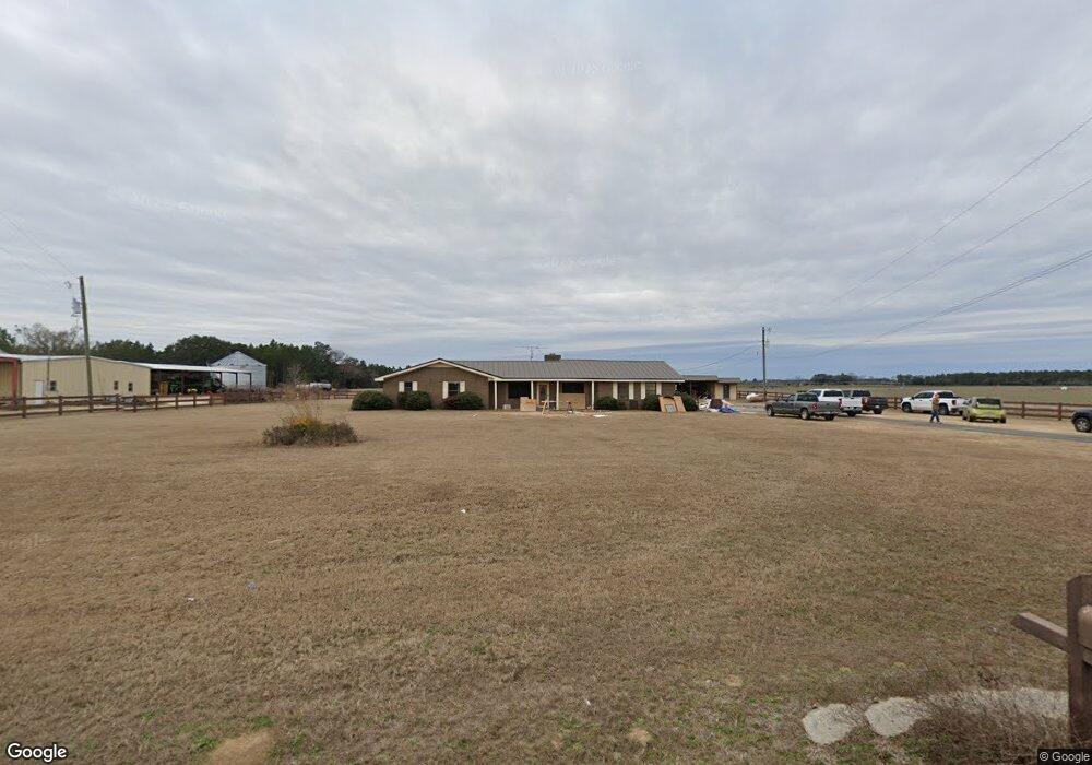
91 Avenue Rd Colquitt, GA 39837
Estimated Value: $116,000 - $274,775
3
Beds
2
Baths
2,251
Sq Ft
$98/Sq Ft
Est. Value
About This Home
This home is located at 91 Avenue Rd, Colquitt, GA 39837 and is currently estimated at $221,258, approximately $98 per square foot. 91 Avenue Rd is a home located in Miller County with nearby schools including Miller County Elementary School, Miller County Middle School, and Miller County High School.
Ownership History
Date
Name
Owned For
Owner Type
Purchase Details
Closed on
Jul 1, 2024
Sold by
Vann Ronald Wesley
Bought by
Vann Garrett Wesley
Current Estimated Value
Home Financials for this Owner
Home Financials are based on the most recent Mortgage that was taken out on this home.
Original Mortgage
$181,466
Interest Rate
7.03%
Mortgage Type
New Conventional
Purchase Details
Closed on
Oct 26, 2022
Sold by
Vann Kenneth Mitchell
Bought by
Vann Ronald Wesley
Purchase Details
Closed on
Sep 16, 2014
Sold by
Vann Ronald K
Bought by
Vann Ronald Wesley and Vann Kenneth Mitchell
Purchase Details
Closed on
Mar 7, 1991
Bought by
Vann Ronald K
Create a Home Valuation Report for This Property
The Home Valuation Report is an in-depth analysis detailing your home's value as well as a comparison with similar homes in the area
Home Values in the Area
Average Home Value in this Area
Purchase History
| Date | Buyer | Sale Price | Title Company |
|---|---|---|---|
| Vann Garrett Wesley | $75,497 | -- | |
| Vann Ronald Wesley | $77,804 | -- | |
| Vann Ronald Wesley | -- | -- | |
| Vann Ronald K | -- | -- |
Source: Public Records
Mortgage History
| Date | Status | Borrower | Loan Amount |
|---|---|---|---|
| Closed | Vann Garrett Wesley | $181,466 |
Source: Public Records
Tax History Compared to Growth
Tax History
| Year | Tax Paid | Tax Assessment Tax Assessment Total Assessment is a certain percentage of the fair market value that is determined by local assessors to be the total taxable value of land and additions on the property. | Land | Improvement |
|---|---|---|---|---|
| 2024 | $3,690 | $109,785 | $5,280 | $104,505 |
| 2023 | $3,049 | $85,614 | $5,280 | $80,334 |
| 2022 | $2,066 | $54,016 | $3,194 | $50,822 |
| 2021 | $2,045 | $54,016 | $3,194 | $50,822 |
| 2020 | $2,045 | $54,016 | $3,194 | $50,822 |
| 2019 | $2,050 | $54,016 | $3,194 | $50,822 |
| 2018 | $1,992 | $54,016 | $3,194 | $50,822 |
| 2017 | $1,992 | $54,016 | $3,194 | $50,822 |
| 2016 | $1,992 | $54,016 | $3,194 | $50,822 |
| 2015 | -- | $68,083 | $3,200 | $64,883 |
| 2014 | -- | $68,083 | $3,200 | $64,883 |
| 2013 | -- | $68,082 | $3,200 | $64,882 |
Source: Public Records
Map
Nearby Homes
- 0 Babcock Rd Unit 12263
- 1502 Brinson Rd
- 424 Grassy Flats Rd
- 0 Johnny Freeman Rd
- 324 Privett Store Rd
- 0 Newton Rd
- 1203 Bellview Rd
- 149 County Line Church Rd
- 721 E Crawford St
- 708 E Crawford St
- 000 Bellview Rd
- 000 Thompson Town Rd
- 160 Manhole Rd
- 2137 Pondtown Rd
- 00 Manhole Rd
- 994 Hornsby Rd
- Brinson Airbase Rd
- 533 Flint River Heights Rd
- 102 Bremond St
- 570 E Pine St