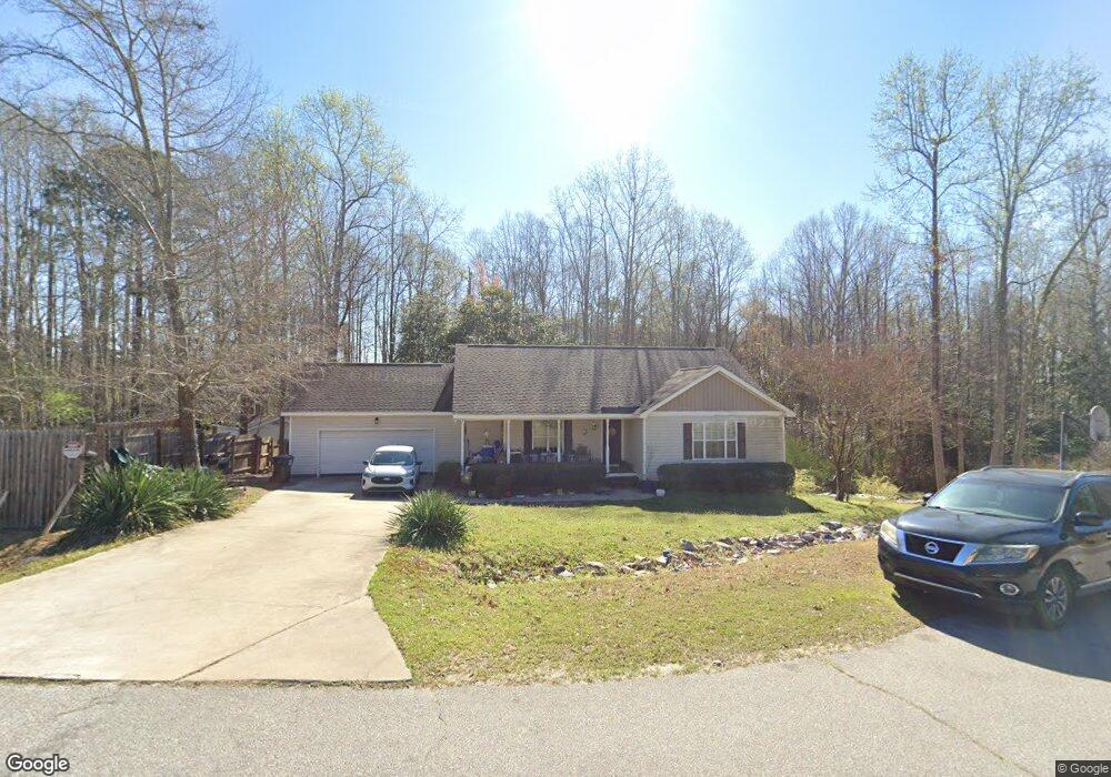
91 Banks Rd Smithfield, NC 27577
Estimated Value: $307,281 - $331,000
3
Beds
2
Baths
1,342
Sq Ft
$238/Sq Ft
Est. Value
About This Home
This home is located at 91 Banks Rd, Smithfield, NC 27577 and is currently estimated at $319,570, approximately $238 per square foot. 91 Banks Rd is a home located in Johnston County with nearby schools including West Smithfield Elementary School, Smithfield Middle School, and Smithfield-Selma High School.
Ownership History
Date
Name
Owned For
Owner Type
Purchase Details
Closed on
Dec 13, 2012
Sold by
Braswell Richard D
Bought by
Saykosy Chanthavong Bobby
Current Estimated Value
Home Financials for this Owner
Home Financials are based on the most recent Mortgage that was taken out on this home.
Original Mortgage
$139,900
Outstanding Balance
$102,973
Interest Rate
3.38%
Mortgage Type
USDA
Estimated Equity
$216,597
Purchase Details
Closed on
Jun 9, 2011
Sold by
Faith Real Estates Investments Llc
Bought by
Braswell Richard D
Create a Home Valuation Report for This Property
The Home Valuation Report is an in-depth analysis detailing your home's value as well as a comparison with similar homes in the area
Home Values in the Area
Average Home Value in this Area
Purchase History
| Date | Buyer | Sale Price | Title Company |
|---|---|---|---|
| Saykosy Chanthavong Bobby | $140,000 | None Available | |
| Braswell Richard D | $19,000 | None Available |
Source: Public Records
Mortgage History
| Date | Status | Borrower | Loan Amount |
|---|---|---|---|
| Open | Saykosy Chanthavong Bobby | $139,900 |
Source: Public Records
Tax History Compared to Growth
Tax History
| Year | Tax Paid | Tax Assessment Tax Assessment Total Assessment is a certain percentage of the fair market value that is determined by local assessors to be the total taxable value of land and additions on the property. | Land | Improvement |
|---|---|---|---|---|
| 2025 | $1,903 | $299,630 | $75,000 | $224,630 |
| 2024 | $1,389 | $171,470 | $36,000 | $135,470 |
| 2023 | $1,363 | $171,470 | $36,000 | $135,470 |
| 2022 | $1,432 | $171,470 | $36,000 | $135,470 |
| 2021 | $1,389 | $171,470 | $36,000 | $135,470 |
| 2020 | $1,440 | $171,470 | $36,000 | $135,470 |
| 2019 | $1,440 | $171,470 | $36,000 | $135,470 |
| 2018 | $1,247 | $145,030 | $24,000 | $121,030 |
| 2017 | $1,247 | $145,030 | $24,000 | $121,030 |
| 2016 | $1,247 | $145,030 | $24,000 | $121,030 |
| 2015 | $1,247 | $145,030 | $24,000 | $121,030 |
| 2014 | $1,247 | $145,030 | $24,000 | $121,030 |
Source: Public Records
Map
Nearby Homes
- 25 Lawrence Ct
- 220 Raptor Dr
- 66 S Hawks Ridge Ln
- 267 Red Hawk Place
- 28 Hagood St
- 10 Silver Ct
- 16 Tanseyleaf Dr
- 72 Hound Dog Ln
- 120 Red Hawk Place
- 146 Cheshire Farm Dr
- 73 S Rabbit Run Dr
- 82 Cheshire Farm Dr
- 52 Cheshire Farm Dr
- 22 Cheshire Farms Dr
- The Avondale Plan at Cheshire
- The Lancaster Plan at Cheshire
- The Avery Plan at Cheshire
- The McGinnis Plan at Cheshire
- The Ellijay Plan at Cheshire
- The Vinings Plan at Cheshire