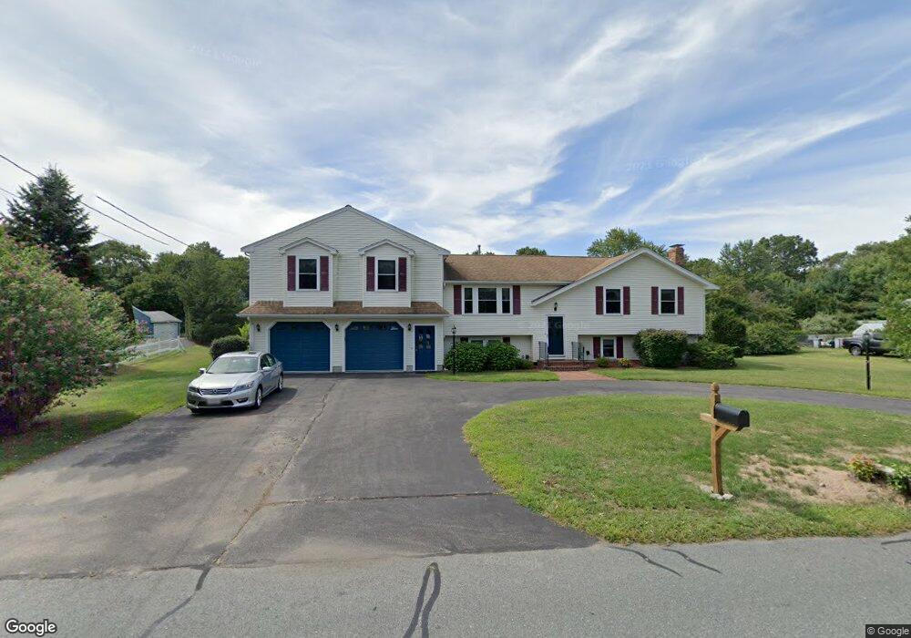
91 Branch St Mansfield, MA 02048
Estimated Value: $698,000 - $878,000
3
Beds
3
Baths
2,124
Sq Ft
$375/Sq Ft
Est. Value
About This Home
This home is located at 91 Branch St, Mansfield, MA 02048 and is currently estimated at $796,335, approximately $374 per square foot. 91 Branch St is a home located in Bristol County with nearby schools including Everett W. Robinson Elementary School, Jordan/Jackson Elementary School, and Harold L. Qualters Middle School.
Ownership History
Date
Name
Owned For
Owner Type
Purchase Details
Closed on
Jul 10, 1978
Bought by
Rubin Bruce J and Rubin Kathryn
Current Estimated Value
Create a Home Valuation Report for This Property
The Home Valuation Report is an in-depth analysis detailing your home's value as well as a comparison with similar homes in the area
Home Values in the Area
Average Home Value in this Area
Purchase History
| Date | Buyer | Sale Price | Title Company |
|---|---|---|---|
| Rubin Bruce J | $42,900 | -- |
Source: Public Records
Mortgage History
| Date | Status | Borrower | Loan Amount |
|---|---|---|---|
| Open | Rubin Bruce J | $100,000 | |
| Closed | Rubin Bruce J | $60,000 | |
| Closed | Rubin Bruce J | $100,000 | |
| Closed | Rubin Bruce J | $55,000 |
Source: Public Records
Tax History
| Year | Tax Paid | Tax Assessment Tax Assessment Total Assessment is a certain percentage of the fair market value that is determined by local assessors to be the total taxable value of land and additions on the property. | Land | Improvement |
|---|---|---|---|---|
| 2025 | $9,528 | $723,500 | $243,700 | $479,800 |
| 2024 | $8,852 | $655,700 | $243,700 | $412,000 |
| 2023 | $8,526 | $605,100 | $243,700 | $361,400 |
| 2022 | $7,992 | $526,800 | $225,500 | $301,300 |
| 2021 | $7,488 | $487,500 | $197,400 | $290,100 |
| 2020 | $7,457 | $485,500 | $188,000 | $297,500 |
| 2019 | $6,911 | $454,100 | $156,600 | $297,500 |
| 2018 | $6,613 | $424,700 | $149,400 | $275,300 |
| 2017 | $6,388 | $425,300 | $145,100 | $280,200 |
| 2016 | $6,221 | $403,700 | $138,200 | $265,500 |
| 2015 | $5,684 | $366,700 | $138,200 | $228,500 |
Source: Public Records
Map
Nearby Homes
- 44 Fairfield Park Unit 44
- 28 Court St
- 46 Hope St
- 266 N Main St Unit 3
- 150 Rumford Ave Unit 110
- 81 Chilson Ave
- 22 Pleasant St Unit C
- 1 Deer Path Ln
- 152 Central St
- 460 Ware St
- 166 Chauncy St
- 73-75 Draper Ave
- 571 Ware St
- 14 Windchime Dr
- 619 N Main St
- 4 Concetta Cir
- 356 Central St
- 4 Erick Rd Unit 90
- 19 Barberry Rd
- 212 Mill St
Your Personal Tour Guide
Ask me questions while you tour the home.