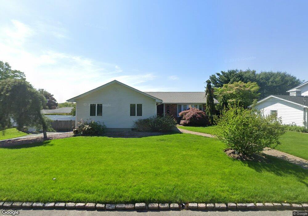
91 Freedom Dr Cranston, RI 02920
Meshanticut NeighborhoodEstimated Value: $541,000 - $744,000
3
Beds
2
Baths
1,584
Sq Ft
$384/Sq Ft
Est. Value
About This Home
This home is located at 91 Freedom Dr, Cranston, RI 02920 and is currently estimated at $607,837, approximately $383 per square foot. 91 Freedom Dr is a home located in Providence County with nearby schools including Glen Hills School, Western Hills Middle School, and Cranston High School West.
Ownership History
Date
Name
Owned For
Owner Type
Purchase Details
Closed on
Nov 27, 2000
Sold by
Mooney Colleen A and Rowles Susan
Bought by
D-Cabral Rosanna
Current Estimated Value
Purchase Details
Closed on
Apr 6, 1999
Sold by
Paolino Frank
Bought by
Mooney Colleen A
Purchase Details
Closed on
Jun 30, 1993
Sold by
Hahn Beverly L
Bought by
Mignacca David J and Mignacca Kathy
Create a Home Valuation Report for This Property
The Home Valuation Report is an in-depth analysis detailing your home's value as well as a comparison with similar homes in the area
Home Values in the Area
Average Home Value in this Area
Purchase History
| Date | Buyer | Sale Price | Title Company |
|---|---|---|---|
| D-Cabral Rosanna | $200,000 | -- | |
| Mooney Colleen A | $186,000 | -- | |
| Mignacca David J | $170,000 | -- |
Source: Public Records
Mortgage History
| Date | Status | Borrower | Loan Amount |
|---|---|---|---|
| Open | Mignacca David J | $142,222 | |
| Closed | Mignacca David J | $113,000 | |
| Closed | Mignacca David J | $81,000 |
Source: Public Records
Tax History
| Year | Tax Paid | Tax Assessment Tax Assessment Total Assessment is a certain percentage of the fair market value that is determined by local assessors to be the total taxable value of land and additions on the property. | Land | Improvement |
|---|---|---|---|---|
| 2025 | $7,065 | $509,000 | $145,800 | $363,200 |
| 2024 | $6,927 | $509,000 | $145,800 | $363,200 |
| 2023 | $7,205 | $381,200 | $104,300 | $276,900 |
| 2022 | $7,056 | $381,200 | $104,300 | $276,900 |
| 2021 | $6,862 | $381,200 | $104,300 | $276,900 |
| 2020 | $6,667 | $321,000 | $108,100 | $212,900 |
| 2019 | $6,667 | $321,000 | $108,100 | $212,900 |
| 2018 | $6,513 | $321,000 | $108,100 | $212,900 |
| 2017 | $6,492 | $283,000 | $100,600 | $182,400 |
| 2016 | $6,353 | $283,000 | $100,600 | $182,400 |
| 2015 | $6,353 | $283,000 | $100,600 | $182,400 |
| 2014 | $6,409 | $280,600 | $108,100 | $172,500 |
Source: Public Records
Map
Nearby Homes
- 214 Meshanticut Valley Pkwy
- 135 Meshanticut Valley Pkwy
- 275 Meshanticut Valley Pkwy
- 203 Dean Ridge Ct
- 47 Bretton Woods Dr
- 141 Glen Ridge Rd
- 242 Brettonwoods Dr
- 7 Oak Tree Ln
- 58 Meredith Dr
- 29 Valley St
- 140 Lake View Rd
- 11 W Blue Ridge Rd
- 105 Coldbrook Dr
- 210 Summit Dr
- 51 E Bel Air Rd
- 80 W View Ave
- 178 Highland St
- 29 Poppy Dr
- 99 Salem Ave
- 19 Salem Ave
- 99 Freedom Dr
- 56 Ralls Dr
- 62 Ralls Dr
- 88 Freedom Dr
- 48 Ralls Dr
- 99 Greening Ln
- 82 Freedom Dr
- 57 Ralls Dr
- 76 Freedom Dr
- 0 Erickson Tudor Hosey St Unit 839738
- 0 Randolph To Robson and MacOn Corner St Unit 841381
- 40 Kearsage Dr
- 65 Freedom Dr
- 40 Ralls Dr
- 110 Greening Ln
- 130 Greening Ln
- 51 Ralls Dr
- 115 Church Hill Dr
- 65 Ralls Dr
- 107 Church Hill Dr
Your Personal Tour Guide
Ask me questions while you tour the home.