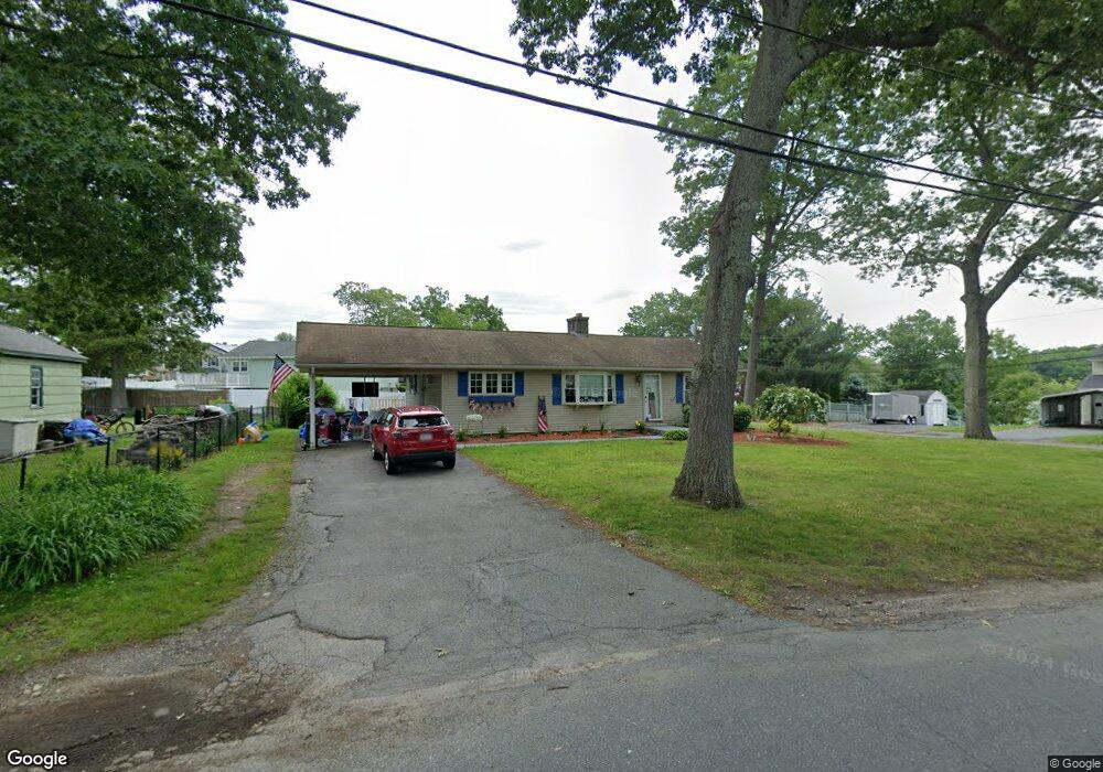
91 Macarthur Dr Millbury, MA 01527
Estimated Value: $443,000 - $492,000
2
Beds
2
Baths
1,215
Sq Ft
$384/Sq Ft
Est. Value
About This Home
This home is located at 91 Macarthur Dr, Millbury, MA 01527 and is currently estimated at $466,713, approximately $384 per square foot. 91 Macarthur Dr is a home located in Worcester County with nearby schools including Elmwood Street Elementary School, Raymond E. Shaw Elementary School, and Millbury Junior/Senior High School.
Ownership History
Date
Name
Owned For
Owner Type
Purchase Details
Closed on
Mar 1, 1991
Sold by
Gagnon Kenneth L and Gagnon Mary P
Bought by
Hakala Carl D and Hakala Deborah A
Current Estimated Value
Create a Home Valuation Report for This Property
The Home Valuation Report is an in-depth analysis detailing your home's value as well as a comparison with similar homes in the area
Home Values in the Area
Average Home Value in this Area
Purchase History
| Date | Buyer | Sale Price | Title Company |
|---|---|---|---|
| Hakala Carl D | $91,000 | -- | |
| Hakala Carl D | $91,000 | -- |
Source: Public Records
Mortgage History
| Date | Status | Borrower | Loan Amount |
|---|---|---|---|
| Open | Hakala Carl D | $215,000 | |
| Closed | Hakala Carl D | $172,000 | |
| Closed | Hakala Carl D | $144,800 |
Source: Public Records
Tax History Compared to Growth
Tax History
| Year | Tax Paid | Tax Assessment Tax Assessment Total Assessment is a certain percentage of the fair market value that is determined by local assessors to be the total taxable value of land and additions on the property. | Land | Improvement |
|---|---|---|---|---|
| 2025 | $5,609 | $418,900 | $109,100 | $309,800 |
| 2024 | $5,153 | $389,500 | $101,000 | $288,500 |
| 2023 | $4,683 | $324,100 | $70,900 | $253,200 |
| 2022 | $4,461 | $297,400 | $70,900 | $226,500 |
| 2021 | $4,367 | $283,000 | $70,900 | $212,100 |
| 2020 | $4,257 | $277,700 | $70,900 | $206,800 |
| 2019 | $4,099 | $258,600 | $64,400 | $194,200 |
| 2018 | $3,846 | $235,400 | $64,400 | $171,000 |
| 2017 | $3,585 | $218,200 | $64,400 | $153,800 |
| 2016 | $3,338 | $202,800 | $64,400 | $138,400 |
| 2015 | $3,350 | $203,500 | $68,500 | $135,000 |
| 2014 | $3,162 | $184,900 | $68,500 | $116,400 |
Source: Public Records
Map
Nearby Homes
- 90 Macarthur Dr
- 3 May St
- 86 Wheelock Ave
- 2 Diane St
- 11 Westview Ave
- 12 Alstead Path
- 12 Irene Ct
- 123 Riverlin St
- 1 Pineland Ave
- 64 Millbury Ave
- 1 Broadmeadow Ave
- 15 Rayburn Dr
- 46 John Dr Unit 46
- 5 Edward Dr
- 28 Lincoln Ln
- 330 Millbury Ave
- 5 Lincoln Ln Unit 5
- 21 Lordvale Blvd Unit 406
- 52 Clearview Terrace Unit 39
- 76 Samuel Dr
- 87 Macarthur Dr
- 111 Macarthur Dr
- 100 Macarthur Dr
- 104 Macarthur Dr
- 85 Macarthur Dr
- 108 Macarthur Dr
- 88 Macarthur Dr
- 117 Macarthur Dr
- 112 Macarthur Dr
- 86 Macarthur Dr
- 86 Macarthur Dr Unit left side
- 94-A B MacArthur Dr
- 92 Macarthur Dr
- 116 Macarthur Dr
- 118 Macarthur Dr
- 82 Macarthur Dr
- 77 Macarthur Dr
- 120 Macarthur Dr
- 127 Macarthur Dr
- 78 Macarthur Dr