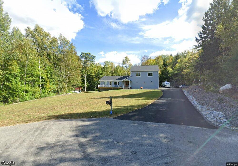
91 Mckenny Dr New Gloucester, ME 04260
Estimated Value: $412,000 - $600,000
3
Beds
2
Baths
1,260
Sq Ft
$399/Sq Ft
Est. Value
About This Home
This home is located at 91 Mckenny Dr, New Gloucester, ME 04260 and is currently estimated at $502,132, approximately $398 per square foot. 91 Mckenny Dr is a home located in Cumberland County with nearby schools including Gray-New Gloucester High School.
Ownership History
Date
Name
Owned For
Owner Type
Purchase Details
Closed on
May 4, 2023
Sold by
Maclean Sallya
Bought by
Karim Ali R and Karim Crystal J
Current Estimated Value
Create a Home Valuation Report for This Property
The Home Valuation Report is an in-depth analysis detailing your home's value as well as a comparison with similar homes in the area
Home Values in the Area
Average Home Value in this Area
Purchase History
| Date | Buyer | Sale Price | Title Company |
|---|---|---|---|
| Karim Ali R | -- | None Available |
Source: Public Records
Tax History Compared to Growth
Tax History
| Year | Tax Paid | Tax Assessment Tax Assessment Total Assessment is a certain percentage of the fair market value that is determined by local assessors to be the total taxable value of land and additions on the property. | Land | Improvement |
|---|---|---|---|---|
| 2025 | $6,106 | $394,712 | $77,640 | $317,072 |
| 2024 | $5,455 | $366,350 | $77,640 | $288,710 |
| 2023 | $3,150 | $220,434 | $77,640 | $142,794 |
| 2022 | $3,042 | $220,434 | $77,640 | $142,794 |
| 2021 | $3,042 | $220,434 | $77,640 | $142,794 |
| 2020 | $3,009 | $220,434 | $77,640 | $142,794 |
| 2019 | $2,949 | $174,500 | $59,700 | $114,800 |
| 2018 | $2,757 | $174,500 | $59,700 | $114,800 |
| 2017 | $2,722 | $174,500 | $59,700 | $114,800 |
| 2016 | $2,565 | $174,500 | $59,700 | $114,800 |
| 2015 | $2,556 | $174,500 | $59,700 | $114,800 |
| 2014 | $2,530 | $174,500 | $59,700 | $114,800 |
| 2013 | $2,347 | $174,500 | $59,700 | $114,800 |
Source: Public Records
Map
Nearby Homes
- 24 Swamp Rd
- 271 Bennett Rd
- 22 Shaw Rd
- 164 Intervale Rd
- TBD Targett Rd
- 160 Gloucester Hill Rd
- 10 Cobbs Bridge Rd
- 155 & 151 Gloucester Hill Rd
- 0018-C Gloucester Hill Rd
- 29 Rockwood Dr
- 14 Golden Way
- 12 Country Charm Ln
- 423 Sabbathday Rd
- 161 Beaver Dam Dr
- 10-56 C&E Bowdoin Way
- 200 Woodman Rd
- 343 Shaker Rd
- 26 Carpenter Rd
- 10 Spring Valley Ln
- 46-47D Hines Rd & Main St