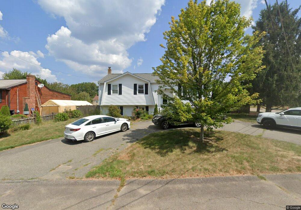
91 Pomona Dr Brockton, MA 02302
Estimated Value: $475,000 - $533,000
4
Beds
2
Baths
1,092
Sq Ft
$465/Sq Ft
Est. Value
About This Home
This home is located at 91 Pomona Dr, Brockton, MA 02302 and is currently estimated at $507,571, approximately $464 per square foot. 91 Pomona Dr is a home located in Plymouth County with nearby schools including Brookfield Elementary School, Downey Elementary School, and Ashfield Middle School.
Ownership History
Date
Name
Owned For
Owner Type
Purchase Details
Closed on
Oct 24, 2008
Sold by
Franson Bradley G and Franson Edna L
Bought by
Hernando Miguel A and Hernando Loida
Current Estimated Value
Home Financials for this Owner
Home Financials are based on the most recent Mortgage that was taken out on this home.
Original Mortgage
$186,000
Interest Rate
5.94%
Mortgage Type
Purchase Money Mortgage
Purchase Details
Closed on
Sep 23, 1998
Sold by
Grant Jeanne B
Bought by
Franson Bradley G
Create a Home Valuation Report for This Property
The Home Valuation Report is an in-depth analysis detailing your home's value as well as a comparison with similar homes in the area
Home Values in the Area
Average Home Value in this Area
Purchase History
| Date | Buyer | Sale Price | Title Company |
|---|---|---|---|
| Hernando Miguel A | $246,000 | -- | |
| Franson Bradley G | $141,500 | -- |
Source: Public Records
Mortgage History
| Date | Status | Borrower | Loan Amount |
|---|---|---|---|
| Open | Franson Bradley G | $181,700 | |
| Closed | Franson Bradley G | $186,000 |
Source: Public Records
Tax History Compared to Growth
Tax History
| Year | Tax Paid | Tax Assessment Tax Assessment Total Assessment is a certain percentage of the fair market value that is determined by local assessors to be the total taxable value of land and additions on the property. | Land | Improvement |
|---|---|---|---|---|
| 2025 | $5,227 | $431,600 | $146,400 | $285,200 |
| 2024 | $5,089 | $423,400 | $146,400 | $277,000 |
| 2023 | $5,324 | $410,200 | $111,500 | $298,700 |
| 2022 | $5,095 | $364,700 | $101,400 | $263,300 |
| 2021 | $4,808 | $331,600 | $95,900 | $235,700 |
| 2020 | $4,428 | $292,300 | $91,900 | $200,400 |
| 2019 | $4,280 | $275,400 | $86,200 | $189,200 |
| 2018 | $4,029 | $250,900 | $86,200 | $164,700 |
| 2017 | $3,716 | $230,800 | $86,200 | $144,600 |
| 2016 | $3,712 | $213,800 | $82,300 | $131,500 |
| 2015 | $3,485 | $192,000 | $82,300 | $109,700 |
| 2014 | $3,419 | $188,600 | $82,300 | $106,300 |
Source: Public Records
Map
Nearby Homes
- 95 Royal Rd
- 72 Annette Rd
- 65 Leahy Rd
- 209 Bates Rd
- 232 Bates Rd
- 21 Annette Rd
- 35 Errol Rd
- 146 Gloucester St
- 82 Debbie Rd Unit Lot 18
- 59 Sharon St
- 92 Gloucester St
- 9 Massachusetts Ave
- 111 Ames Rd
- 135 Guild Rd
- 590 E Ashland St
- 43 Pinehurst Ave
- 10 Exeter St
- 2 Dundee St
- 877 Brockton Ave Unit 877
- 16 Davis St