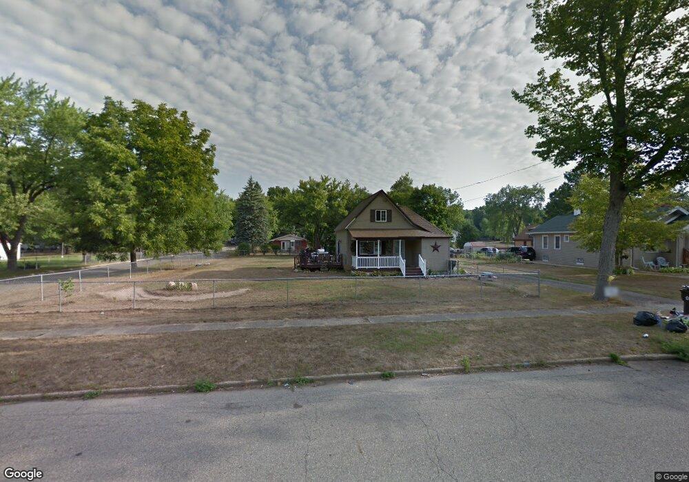
91 Willard Ave E Battle Creek, MI 49037
Urbandale NeighborhoodEstimated Value: $122,000 - $147,000
2
Beds
1
Bath
1,029
Sq Ft
$133/Sq Ft
Est. Value
About This Home
This home is located at 91 Willard Ave E, Battle Creek, MI 49037 and is currently estimated at $137,189, approximately $133 per square foot. 91 Willard Ave E is a home located in Calhoun County with nearby schools including Northwestern Middle School, Battle Creek Central High School, and Battle Creek Montessori Academy.
Ownership History
Date
Name
Owned For
Owner Type
Purchase Details
Closed on
Jul 30, 2005
Sold by
Dykgraaf Timothy L
Bought by
St John Windy
Current Estimated Value
Home Financials for this Owner
Home Financials are based on the most recent Mortgage that was taken out on this home.
Original Mortgage
$60,000
Outstanding Balance
$31,580
Interest Rate
5.69%
Mortgage Type
Fannie Mae Freddie Mac
Estimated Equity
$105,609
Purchase Details
Closed on
Nov 6, 2002
Sold by
Dykgraaf Timothy L
Bought by
St John,Windy S
Purchase Details
Closed on
May 5, 1995
Bought by
Dykgraaf
Create a Home Valuation Report for This Property
The Home Valuation Report is an in-depth analysis detailing your home's value as well as a comparison with similar homes in the area
Home Values in the Area
Average Home Value in this Area
Purchase History
| Date | Buyer | Sale Price | Title Company |
|---|---|---|---|
| St John Windy | $50,000 | Nta | |
| St John,Windy S | $50,000 | -- | |
| Dykgraaf | $15,000 | -- |
Source: Public Records
Mortgage History
| Date | Status | Borrower | Loan Amount |
|---|---|---|---|
| Open | St John Windy | $60,000 |
Source: Public Records
Tax History Compared to Growth
Tax History
| Year | Tax Paid | Tax Assessment Tax Assessment Total Assessment is a certain percentage of the fair market value that is determined by local assessors to be the total taxable value of land and additions on the property. | Land | Improvement |
|---|---|---|---|---|
| 2025 | -- | $54,700 | $0 | $0 |
| 2024 | $1,416 | $50,133 | $0 | $0 |
| 2023 | $1,918 | $45,605 | $0 | $0 |
| 2022 | $1,159 | $35,527 | $0 | $0 |
| 2021 | $1,062 | $30,488 | $0 | $0 |
| 2020 | $1,052 | $29,285 | $0 | $0 |
| 2019 | $996 | $25,725 | $0 | $0 |
| 2018 | $996 | $23,805 | $2,771 | $21,034 |
| 2017 | $965 | $29,021 | $0 | $0 |
| 2016 | $963 | $23,210 | $0 | $0 |
| 2015 | $944 | $22,363 | $9,170 | $13,193 |
| 2014 | $944 | $20,479 | $9,170 | $11,309 |
Source: Public Records
Map
Nearby Homes
- 137 Dunning Ave
- 134 Willard Ave E
- 51 Dunning Ave
- 42 Althea Ave
- 1528 Michigan Ave W
- 33 Shellenberger Ave
- 1 Brizse Ave
- 35 Avery Ave
- 0 Bynum Drive Lots 29 & 30 Dr Unit 25025910
- 40 Kellogg St
- 124 Parkridge Dr
- 163 Spaulding Ave W
- 1111 Michigan Ave W
- 81 Taylor Ave
- 116 Geneva Ave
- 387 Waubascon Rd
- 134 Creekview Dr
- 133 Mosher Ave
- 1823 Michigan Ave W
- 180 Woodlawn Ave N
- 99 Willard Ave E
- 96 Willard Ave E
- 102 Willard Ave E
- 111 Willard Ave E
- 77 Willard Ave E
- 86 Willard Ave E
- 97 Myrtle Ave
- 97 Dunning Ave
- 90 Willard Ave E
- 137 Dunning Ave
- 91 Dunning Ave
- 82 Willard Ave E
- 69 Willard Ave E
- 0 Dunning Ave
- 000 Dunning Ave
- 126 Willard Ave E
- 116 Dunning Ave
- 78 Myrtle Ave
- 74 Hinman Ave N
- 128 Dunning Ave