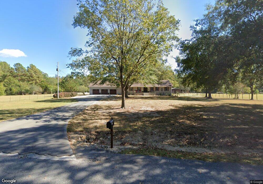
910 Camp Branch Rd Unit 2A & 3A Alabaster, AL 35007
Estimated Value: $427,000 - $634,000
Studio
--
Bath
2,479
Sq Ft
$198/Sq Ft
Est. Value
About This Home
This home is located at 910 Camp Branch Rd Unit 2A & 3A, Alabaster, AL 35007 and is currently estimated at $490,247, approximately $197 per square foot. 910 Camp Branch Rd Unit 2A & 3A is a home located in Shelby County with nearby schools including Thompson Intermediate School, Thompson Middle School, and Thompson High School.
Ownership History
Date
Name
Owned For
Owner Type
Purchase Details
Closed on
May 4, 2018
Sold by
Camp Banch Llc
Bought by
Hess Michael E and Hess Kimberly S
Current Estimated Value
Home Financials for this Owner
Home Financials are based on the most recent Mortgage that was taken out on this home.
Original Mortgage
$228,000
Outstanding Balance
$195,278
Interest Rate
4.45%
Mortgage Type
New Conventional
Estimated Equity
$294,969
Purchase Details
Closed on
Sep 11, 2017
Sold by
Graves Jerry Wayne and Graves Patrick Dewayne
Bought by
Camp Branch Llc
Home Financials for this Owner
Home Financials are based on the most recent Mortgage that was taken out on this home.
Original Mortgage
$340,000
Interest Rate
3.92%
Mortgage Type
Commercial
Create a Home Valuation Report for This Property
The Home Valuation Report is an in-depth analysis detailing your home's value as well as a comparison with similar homes in the area
Home Values in the Area
Average Home Value in this Area
Purchase History
| Date | Buyer | Sale Price | Title Company |
|---|---|---|---|
| Hess Michael E | $285,000 | None Available | |
| Camp Branch Llc | $405,000 | None Available |
Source: Public Records
Mortgage History
| Date | Status | Borrower | Loan Amount |
|---|---|---|---|
| Open | Hess Michael E | $228,000 | |
| Previous Owner | Camp Branch Llc | $340,000 |
Source: Public Records
Tax History
| Year | Tax Paid | Tax Assessment Tax Assessment Total Assessment is a certain percentage of the fair market value that is determined by local assessors to be the total taxable value of land and additions on the property. | Land | Improvement |
|---|---|---|---|---|
| 2024 | $1,688 | $38,320 | $0 | $0 |
| 2023 | $1,515 | $35,320 | $0 | $0 |
| 2022 | $1,382 | $32,300 | $0 | $0 |
| 2021 | $1,274 | $29,860 | $0 | $0 |
| 2020 | $1,251 | $29,320 | $0 | $0 |
| 2019 | $1,215 | $28,520 | $0 | $0 |
| 2017 | $2,265 | $51,440 | $0 | $0 |
| 2015 | $490 | $37,980 | $0 | $0 |
| 2014 | $612 | $38,400 | $0 | $0 |
Source: Public Records
Map
Nearby Homes
- 1383 Camp Branch Rd
- 207 Stetson Ln
- 236 Thoroughbred Ln
- 105 Quarterhorse Ln
- 595 Ridgeview Lake Dr
- 1093 Deer Run Rd
- 2041 Lonesome Hen Ln
- 551 Oakmont Dr
- 770 Highway 31 S
- 0 Deer Run Rd Unit 21447757
- 2 Oakmont Dr
- 3 Oakmont Dr
- 1775 Ridgeview Lake Rd
- 133 Broadmoor Ln
- 405 Weatherly Club Dr
- 169 Windsor Ln
- 136 Lauchlin Ln
- 123 Cove Ln
- 00 Highway 87
- 212 Broadmoor Cir
- 910 Camp Branch Rd
- 939 Camp Branch Rd
- 1010 Camp Branch Rd
- 1998 Timber Ln
- 867 Camp Branch Rd
- 863 Camp Branch Rd
- 774 Camp Branch Rd
- 2000 Timber Ln
- 2002 Timber Ln
- 1999 Timber Ln
- 797 Camp Branch Rd
- 2005 Timber Ln
- 735 Camp Branch Rd
- 2004 Timber Ln
- 1125 Camp Branch Rd
- 707 Camp Branch Rd
- 2001 Timber Ln
- 0 Timber Ln Unit 506386
- 0 Timber Ln Unit 16 AC
- 35 Ballard Ln
Your Personal Tour Guide
Ask me questions while you tour the home.