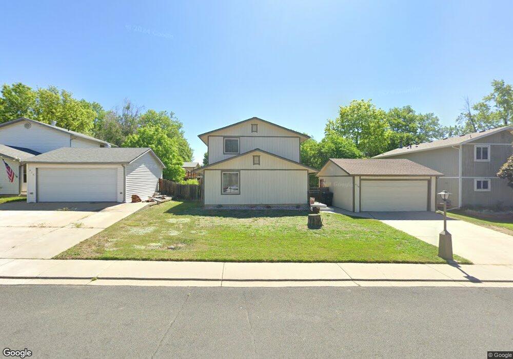
910 Marmot Ct Longmont, CO 80504
Clark Centennial NeighborhoodEstimated Value: $483,408 - $536,000
4
Beds
2
Baths
1,824
Sq Ft
$276/Sq Ft
Est. Value
About This Home
This home is located at 910 Marmot Ct, Longmont, CO 80504 and is currently estimated at $502,602, approximately $275 per square foot. 910 Marmot Ct is a home located in Boulder County with nearby schools including Timberline Pk-8, Skyline High School, and Messiahville Baptist Academy.
Ownership History
Date
Name
Owned For
Owner Type
Purchase Details
Closed on
May 16, 2018
Sold by
Pearson Virginia H and Estate Of Douglas C Pearson
Bought by
Pearson Virginia H
Current Estimated Value
Purchase Details
Closed on
Apr 16, 1979
Bought by
Pearson Douglas C and Pearson Virginia H
Purchase Details
Closed on
Jun 7, 1977
Bought by
Pearson Douglas C and Pearson Virginia H
Purchase Details
Closed on
May 17, 1976
Bought by
Pearson Douglas C and Pearson Virginia H
Create a Home Valuation Report for This Property
The Home Valuation Report is an in-depth analysis detailing your home's value as well as a comparison with similar homes in the area
Home Values in the Area
Average Home Value in this Area
Purchase History
| Date | Buyer | Sale Price | Title Company |
|---|---|---|---|
| Pearson Virginia H | -- | None Available | |
| Pearson Douglas C | $57,800 | -- | |
| Pearson Douglas C | $43,800 | -- | |
| Pearson Douglas C | $34,000 | -- |
Source: Public Records
Tax History Compared to Growth
Tax History
| Year | Tax Paid | Tax Assessment Tax Assessment Total Assessment is a certain percentage of the fair market value that is determined by local assessors to be the total taxable value of land and additions on the property. | Land | Improvement |
|---|---|---|---|---|
| 2025 | $1,987 | $28,488 | $7,825 | $20,663 |
| 2024 | $1,987 | $28,488 | $7,825 | $20,663 |
| 2023 | $1,960 | $27,470 | $8,630 | $22,525 |
| 2022 | $1,630 | $23,421 | $6,491 | $16,930 |
| 2021 | $1,651 | $24,095 | $6,678 | $17,417 |
| 2020 | $1,308 | $20,614 | $5,792 | $14,822 |
| 2019 | $1,287 | $20,614 | $5,792 | $14,822 |
| 2018 | $988 | $17,597 | $5,832 | $11,765 |
| 2017 | $974 | $19,455 | $6,448 | $13,007 |
| 2016 | $746 | $15,609 | $5,094 | $10,515 |
| 2015 | $711 | $13,484 | $4,298 | $9,186 |
| 2014 | $630 | $13,484 | $4,298 | $9,186 |
Source: Public Records
Map
Nearby Homes
- 811 Brookside Dr
- 884 Elliott St
- 908 Sugar Mill Ave
- 902 Sugar Mill Ave
- 756 Brookside Dr
- 741 Elliott St
- 742 Megan Ct
- 620 Independence Dr
- 712 Pendleton Ave
- 1267 E 9th Ave
- 619 Brookside Dr
- 713 Pendleton Ave
- 575 Brookside Dr
- 618 Silver Star Ct
- 1245 Trail Ridge Rd
- 829 Independence Dr
- 225 E 8th Ave Unit E20
- 225 E 8th Ave Unit A2
- 225 E 8th Ave Unit E10
- 12027 Saint Vrain Rd