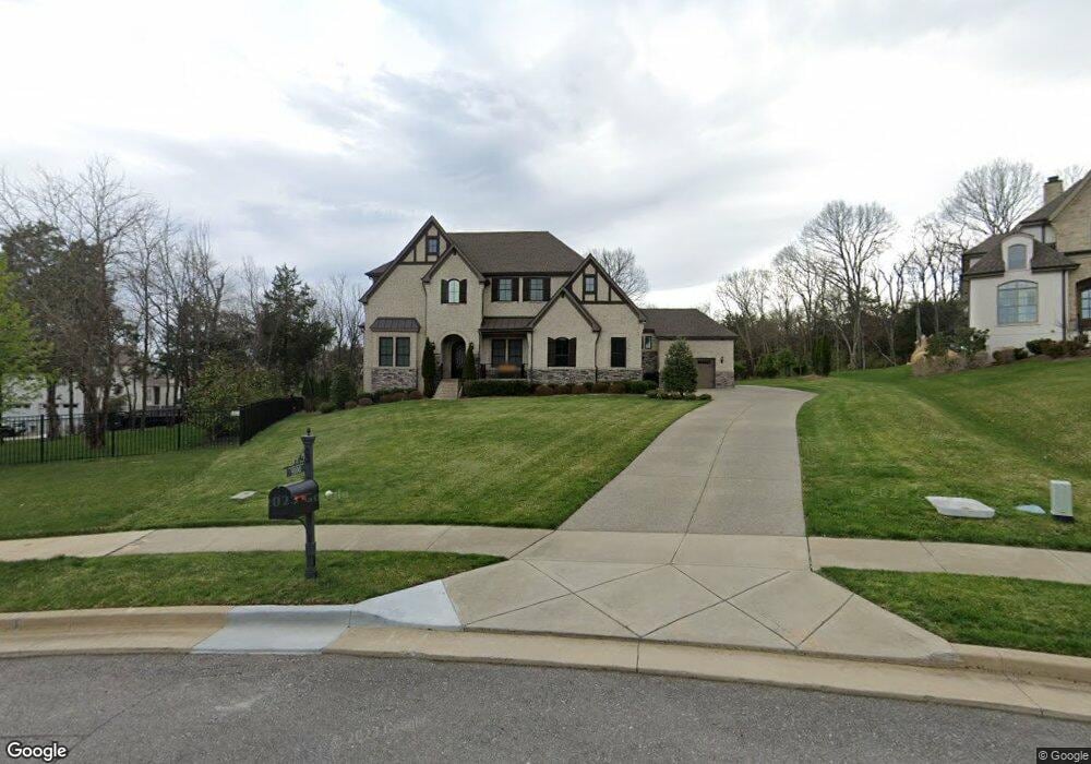
9100 Raindrop Cir Unit 7 Brentwood, TN 37027
Estimated Value: $1,768,000 - $2,193,128
--
Bed
5
Baths
5,066
Sq Ft
$391/Sq Ft
Est. Value
About This Home
This home is located at 9100 Raindrop Cir Unit 7, Brentwood, TN 37027 and is currently estimated at $1,980,564, approximately $390 per square foot. 9100 Raindrop Cir Unit 7 is a home located in Williamson County with nearby schools including Kenrose Elementary School, Woodland Middle School, and Ravenwood High School.
Ownership History
Date
Name
Owned For
Owner Type
Purchase Details
Closed on
Mar 22, 2018
Sold by
Drees Premier Homes Inc An Ohio Corporat
Bought by
Berry James C and Berry Diana H
Current Estimated Value
Home Financials for this Owner
Home Financials are based on the most recent Mortgage that was taken out on this home.
Original Mortgage
$651,000
Outstanding Balance
$542,509
Interest Rate
3.37%
Mortgage Type
Adjustable Rate Mortgage/ARM
Estimated Equity
$1,438,055
Purchase Details
Closed on
Sep 6, 2017
Sold by
Whistler Farms Limited Liability Company
Bought by
Drees Premier Homes Inc
Create a Home Valuation Report for This Property
The Home Valuation Report is an in-depth analysis detailing your home's value as well as a comparison with similar homes in the area
Home Values in the Area
Average Home Value in this Area
Purchase History
| Date | Buyer | Sale Price | Title Company |
|---|---|---|---|
| Berry James C | $1,074,803 | Limestone Title & Escrow Llc | |
| Drees Premier Homes Inc | $265,000 | Midtown Title Llc |
Source: Public Records
Mortgage History
| Date | Status | Borrower | Loan Amount |
|---|---|---|---|
| Open | Berry James C | $651,000 |
Source: Public Records
Tax History Compared to Growth
Tax History
| Year | Tax Paid | Tax Assessment Tax Assessment Total Assessment is a certain percentage of the fair market value that is determined by local assessors to be the total taxable value of land and additions on the property. | Land | Improvement |
|---|---|---|---|---|
| 2025 | -- | $531,275 | $162,500 | $368,775 |
| 2024 | -- | $315,350 | $91,250 | $224,100 |
| 2023 | $0 | $315,350 | $91,250 | $224,100 |
| 2022 | $6,844 | $315,350 | $91,250 | $224,100 |
| 2021 | $6,844 | $315,350 | $91,250 | $224,100 |
| 2020 | $6,732 | $260,950 | $62,500 | $198,450 |
| 2019 | $6,732 | $260,950 | $62,500 | $198,450 |
| 2018 | $5,389 | $214,675 | $62,500 | $152,175 |
| 2017 | $1,556 | $62,500 | $62,500 | $0 |
Source: Public Records
Map
Nearby Homes
- 1931 Parade Dr
- 1885 Barnstaple Ln
- 1884 Barnstaple Ln
- 9479 Helston Ct
- 1851 Barnstaple Ln
- 1852 Traditions Cir
- 9488 Stillbrook Trace
- 1832 Ivy Crest Dr
- 109 Bayhill Cir
- 1800 Grey Pointe Dr
- 1830 Kettering Trace
- 9409 Clovercroft Rd
- 1801 Morgan Farms Way
- 6128 Lookaway Cir
- 9092 Chardonnay Trace
- 6124 Lookaway Cir
- 9085 Chardonnay Trace
- 9560 Dresden Square
- 9065 Chardonnay Trace
- 9539 Dresden Square
- 9100 Raindrop Cir
- 1952 Parade Dr
- 1952 Parade Dr
- 1954 Parade Dr
- 1950 Parade Dr Unit 10
- 9104 Raindrop Cir
- 1950 Parade Drive #10
- 9106 Raindrop Cir
- 9106 Raindrop Cir
- 9104 9104 Raindrop Cir *Lot 5*
- 9108 Raindrop Cir
- 1958 Parade Dr
- 1940 Parade Drive #11
- 1938 Parade Dr
- 1945 Parade Drive #109
- 1947 Parade Dr
- 1960 Parade Dr
- 1936 Parade Drive #13
- 1941 Parade Drive #100
- 1934 Parade Drive #14