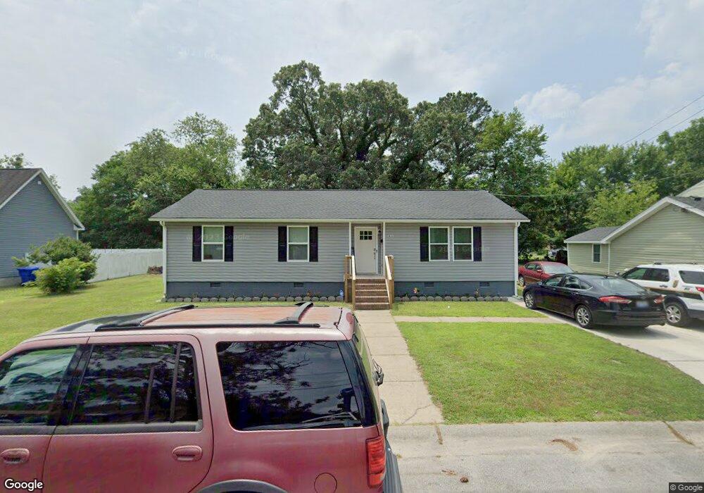
911 Battery Ave Suffolk, VA 23434
Holy Neck NeighborhoodEstimated Value: $264,000 - $291,000
3
Beds
2
Baths
1,390
Sq Ft
$198/Sq Ft
Est. Value
About This Home
This home is located at 911 Battery Ave, Suffolk, VA 23434 and is currently estimated at $275,475, approximately $198 per square foot. 911 Battery Ave is a home located in Suffolk City with nearby schools including Hillpoint Elementary School, Forest Glen Middle School, and Lakeland High School.
Ownership History
Date
Name
Owned For
Owner Type
Purchase Details
Closed on
May 24, 2022
Sold by
Green Willie L and Green Barbara L
Bought by
Vaughan Veronica
Current Estimated Value
Home Financials for this Owner
Home Financials are based on the most recent Mortgage that was taken out on this home.
Original Mortgage
$245,373
Outstanding Balance
$232,134
Interest Rate
5.27%
Mortgage Type
FHA
Estimated Equity
$43,341
Create a Home Valuation Report for This Property
The Home Valuation Report is an in-depth analysis detailing your home's value as well as a comparison with similar homes in the area
Home Values in the Area
Average Home Value in this Area
Purchase History
| Date | Buyer | Sale Price | Title Company |
|---|---|---|---|
| Vaughan Veronica | $249,900 | None Listed On Document |
Source: Public Records
Mortgage History
| Date | Status | Borrower | Loan Amount |
|---|---|---|---|
| Open | Vaughan Veronica | $245,373 |
Source: Public Records
Tax History
| Year | Tax Paid | Tax Assessment Tax Assessment Total Assessment is a certain percentage of the fair market value that is determined by local assessors to be the total taxable value of land and additions on the property. | Land | Improvement |
|---|---|---|---|---|
| 2025 | $3,008 | $239,100 | $49,100 | $190,000 |
| 2024 | $3,008 | $231,100 | $49,100 | $182,000 |
| 2023 | $2,866 | $220,400 | $46,800 | $173,600 |
| 2022 | $1,970 | $180,700 | $33,400 | $147,300 |
| 2021 | $1,183 | $106,600 | $26,700 | $79,900 |
| 2020 | $1,079 | $97,200 | $24,300 | $72,900 |
| 2019 | $1,079 | $97,200 | $24,300 | $72,900 |
| 2018 | $1,211 | $97,000 | $24,300 | $72,700 |
| 2017 | $1,038 | $97,000 | $24,300 | $72,700 |
| 2016 | $1,038 | $97,000 | $24,300 | $72,700 |
| 2015 | $657 | $100,500 | $24,300 | $76,200 |
| 2014 | $657 | $100,500 | $24,300 | $76,200 |
Source: Public Records
Map
Nearby Homes
- 812 Battery Ave
- 814 Battery Ave
- 729 Brook Ave
- 731 Brook Ave
- 727 Brook Ave
- 721 Ashley Ave Unit A
- 711 Brook Ave
- 608 Battery Ave
- 603 Mason Ave
- 532 Battery Ave
- 207 Causey Ave
- 309 Linden Ave
- 435 Wellons St
- 441 Wellons St
- 439 Wellons St
- 437 Wellons St
- 433 Wellons St
- 314 Linden Ave
- 1107 Lake Point Ln
- 921 Howard Place
- 913 Battery Ave
- 915 Battery Ave
- 904 Brook Ave
- 910 Brook Ave
- 900 Brook Ave
- 908 Battery Ave
- 910 Battery Ave
- 902 Battery Ave
- 919 Battery Ave
- 900 Battery Ave
- 833 Battery Ave
- 916 Brook Ave
- 834 Brook Ave
- 832 Brook Ave
- 832 Battery Ave
- 829 Battery Ave
- 905 Ashley Ave
- 907 Ashley Ave
- 827 Battery Ave
- 431 Hull St
Your Personal Tour Guide
Ask me questions while you tour the home.