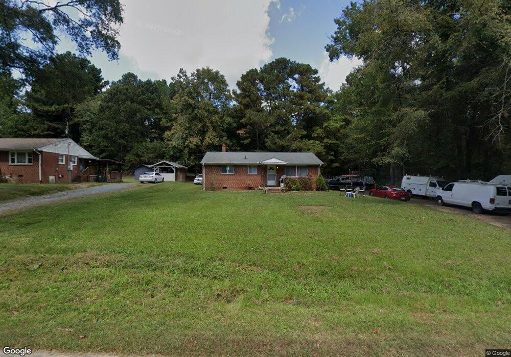
911 Jones Cir Durham, NC 27703
Bethesda NeighborhoodEstimated Value: $229,442 - $304,000
3
Beds
1
Bath
1,025
Sq Ft
$258/Sq Ft
Est. Value
About This Home
This home is located at 911 Jones Cir, Durham, NC 27703 and is currently estimated at $264,611, approximately $258 per square foot. 911 Jones Cir is a home located in Durham County with nearby schools including Bethesda Elementary School, John W Neal Middle School, and Southern School of Energy & Sustainability.
Ownership History
Date
Name
Owned For
Owner Type
Purchase Details
Closed on
Oct 28, 2024
Sold by
Hight Robert E and Hight Jan Weaver
Bought by
Mmrj Enterprises Llc
Current Estimated Value
Purchase Details
Closed on
Aug 24, 2020
Sold by
Hight Family Properties I Llc
Bought by
Hight Robert E
Purchase Details
Closed on
Oct 29, 2015
Sold by
Black Brenda High and Robert Edward High Marital Tru
Bought by
High Family Properties 1 Llc
Purchase Details
Closed on
May 23, 2007
Sold by
Hight Gloria Faye Jones and Hight Robert Edward
Bought by
The Robert Edward Hight Marital Trust
Create a Home Valuation Report for This Property
The Home Valuation Report is an in-depth analysis detailing your home's value as well as a comparison with similar homes in the area
Home Values in the Area
Average Home Value in this Area
Purchase History
| Date | Buyer | Sale Price | Title Company |
|---|---|---|---|
| Mmrj Enterprises Llc | -- | None Listed On Document | |
| Hight Robert E | -- | None Available | |
| High Family Properties 1 Llc | -- | Attorney | |
| The Robert Edward Hight Marital Trust | -- | None Available |
Source: Public Records
Tax History
| Year | Tax Paid | Tax Assessment Tax Assessment Total Assessment is a certain percentage of the fair market value that is determined by local assessors to be the total taxable value of land and additions on the property. | Land | Improvement |
|---|---|---|---|---|
| 2025 | $1,796 | $246,006 | $126,875 | $119,131 |
| 2024 | $894 | $73,707 | $29,040 | $44,667 |
| 2023 | $863 | $73,707 | $29,040 | $44,667 |
| 2022 | $835 | $73,707 | $29,040 | $44,667 |
| 2021 | $646 | $73,707 | $29,040 | $44,667 |
| 2020 | $632 | $73,707 | $29,040 | $44,667 |
| 2019 | $678 | $80,048 | $29,040 | $51,008 |
| 2018 | $628 | $68,083 | $28,920 | $39,163 |
| 2017 | $608 | $68,083 | $28,920 | $39,163 |
| 2016 | $589 | $88,425 | $28,920 | $59,505 |
| 2015 | $693 | $60,000 | $33,434 | $26,566 |
| 2014 | $696 | $60,000 | $33,434 | $26,566 |
Source: Public Records
Map
Nearby Homes
- 3525 Angier Ave
- 3642 Star Gazing Ln
- 3112 Star Gazing Ln
- 519 Pleasant Dr
- 1112 Pate Farm Ln
- 706 Carter Ave
- 3857 Angier Ave
- 2157 Mica Ridge Ln
- 2159 Mica Ridge Ln
- 2203 Mica Ridge Ln
- 3311 Gypsum Dr
- 3201 Delmar Dr
- 3301 Gypsum Dr
- 3212 Opal Dr
- 3214 Opal Dr
- 3303 Gypsum Dr
- 3309 Gypsum Dr
- 1172 Pate Farm Ln
- 3215 Opal Dr
- 3217 Gypsum Dr
- 909 Jones Cir
- 907 Jones Cir
- 915 Jones Cir
- 905 Jones Cir
- 912 Jones Cir
- 917 Jones Cir
- 914 Jones Cir
- 903 Jones Cir
- 919 Jones Cir
- 916 Jones Cir
- 921 Jones Cir
- 918 Jones Cir
- 3627 Angier Ave
- 3625 Angier Ave
- 920 Jones Cir
- 923 Jones Cir
- 3623 Angier Ave
- 1274 S Miami Blvd
- 1274 S Miami Blvd Unit 52
- 922 Jones Cir
Your Personal Tour Guide
Ask me questions while you tour the home.