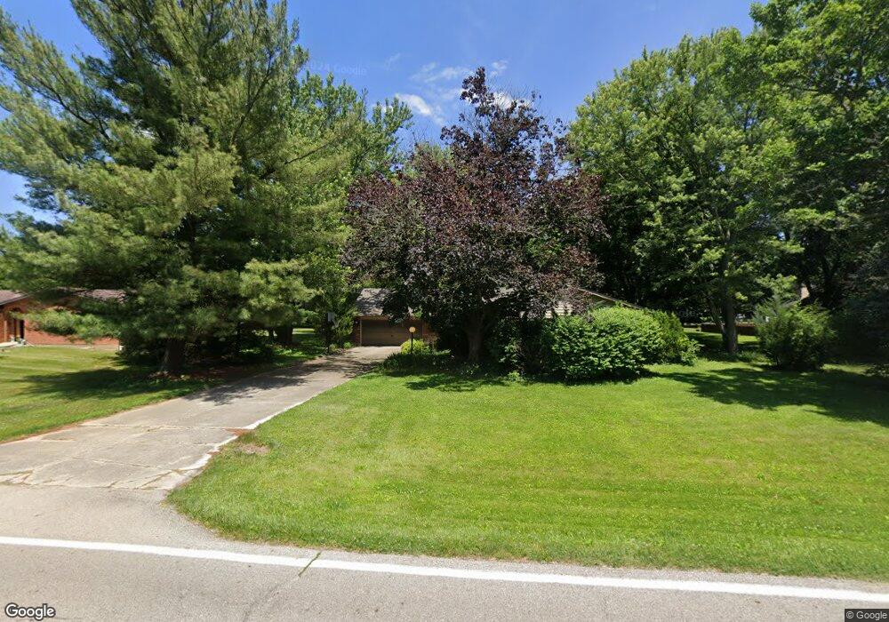
911 Michaels Rd Tipp City, OH 45371
Estimated Value: $357,212 - $379,000
4
Beds
2
Baths
2,125
Sq Ft
$175/Sq Ft
Est. Value
About This Home
This home is located at 911 Michaels Rd, Tipp City, OH 45371 and is currently estimated at $372,053, approximately $175 per square foot. 911 Michaels Rd is a home located in Miami County with nearby schools including Broadway Elementary School, Nevin Coppock Elementary School, and L. T. Ball Intermediate School.
Ownership History
Date
Name
Owned For
Owner Type
Purchase Details
Closed on
Apr 14, 2025
Sold by
Mosier Builders Inc and Richard J Mosier Builders Inc
Bought by
Oen Mark Alan and Oen Christa Lynn
Current Estimated Value
Purchase Details
Closed on
Oct 18, 2024
Sold by
Baron Beverly Leigh Herndon and Routte Jennifer L
Bought by
Mosier Builders Inc
Purchase Details
Closed on
Mar 29, 2002
Sold by
Baron John Christopher
Bought by
Baron Leigh Herndon
Purchase Details
Closed on
Jan 24, 1991
Bought by
Baron John Christopher
Create a Home Valuation Report for This Property
The Home Valuation Report is an in-depth analysis detailing your home's value as well as a comparison with similar homes in the area
Home Values in the Area
Average Home Value in this Area
Purchase History
| Date | Buyer | Sale Price | Title Company |
|---|---|---|---|
| Oen Mark Alan | $365,000 | None Listed On Document | |
| Mosier Builders Inc | $120,000 | None Listed On Document | |
| Baron Leigh Herndon | -- | -- | |
| Baron John Christopher | $125,000 | -- |
Source: Public Records
Tax History Compared to Growth
Tax History
| Year | Tax Paid | Tax Assessment Tax Assessment Total Assessment is a certain percentage of the fair market value that is determined by local assessors to be the total taxable value of land and additions on the property. | Land | Improvement |
|---|---|---|---|---|
| 2024 | $4,176 | $79,280 | $14,040 | $65,240 |
| 2023 | $4,176 | $79,280 | $14,040 | $65,240 |
| 2022 | $3,828 | $79,280 | $14,040 | $65,240 |
| 2021 | $3,066 | $58,740 | $10,400 | $48,340 |
| 2020 | $3,066 | $58,740 | $10,400 | $48,340 |
| 2019 | $3,093 | $58,740 | $10,400 | $48,340 |
| 2018 | $2,845 | $50,340 | $11,660 | $38,680 |
| 2017 | $2,855 | $50,340 | $11,660 | $38,680 |
| 2016 | $2,738 | $50,340 | $11,660 | $38,680 |
| 2015 | $2,316 | $44,950 | $10,400 | $34,550 |
| 2014 | $2,316 | $44,950 | $10,400 | $34,550 |
| 2013 | $2,327 | $44,950 | $10,400 | $34,550 |
Source: Public Records
Map
Nearby Homes
- 6060 Detrick Rd
- 295 Coach Dr
- 512 Cider Mill Way
- The Prescott Plan at Fieldstone Place
- The Lynwood Plan at Emerson Crossing
- The Concord Plan at Emerson Crossing
- The Magnolia Plan at Fieldstone Place
- The Cambridge Plan at Emerson Crossing
- The Sandalwood Plan at Fieldstone Place
- The Lincoln Plan at Emerson Crossing
- The Plainfield Plan at Fieldstone Place
- The Cambridge Plan at Fieldstone Place
- The Magnolia Plan at Emerson Crossing
- The Prescott Plan at Emerson Crossing
- The Fieldstone Plan at Emerson Crossing
- The Zink Plan at Fieldstone Place
- The Concord Plan at Fieldstone Place
- The Warren Plan at Fieldstone Place
- The Fieldstone Plan at Fieldstone Place
- The Warren Plan at Emerson Crossing
- 885 Michaels Rd
- 933 Michaels Rd
- 5945 Phillip Dr
- 865 Michaels Rd
- 5940 Bradley Dr
- 910 Michaels Rd
- 890 Michaels Rd
- 965 Michaels Rd
- 6033 Detrick Rd
- 5925 Phillip Dr
- 870 Michaels Rd
- 5920 Bradley Dr
- 970 Michaels Rd
- 5940 Phillip Dr
- 995 Michaels Rd
- 5895 Phillip Dr
- 6065 Detrick Rd
- 825 Michaels Rd
- 840 Michaels Rd
- 5920 Phillip Dr