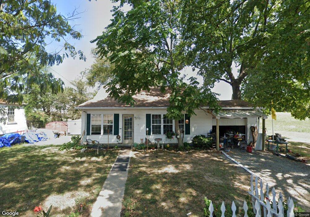
911 Power St Clarksville, TN 37042
New Providence NeighborhoodEstimated Value: $123,000 - $258,000
--
Bed
1
Bath
1,052
Sq Ft
$162/Sq Ft
Est. Value
About This Home
This home is located at 911 Power St, Clarksville, TN 37042 and is currently estimated at $170,061, approximately $161 per square foot. 911 Power St is a home located in Montgomery County with nearby schools including Byrns L. Darden Elementary School, Kenwood Middle School, and Kenwood High School.
Ownership History
Date
Name
Owned For
Owner Type
Purchase Details
Closed on
Jan 26, 2010
Sold by
Bank Of America National A
Bought by
Arzon Fred B
Current Estimated Value
Purchase Details
Closed on
Feb 12, 2009
Sold by
Williams James
Bought by
Bank Of America
Purchase Details
Closed on
Jul 8, 2006
Sold by
Wright Robert E
Bought by
William James
Purchase Details
Closed on
Mar 26, 2002
Sold by
Curtis Brenda J
Bought by
Wright Robert E
Purchase Details
Closed on
Dec 2, 1998
Sold by
Smith T W
Bought by
Curtis Brenda J
Create a Home Valuation Report for This Property
The Home Valuation Report is an in-depth analysis detailing your home's value as well as a comparison with similar homes in the area
Home Values in the Area
Average Home Value in this Area
Purchase History
| Date | Buyer | Sale Price | Title Company |
|---|---|---|---|
| Arzon Fred B | $20,000 | -- | |
| Bank Of America | $31,281 | -- | |
| William James | $53,500 | -- | |
| Wright Robert E | $41,000 | -- | |
| Curtis Brenda J | -- | -- |
Source: Public Records
Tax History Compared to Growth
Tax History
| Year | Tax Paid | Tax Assessment Tax Assessment Total Assessment is a certain percentage of the fair market value that is determined by local assessors to be the total taxable value of land and additions on the property. | Land | Improvement |
|---|---|---|---|---|
| 2024 | $1,080 | $25,600 | $0 | $0 |
| 2023 | $487 | $11,550 | $0 | $0 |
| 2022 | $345 | $11,550 | $0 | $0 |
| 2021 | $345 | $11,550 | $0 | $0 |
| 2020 | $119 | $11,550 | $0 | $0 |
| 2019 | $464 | $11,550 | $0 | $0 |
| 2018 | $494 | $6,575 | $0 | $0 |
| 2017 | $142 | $11,450 | $0 | $0 |
| 2016 | $352 | $11,450 | $0 | $0 |
| 2015 | $483 | $11,450 | $0 | $0 |
| 2014 | $476 | $11,450 | $0 | $0 |
| 2013 | $597 | $13,625 | $0 | $0 |
Source: Public Records
Map
Nearby Homes
- 914 Power St
- 826 Power St
- 402 Shelby St
- 182 Sunset Ct
- 103 Circle Hill Dr
- 200 Power St
- 428 Shelby St
- 118 Walnut St
- 96 Cedarcrest Dr
- 123 Church Ct
- 198 Oak St
- 194 Oak St
- 170 Oak St
- 68 Seminole Trail
- 256 Fritz Cir
- 240 Zachry Dr
- 166 Oak St
- 273 Fritz Cir
- 500 Peachers Mill Rd Unit C3
- 500 Peachers Mill Rd Unit C4