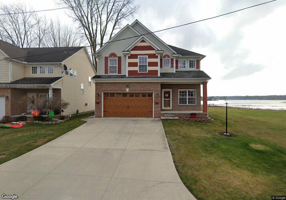
911 Ruskin Dr Algonac, MI 48001
Estimated Value: $367,238 - $472,000
About This Home
This home is located at 911 Ruskin Dr, Algonac, MI 48001 and is currently estimated at $415,560, approximately $189 per square foot. 911 Ruskin Dr is a home located in St. Clair County.
Ownership History
We collect this data history from publicly available records. To have your information removed, we recommend requesting removal directly through your county’s website.
Purchase Details
Home Financials for this Owner
Home Financials are based on the most recent Mortgage that was taken out on this home.Purchase Details
Home Financials for this Owner
Home Financials are based on the most recent Mortgage that was taken out on this home.Home Values in the Area
Average Home Value in this Area
Purchase History
We collect this data history from publicly available records. To have your information removed, we recommend requesting removal directly through your county’s website.
| Date | Buyer | Sale Price | Title Company |
|---|---|---|---|
| $150,675 | None Available | ||
| $18,500 | Chirco Title Company |
Mortgage History
We collect this data history from publicly available records. To have your information removed, we recommend requesting removal directly through your county’s website.
| Date | Status | Borrower | Loan Amount |
|---|---|---|---|
| Closed | $130,000 | ||
| Closed | $154,081 | ||
| Closed | $149,600 |
Tax History
We collect this data history from publicly available records. To have your information removed, we recommend requesting removal directly through your county’s website.
| Year | Tax Paid | Tax Assessment Tax Assessment Total Assessment is a certain percentage of the fair market value that is determined by local assessors to be the total taxable value of land and additions on the property. | Land | Improvement |
|---|---|---|---|---|
| 2025 | $2,435 | $158,600 | $0 | $0 |
| 2024 | $3,638 | $161,800 | $0 | $0 |
| 2023 | $3,389 | $142,000 | $0 | $0 |
| 2022 | $3,589 | $123,300 | $0 | $0 |
| 2020 | $3,434 | $107,500 | $7,400 | $100,100 |
| 2019 | $3,391 | $114,100 | $0 | $0 |
| 2018 | $3,326 | $93,500 | $0 | $0 |
| 2017 | $3,137 | $81,500 | $0 | $0 |
| 2016 | $2,722 | $81,500 | $0 | $0 |
| 2015 | -- | $78,300 | $7,400 | $70,900 |
| 2014 | -- | $78,000 | $7,400 | $70,600 |
| 2013 | -- | $79,100 | $0 | $0 |
Map
- 710 Ruskin Ave
- 117 Kenyon Rd
- 523 Lathrop Ave
- 432 Edgewater Dr
- 447 Ruskin Dr
- 429 Edgewater Dr
- 408 Conley St
- 206 Edgewater Dr
- 401 Pointe Tremble Rd
- 393 Pointe Tremble Rd
- 829 Townsend Crescent W
- 506 Fassett St
- 0 N Channel Dr Unit 50172349
- 304 Kama Ct
- 1032 Summer St
- 1600 N Channel Dr
- 729 Smith St
- 146 Algonac
- 1825 State St
- 3099 Fruit St
Ask me questions while you tour the home.