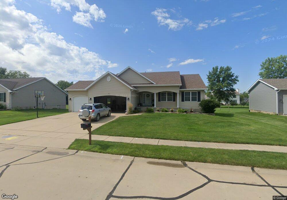
911 Springbrook Ln de Witt, IA 52742
Estimated Value: $311,000 - $439,000
3
Beds
2
Baths
1,586
Sq Ft
$253/Sq Ft
Est. Value
About This Home
This home is located at 911 Springbrook Ln, de Witt, IA 52742 and is currently estimated at $401,276, approximately $253 per square foot. 911 Springbrook Ln is a home located in Clinton County with nearby schools including Ekstrand Elementary School, Central Dewitt Intermediate School, and Central Dewitt Middle School.
Ownership History
Date
Name
Owned For
Owner Type
Purchase Details
Closed on
Mar 25, 2021
Sold by
Birt Jered J and Birt Laurie L
Bought by
Hoepner Amanda and Hoepner Cory M
Current Estimated Value
Home Financials for this Owner
Home Financials are based on the most recent Mortgage that was taken out on this home.
Original Mortgage
$332,500
Outstanding Balance
$296,409
Interest Rate
2.9%
Mortgage Type
New Conventional
Estimated Equity
$104,867
Purchase Details
Closed on
Sep 22, 2006
Sold by
Dwyer James A and Dwyer Karen A
Bought by
Birt Jered J and Birt Laurie L
Home Financials for this Owner
Home Financials are based on the most recent Mortgage that was taken out on this home.
Original Mortgage
$41,000
Interest Rate
6.49%
Mortgage Type
Stand Alone Second
Create a Home Valuation Report for This Property
The Home Valuation Report is an in-depth analysis detailing your home's value as well as a comparison with similar homes in the area
Home Values in the Area
Average Home Value in this Area
Purchase History
| Date | Buyer | Sale Price | Title Company |
|---|---|---|---|
| Hoepner Amanda | $350,000 | None Available | |
| Birt Jered J | $205,000 | None Available |
Source: Public Records
Mortgage History
| Date | Status | Borrower | Loan Amount |
|---|---|---|---|
| Open | Hoepner Amanda | $332,500 | |
| Previous Owner | Birt Jered J | $41,000 | |
| Previous Owner | Birt Jered J | $164,000 |
Source: Public Records
Tax History
| Year | Tax Paid | Tax Assessment Tax Assessment Total Assessment is a certain percentage of the fair market value that is determined by local assessors to be the total taxable value of land and additions on the property. | Land | Improvement |
|---|---|---|---|---|
| 2025 | $6,008 | $364,490 | $48,150 | $316,340 |
| 2024 | $6,008 | $336,770 | $48,150 | $288,620 |
| 2023 | $5,512 | $336,770 | $48,150 | $288,620 |
| 2022 | $5,470 | $313,050 | $48,150 | $264,900 |
| 2021 | $5,316 | $278,330 | $42,800 | $235,530 |
| 2020 | $5,316 | $257,850 | $42,800 | $215,050 |
| 2019 | $5,096 | $247,610 | $0 | $0 |
| 2018 | $4,972 | $247,610 | $0 | $0 |
| 2017 | $4,972 | $247,610 | $0 | $0 |
| 2016 | $4,738 | $0 | $0 | $0 |
| 2015 | $4,738 | $236,100 | $0 | $0 |
| 2014 | $4,798 | $236,100 | $0 | $0 |
| 2013 | -- | $0 | $0 | $0 |
Source: Public Records
Map
Nearby Homes
- 1037 Brookview Dr
- 1144 Brookview Dr
- 627 12th St
- 1545 Silver Valley Dr
- 00 Maynard Way
- 1710 Mackin Dr
- 401 10th St
- 2307 18th Ave
- 285th St Old Hwy 61
- 1527 11th St
- 308 8th St
- 0 285th St Old Highway 61 Unit parcel 1808590000
- 285th Ave Old Hwy 61 Unit Parcel-1808600000/1
- 285th Ave Old Hwy 61 Unit Parcels 1808590000/
- 00 3rd St
- 306 13th Ave
- 510 2nd St
- lot 1 225th St
- lot 2 225th St
- 119 14th Ave
- 903 Springbrook Ln
- 919 Springbrook Ln
- 908 Springbrook Ln
- 940 Springbrook Ln
- 916 Springbrook Ln
- 831 Springbrook Ln
- 927 Springbrook Ln
- 924 Springbrook Ln
- 822 Springbrook Ln
- 920 Pleasant Hill Dr
- 932 Springbrook Ln
- 928 Pleasant Hill Dr
- 823 Springbrook Ln
- 1016 Springbrook Ln
- 1024 Springbrook Ln
- 1004 Pleasant Hill Dr
- 904 Pleasant Hill Dr
- 912 Pleasant Hill Dr
- 1012 Pleasant Hill Dr
- 935 Springbrook Ln
Your Personal Tour Guide
Ask me questions while you tour the home.