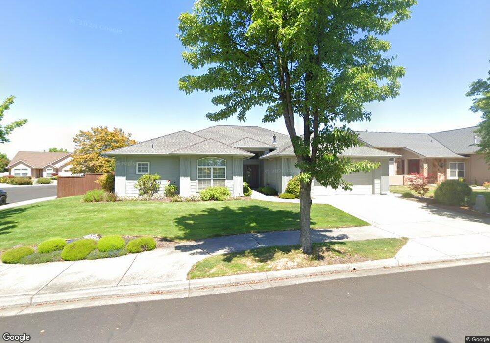
911 St Andrews Way Eagle Point, OR 97524
Estimated Value: $531,256 - $595,000
3
Beds
2
Baths
2,400
Sq Ft
$236/Sq Ft
Est. Value
About This Home
This home is located at 911 St Andrews Way, Eagle Point, OR 97524 and is currently estimated at $565,314, approximately $235 per square foot. 911 St Andrews Way is a home located in Jackson County with nearby schools including Eagle Point Middle School, White Mountain Middle School, and Eagle Point High School.
Ownership History
Date
Name
Owned For
Owner Type
Purchase Details
Closed on
Apr 14, 2010
Sold by
Kabel James A and Kabel Janice M
Bought by
Kabel James A and Kabel Janice M
Current Estimated Value
Purchase Details
Closed on
Sep 2, 2004
Sold by
Eagle Point Development Llc
Bought by
Kabel James A and Kabel Janice M
Create a Home Valuation Report for This Property
The Home Valuation Report is an in-depth analysis detailing your home's value as well as a comparison with similar homes in the area
Home Values in the Area
Average Home Value in this Area
Purchase History
| Date | Buyer | Sale Price | Title Company |
|---|---|---|---|
| Kabel James A | -- | None Available | |
| Kabel James A | $120,000 | Lawyers Title Ins |
Source: Public Records
Tax History
| Year | Tax Paid | Tax Assessment Tax Assessment Total Assessment is a certain percentage of the fair market value that is determined by local assessors to be the total taxable value of land and additions on the property. | Land | Improvement |
|---|---|---|---|---|
| 2026 | $3,753 | $275,840 | -- | -- |
| 2025 | $3,665 | $267,810 | $93,410 | $174,400 |
| 2024 | $3,665 | $260,010 | $90,690 | $169,320 |
| 2023 | $3,540 | $252,440 | $88,050 | $164,390 |
| 2022 | $3,444 | $252,440 | $88,050 | $164,390 |
| 2021 | $3,342 | $245,090 | $85,480 | $159,610 |
| 2020 | $3,550 | $237,960 | $82,990 | $154,970 |
| 2019 | $3,496 | $224,310 | $78,230 | $146,080 |
| 2018 | $3,429 | $217,780 | $75,950 | $141,830 |
| 2017 | $3,345 | $217,780 | $75,950 | $141,830 |
| 2016 | $3,280 | $205,290 | $71,580 | $133,710 |
| 2015 | $3,173 | $205,290 | $71,580 | $133,710 |
| 2014 | $3,082 | $193,520 | $67,460 | $126,060 |
Source: Public Records
Map
Nearby Homes
- 869 St Andrews Way
- 131 Bellerive Dr
- 964 Pumpkin Ridge
- 988 Pumpkin Ridge
- 959 Pumpkin Ridge Dr
- 888 Arrowhead Trail
- 131 Spanish Bay Ct
- 997 Arrowhead Trail
- 1043 Arrowhead Trail
- 268 Robert Trent Jones Blvd
- 1104 Pumpkin Ridge
- 279 Robert Trent Jones Blvd
- 187 Prairie Landing Dr
- 184 Keystone Way
- 198 Prairie Landing Dr
- 1146 Pumpkin Unit 335
- 422 Robert Trent Jones Blvd
- 421 Stevens Rd Unit 20
- 421 Stevens Rd Unit 14
- 421 Stevens Rd Unit 52
- 917 St Andrews Way
- 0 Saint Andrews Way Unit 100230472
- 0 Saint Andrews Way Unit 136 100235240
- 0 Saint Andrews Way Unit 134
- 977 Fairview Ct
- 899 St Andrews Way
- 923 St Andrews Way
- 908 St Andrews Way
- 914 St Andrews Way
- 971 Fairview Ct
- 902 St Andrews Way
- 920 St Andrews Way
- 18 Blackstone Ct
- 24 Blackstone Ct
- 974 Fairview Ct
- 929 St Andrews Way
- 893 St Andrews Way
- 980 Fairview Ct
- 896 St Andrews Way
- 926 St Andrews Way
Your Personal Tour Guide
Ask me questions while you tour the home.