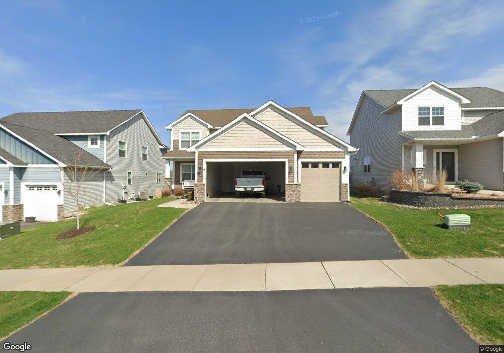
9111 River Rock Dr N Chanhassen, MN 55317
Estimated Value: $635,281 - $670,000
4
Beds
3
Baths
3,253
Sq Ft
$201/Sq Ft
Est. Value
About This Home
This home is located at 9111 River Rock Dr N, Chanhassen, MN 55317 and is currently estimated at $654,820, approximately $201 per square foot. 9111 River Rock Dr N is a home located in Carver County with nearby schools including Bluff Creek Elementary, Chaska Middle School West, and Chanhassen High School.
Ownership History
Date
Name
Owned For
Owner Type
Purchase Details
Closed on
Aug 20, 2015
Sold by
Castle Gate Construction Inc
Bought by
Rohwer James S
Current Estimated Value
Home Financials for this Owner
Home Financials are based on the most recent Mortgage that was taken out on this home.
Original Mortgage
$350,604
Outstanding Balance
$276,309
Interest Rate
4.09%
Mortgage Type
New Conventional
Estimated Equity
$378,511
Create a Home Valuation Report for This Property
The Home Valuation Report is an in-depth analysis detailing your home's value as well as a comparison with similar homes in the area
Home Values in the Area
Average Home Value in this Area
Purchase History
| Date | Buyer | Sale Price | Title Company |
|---|---|---|---|
| Rohwer James S | $438,254 | Premier Title Ins Agency Inc | |
| Castle Gate Construction Inc | $80,000 | Premier Title |
Source: Public Records
Mortgage History
| Date | Status | Borrower | Loan Amount |
|---|---|---|---|
| Open | Rohwer James S | $350,604 |
Source: Public Records
Tax History Compared to Growth
Tax History
| Year | Tax Paid | Tax Assessment Tax Assessment Total Assessment is a certain percentage of the fair market value that is determined by local assessors to be the total taxable value of land and additions on the property. | Land | Improvement |
|---|---|---|---|---|
| 2025 | $5,976 | $600,400 | $165,000 | $435,400 |
| 2024 | $5,772 | $563,700 | $145,000 | $418,700 |
| 2023 | $5,760 | $550,600 | $145,000 | $405,600 |
| 2022 | $5,462 | $554,300 | $144,800 | $409,500 |
| 2021 | $5,258 | $462,200 | $120,600 | $341,600 |
| 2020 | $5,868 | $503,000 | $120,600 | $382,400 |
| 2019 | $5,638 | $462,400 | $114,900 | $347,500 |
| 2018 | $5,376 | $462,400 | $114,900 | $347,500 |
| 2017 | $5,258 | $428,400 | $102,600 | $325,800 |
| 2016 | $5,248 | $384,300 | $0 | $0 |
| 2015 | $354 | $44,900 | $0 | $0 |
| 2014 | $354 | $20,000 | $0 | $0 |
Source: Public Records
Map
Nearby Homes
- 9085 Mills Dr
- 9155 Mills Dr
- 9044 Mills Dr
- 9335 Eagle Ridge Rd
- 1510 Avienda Pkwy
- 1500 Avienda Pkwy
- 8800 Sunset Trail
- 1525 Hemlock Way
- 9523 Declaration Dr
- 9534 Roosevelt Dr
- 1944 Commonwealth Blvd Unit 3
- 1949 Commonwealth Blvd Unit 2
- 1953 Commonwealth Blvd Unit 3
- 1952 Commonwealth Blvd Unit 8
- 1826 Colonial Ln Unit 4
- 1846 Plymouth Ln Unit 205
- Clearwater Plan at Reserve at Autumn Woods - Landmark Collection
- Itasca Plan at Reserve at Autumn Woods - Landmark Collection
- Washburn Plan at Reserve at Autumn Woods - Landmark Collection
- Snelling Plan at Reserve at Autumn Woods - Landmark Collection
- 9101 River Rock Dr N
- 9121 River Rock Dr N
- 9091 River Rock Dr N
- 9081 River Rock Dr N
- 9214 Mills Dr
- 9112 River Rock Dr N
- 9102 River Rock Dr N
- 9122 River Rock Dr N
- 9092 River Rock Dr N
- 1234 Mill Creek Ln
- 9071 River Rock Dr N
- 9141 River Rock Dr N
- 1435 Mills Dr
- 9082 River Rock Dr N
- 1452 Mills Dr
- 9021 Degler Cir
- 9061 River Rock Dr N
- 9151 River Rock Dr N
- 1445 Mills Dr
- 9164 Mills Dr