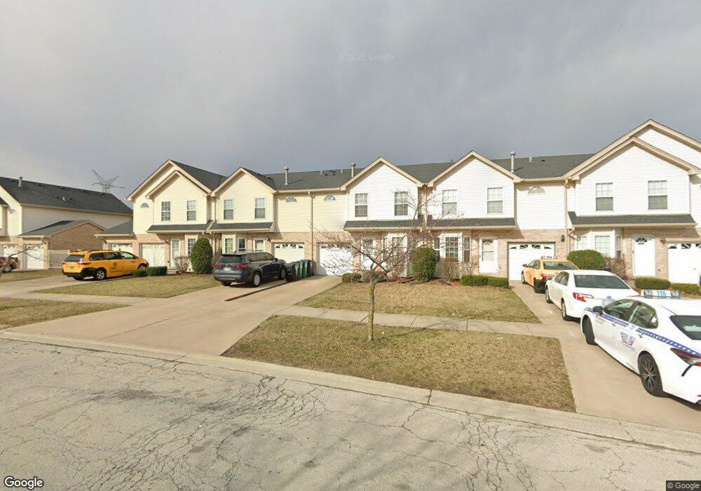
9114 Beloit Ave Bridgeview, IL 60455
Little Palestine NeighborhoodEstimated Value: $276,863 - $314,000
3
Beds
3
Baths
1,533
Sq Ft
$194/Sq Ft
Est. Value
About This Home
This home is located at 9114 Beloit Ave, Bridgeview, IL 60455 and is currently estimated at $296,966, approximately $193 per square foot. 9114 Beloit Ave is a home located in Cook County with nearby schools including Dorn Elementary School, Glen Oaks Elementary School, and H H Conrady Jr High School.
Ownership History
Date
Name
Owned For
Owner Type
Purchase Details
Closed on
Jul 17, 1997
Sold by
Marquette National Bank
Bought by
Alayan Walid
Current Estimated Value
Home Financials for this Owner
Home Financials are based on the most recent Mortgage that was taken out on this home.
Original Mortgage
$105,000
Outstanding Balance
$13,481
Interest Rate
7.81%
Estimated Equity
$283,485
Create a Home Valuation Report for This Property
The Home Valuation Report is an in-depth analysis detailing your home's value as well as a comparison with similar homes in the area
Home Values in the Area
Average Home Value in this Area
Purchase History
| Date | Buyer | Sale Price | Title Company |
|---|---|---|---|
| Alayan Walid | $140,000 | -- |
Source: Public Records
Mortgage History
| Date | Status | Borrower | Loan Amount |
|---|---|---|---|
| Open | Alayan Walid | $105,000 |
Source: Public Records
Tax History
| Year | Tax Paid | Tax Assessment Tax Assessment Total Assessment is a certain percentage of the fair market value that is determined by local assessors to be the total taxable value of land and additions on the property. | Land | Improvement |
|---|---|---|---|---|
| 2025 | $6,152 | $22,000 | $874 | $21,126 |
| 2024 | $6,152 | $22,000 | $874 | $21,126 |
| 2023 | $4,381 | $22,000 | $874 | $21,126 |
| 2022 | $4,381 | $14,283 | $1,124 | $13,159 |
| 2021 | $4,318 | $14,282 | $1,124 | $13,158 |
| 2020 | $4,334 | $14,282 | $1,124 | $13,158 |
| 2019 | $7,378 | $21,929 | $999 | $20,930 |
| 2018 | $7,204 | $21,929 | $999 | $20,930 |
| 2017 | $6,892 | $21,929 | $999 | $20,930 |
| 2016 | $6,549 | $18,867 | $874 | $17,993 |
| 2015 | $6,187 | $18,867 | $874 | $17,993 |
| 2014 | $6,015 | $18,867 | $874 | $17,993 |
| 2013 | $5,811 | $19,715 | $874 | $18,841 |
Source: Public Records
Map
Nearby Homes
- 9237 S 77th Ave
- 8800 S Harlem Ave Unit 19
- 8800 S Harlem Ave Unit 2300
- 8800 S Harlem Ave Unit 2111
- 8800 S Harlem Ave Unit 1127
- 9420 S 77th Ct Unit 2E
- 9417 S 78th Ave
- 7117 W 93rd St Unit 306
- 9435 S 78th Ave
- 7932 W 93rd St Unit 2A
- 7100 W 95th St Unit 111
- 6932 W 91st St
- 8808 Cranbrook Ln
- 9407 S Roberts Rd Unit 3SE
- 7329 W 85th Place Unit 2A
- 7242 W 86th St Unit 3A
- 6906 W 91st St
- 9236 Pembroke Ln
- 8111 W 91st St
- 8912 Windsor Ln
- 9116 Beloit Ave
- 9112 Beloit Ave
- 9118 Beloit Ave
- 9110 Beloit Ave
- 9111 Falcon Ridge Dr
- 9109 Falcon Ridge Dr
- 9108 Beloit Ave
- 9113 Falcon Ridge Dr
- 9107 Falcon Ridge Dr
- 9122 Beloit Ave
- 9106 Beloit Ave Unit 9106
- 9115 Falcon Ridge Dr
- 9105 Falcon Ridge Dr
- 9124 Beloit Ave Unit 9124
- 9120 Beloit Ave Unit 9120
- 9104 Beloit Ave
- 9117 Falcon Ridge Dr
- 9126 Beloit Ave
- 9103 Falcon Ridge Dr
- 9113 Beloit Ave
Your Personal Tour Guide
Ask me questions while you tour the home.