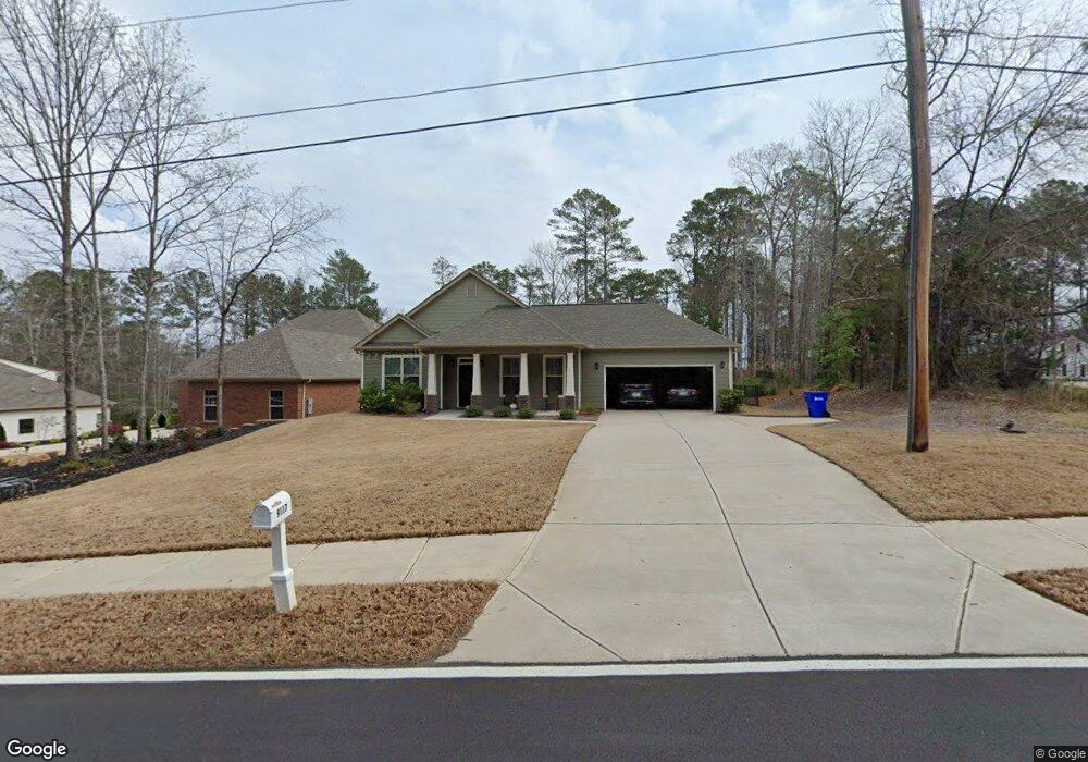
9117 Dearing St SE Unit 8 Covington, GA 30014
Estimated Value: $419,000 - $431,000
3
Beds
2
Baths
1,892
Sq Ft
$225/Sq Ft
Est. Value
About This Home
This home is located at 9117 Dearing St SE Unit 8, Covington, GA 30014 and is currently estimated at $424,945, approximately $224 per square foot. 9117 Dearing St SE Unit 8 is a home located in Newton County with nearby schools including East Newton Elementary School, Cousins Middle School, and Eastside High School.
Ownership History
Date
Name
Owned For
Owner Type
Purchase Details
Closed on
May 21, 2025
Sold by
Vaughn Vincent C
Bought by
Blankenship Earl and Blankenship Elizabeth
Current Estimated Value
Purchase Details
Closed on
Apr 24, 2018
Sold by
Mundy Residential Llc
Bought by
Vaughn Vincent C and Vaughn Stephanie
Home Financials for this Owner
Home Financials are based on the most recent Mortgage that was taken out on this home.
Original Mortgage
$250,260
Interest Rate
4.44%
Mortgage Type
New Conventional
Purchase Details
Closed on
Nov 10, 2017
Sold by
Kaoua Raoul
Bought by
Mundy Residential Llc
Home Financials for this Owner
Home Financials are based on the most recent Mortgage that was taken out on this home.
Original Mortgage
$180,000
Interest Rate
3.91%
Mortgage Type
Unknown
Purchase Details
Closed on
Aug 10, 2017
Sold by
Newton Chris
Bought by
Kaoua Raoul and Kaoua Yvonne
Purchase Details
Closed on
Jul 26, 2016
Sold by
Jeff
Bought by
Newton Chris
Create a Home Valuation Report for This Property
The Home Valuation Report is an in-depth analysis detailing your home's value as well as a comparison with similar homes in the area
Home Values in the Area
Average Home Value in this Area
Purchase History
| Date | Buyer | Sale Price | Title Company |
|---|---|---|---|
| Blankenship Earl | $420,000 | -- | |
| Vaughn Vincent C | $258,000 | -- | |
| Mundy Residential Llc | $40,000 | -- | |
| Kaoua Raoul | $94,900 | -- | |
| Newton Chris | $80,000 | -- |
Source: Public Records
Mortgage History
| Date | Status | Borrower | Loan Amount |
|---|---|---|---|
| Previous Owner | Vaughn Vincent C | $250,260 | |
| Previous Owner | Mundy Residential Llc | $180,000 |
Source: Public Records
Tax History Compared to Growth
Tax History
| Year | Tax Paid | Tax Assessment Tax Assessment Total Assessment is a certain percentage of the fair market value that is determined by local assessors to be the total taxable value of land and additions on the property. | Land | Improvement |
|---|---|---|---|---|
| 2024 | $4,195 | $144,080 | $26,000 | $118,080 |
| 2023 | $4,922 | $156,600 | $17,600 | $139,000 |
| 2022 | $4,234 | $133,520 | $17,600 | $115,920 |
| 2021 | $4,139 | $117,200 | $16,000 | $101,200 |
| 2020 | $3,994 | $103,400 | $16,000 | $87,400 |
| 2019 | $3,971 | $101,000 | $16,000 | $85,000 |
| 2018 | $526 | $12,800 | $12,800 | $0 |
| 2017 | $1,249 | $30,400 | $30,400 | $0 |
| 2016 | $781 | $19,000 | $19,000 | $0 |
| 2015 | $782 | $19,000 | $19,000 | $0 |
| 2014 | -- | $19,000 | $0 | $0 |
Source: Public Records
Map
Nearby Homes
- 8239 High Lake Terrace SE
- 8193 Monticello St
- 8384 Fairway Dr
- 8370 Fairway Dr
- 10110 Malcolm Ct
- 10183 N Links Dr
- 6176 Pinewood Dr SE
- 10119 Azalea Dr
- 10216 Azalea Dr
- 6111 Old Monticello St SE
- 6169 Pinewood Dr SE
- 10155 Malcolm Dr
- 322 Pinewood Dr
- 8291 Fairway Dr
- 9122 Golfview Cir
- 6134 Linwood Dr SE
- 10184 Malcolm Dr
- 9113 Dearing St SE
- 9109 Dearing St SE
- 9109 Dearing St SE
- 9113 S Dearing St
- 9109 S Dearing St
- 9121 Dearing St SE
- 8185 Plantation Trace
- 8177 Plantation Trace
- 8179 Dearing St SE
- 8169 Plantation Trace
- 8201 Plantation Trace
- 8193 Plantation Trace
- 8161 Plantation Trace
- 8125 Woodland Ct SE
- 8221 Plantation Trace
- 8221 Plantation Trace Unit 31
- 8209 Plantation Trace
- 8153 Plantation Trace
- 8205 N Links Dr
- 8126 Woodland Ct SE Unit 2B