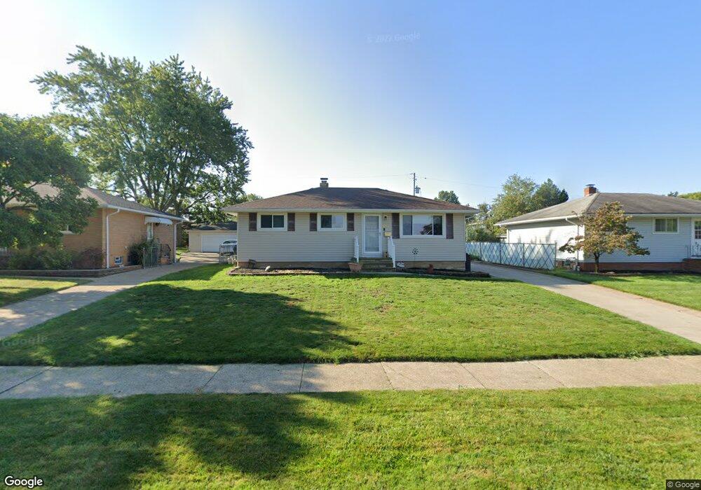
9117 Roedean Dr Cleveland, OH 44129
Estimated Value: $179,000 - $237,000
3
Beds
2
Baths
1,038
Sq Ft
$207/Sq Ft
Est. Value
About This Home
This home is located at 9117 Roedean Dr, Cleveland, OH 44129 and is currently estimated at $214,779, approximately $206 per square foot. 9117 Roedean Dr is a home located in Cuyahoga County with nearby schools including Ridge-Brook Elementary School, Greenbriar Middle School, and Valley Forge High School.
Ownership History
Date
Name
Owned For
Owner Type
Purchase Details
Closed on
Jan 30, 2005
Sold by
James Diane E and Short Diane E
Bought by
Short Lewis D and Short Diane E
Current Estimated Value
Home Financials for this Owner
Home Financials are based on the most recent Mortgage that was taken out on this home.
Original Mortgage
$112,000
Interest Rate
5.77%
Mortgage Type
New Conventional
Purchase Details
Closed on
Aug 28, 1985
Sold by
Gary W Molnar
Bought by
James Dennis C and James Diane E
Purchase Details
Closed on
Oct 16, 1981
Sold by
Molnar Gary W
Bought by
Gary W Molnar
Purchase Details
Closed on
Sep 16, 1980
Sold by
Meola Leonardo and M T
Bought by
Molnar Gary W
Purchase Details
Closed on
Jan 1, 1975
Bought by
Meola Leonardo and M T
Create a Home Valuation Report for This Property
The Home Valuation Report is an in-depth analysis detailing your home's value as well as a comparison with similar homes in the area
Home Values in the Area
Average Home Value in this Area
Purchase History
| Date | Buyer | Sale Price | Title Company |
|---|---|---|---|
| Short Lewis D | -- | -- | |
| James Dennis C | $63,000 | -- | |
| Gary W Molnar | -- | -- | |
| Molnar Gary W | $64,500 | -- | |
| Meola Leonardo | -- | -- |
Source: Public Records
Mortgage History
| Date | Status | Borrower | Loan Amount |
|---|---|---|---|
| Previous Owner | Short Lewis D | $112,000 | |
| Closed | Short Lewis D | $28,000 |
Source: Public Records
Tax History Compared to Growth
Tax History
| Year | Tax Paid | Tax Assessment Tax Assessment Total Assessment is a certain percentage of the fair market value that is determined by local assessors to be the total taxable value of land and additions on the property. | Land | Improvement |
|---|---|---|---|---|
| 2024 | $3,346 | $63,350 | $11,795 | $51,555 |
| 2023 | $2,826 | $47,850 | $9,870 | $37,980 |
| 2022 | $2,826 | $47,850 | $9,870 | $37,980 |
| 2021 | $2,904 | $47,850 | $9,870 | $37,980 |
| 2020 | $2,580 | $39,200 | $8,090 | $31,120 |
| 2019 | $2,457 | $112,000 | $23,100 | $88,900 |
| 2018 | $2,307 | $39,200 | $8,090 | $31,120 |
| 2017 | $2,290 | $34,900 | $6,580 | $28,320 |
| 2016 | $2,277 | $34,900 | $6,580 | $28,320 |
| 2015 | $2,304 | $34,900 | $6,580 | $28,320 |
| 2014 | $2,304 | $37,140 | $7,000 | $30,140 |
Source: Public Records
Map
Nearby Homes
- 9118 Fernhill Ave
- 9417 Fernhill Ave
- 5440 W 84th St Unit 42
- 8206 Newport Ave
- 7915 Fernhill Ave
- 5630 Onaway Oval
- 5717 Chestnut Dr
- 10620 Aaron Dr
- 7707 Liberty Ave
- 9621 Elsmere Dr
- 7609 Wooster Pkwy
- 7910 Dresden Ave
- 5845 Lotusdale Dr
- 5860 Pearl Rd
- 0 Parkhill Dr Unit 5116837
- 4830 Autumn Ln
- 5906 Twin Lakes Dr
- 5926 Deering Ave
- 9909 Richard Dr
- 11002 Brainard Dr
- 9113 Roedean Dr
- 9205 Roedean Dr
- 9109 Roedean Dr
- 9209 Roedean Dr
- 9116 Malvern Dr
- 9112 Malvern Dr
- 9204 Malvern Dr
- 9208 Malvern Dr
- 9108 Malvern Dr
- 9105 Roedean Dr
- 9213 Roedean Dr
- 9116 Roedean Dr
- 9204 Roedean Dr
- 9112 Roedean Dr
- 9104 Malvern Dr
- 9208 Roedean Dr
- 9212 Malvern Dr
- 9108 Roedean Dr
- 9101 Roedean Dr
- 9212 Roedean Dr