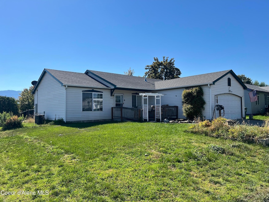
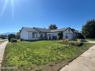
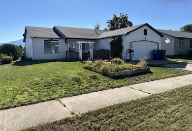
912 E Shasta Ave Post Falls, ID 83854
North Prairie NeighborhoodEstimated payment $2,266/month
Highlights
- Primary Bedroom Suite
- Corner Lot
- Covered Patio or Porch
- Mountain View
- Lawn
- 4-minute walk to Singing Hills Park
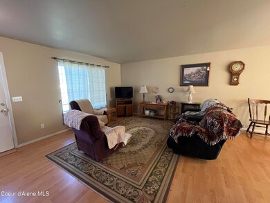
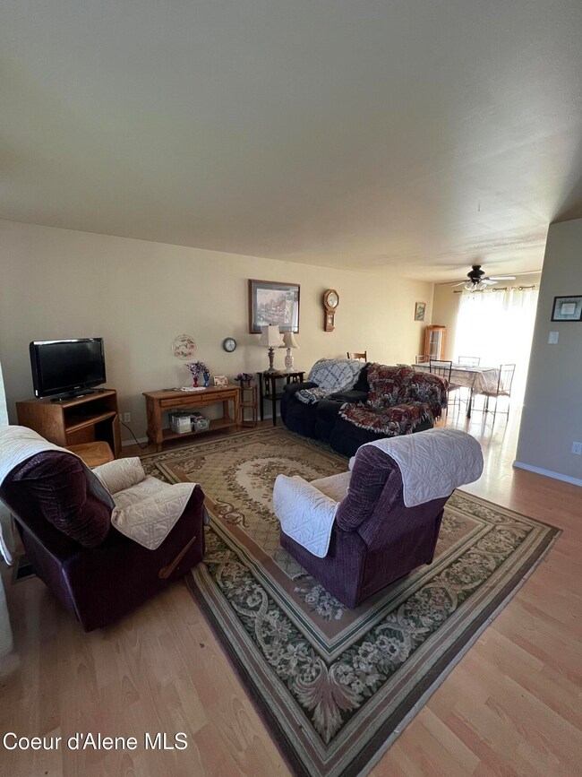
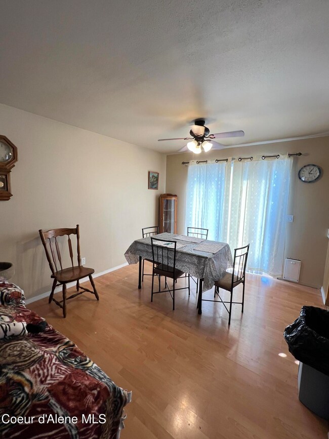
About This Home
Single level home on corner lot in nice Post Falls neighborhood. Close to it all, grocery, medical, schools, and freeway access. Gas forced air heat with AC. Fenced backyard. Perfect for first time buyer, investor, or for someone sizing down. Easy to show.

Home Details
Home Type
- Single Family
Est. Annual Taxes
- $458
Year Built
- Built in 1995
Lot Details
- 7,841 Sq Ft Lot
- Open Space
- Corner Lot
- Level Lot
- Open Lot
- Lawn
HOA Fees
- $19 Monthly HOA Fees
Parking
- Attached Garage
Property Views
- Mountain
- Neighborhood
Home Design
- Treated Wood Foundation
- Frame Construction
- Shingle Roof
- Composition Roof
- Vinyl Siding
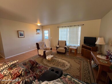
Interior Spaces
- 1,144 Sq Ft Home
- 1-Story Property
- Partially Furnished
- Crawl Space
- Washer and Electric Dryer Hookup
Kitchen
- Gas Oven or Range
- Dishwasher
- Disposal
Flooring
- Carpet
- Laminate
- Vinyl
Bedrooms and Bathrooms
- 3 Main Level Bedrooms
- Primary Bedroom Suite
- 2 Bathrooms
Outdoor Features
- Covered Patio or Porch
- Rain Gutters
Utilities
- Forced Air Heating System
- Heating System Uses Natural Gas
- Gas Available
- Gas Water Heater
- Internet Available
- Cable TV Available
Community Details
- Harmony Place Association
- Harmony Place Subdivision
Listing and Financial Details
- Assessor Parcel Number P41800100020
Map
Home Values in the Area
Average Home Value in this Area
Tax History
| Year | Tax Paid | Tax Assessment Tax Assessment Total Assessment is a certain percentage of the fair market value that is determined by local assessors to be the total taxable value of land and additions on the property. | Land | Improvement |
|---|---|---|---|---|
| 2025 | $458 | $362,460 | $165,000 | $197,460 |
| 2024 | $458 | $352,930 | $155,250 | $197,680 |
| 2023 | $458 | $370,180 | $172,500 | $197,680 |
| 2022 | $868 | $403,786 | $172,500 | $231,286 |
| 2021 | $619 | $261,200 | $115,000 | $146,200 |
| 2020 | $809 | $204,310 | $90,000 | $114,310 |
| 2019 | $573 | $187,440 | $80,000 | $107,440 |
| 2018 | $585 | $162,990 | $65,000 | $97,990 |
| 2017 | $692 | $144,880 | $48,000 | $96,880 |
| 2016 | $1,091 | $128,530 | $40,000 | $88,530 |
| 2015 | $970 | $110,990 | $34,000 | $76,990 |
| 2013 | $942 | $99,670 | $31,500 | $68,170 |
Property History
| Date | Event | Price | List to Sale | Price per Sq Ft |
|---|---|---|---|---|
| 10/04/2025 10/04/25 | Pending | -- | -- | -- |
| 09/26/2025 09/26/25 | For Sale | $419,000 | -- | $366 / Sq Ft |
Purchase History
| Date | Type | Sale Price | Title Company |
|---|---|---|---|
| Warranty Deed | -- | First American Title Kootena | |
| Sheriffs Deed | $141,750 | None Available | |
| Warranty Deed | -- | -- |
Mortgage History
| Date | Status | Loan Amount | Loan Type |
|---|---|---|---|
| Open | $4,829 | Unknown | |
| Open | $165,000 | USDA | |
| Previous Owner | $159,000 | Adjustable Rate Mortgage/ARM |
Source: Coeur d'Alene Multiple Listing Service
MLS Number: 25-9810
APN: P41800100020
Disclaimer: Certain information contained herein is derived from information provided by parties other than Homes.com. All information provided is deemed reliable, but is not guaranteed to be accurate and should be independently verified.
![]() IDX information is provided exclusively for personal, non-commercial use, and may not be used for any purpose other than to identify prospective properties consumers may be interested in purchasing.
IDX information is provided exclusively for personal, non-commercial use, and may not be used for any purpose other than to identify prospective properties consumers may be interested in purchasing.
Information is deemed reliable but not guaranteed.
- 2499 Side Saddle
- 2011 N Quail Run Blvd
- 2644 N Mackenzie Dr
- 2870 N Dandelion St
- 709 E 20th Ave
- 2248 N Syringa St
- 2240 N Syringa St
- 1545 E Legion St
- 2227 N Chaffee St
- 2230 N Chaffee St
- 2238 N Chaffee St
- 1547 E Crossing Ave
- 2815 N Sand Trap Way
- 2815 N Slice Dr
- 2441 N Henry St
- 1563 N McKelvy Ln
- The Orchard Encore Plan at Mongeau Meadows
- The Hudson Plan at Mongeau Meadows
- The Waterbrook Plan at Mongeau Meadows
- 1570 N McKelvy Ln