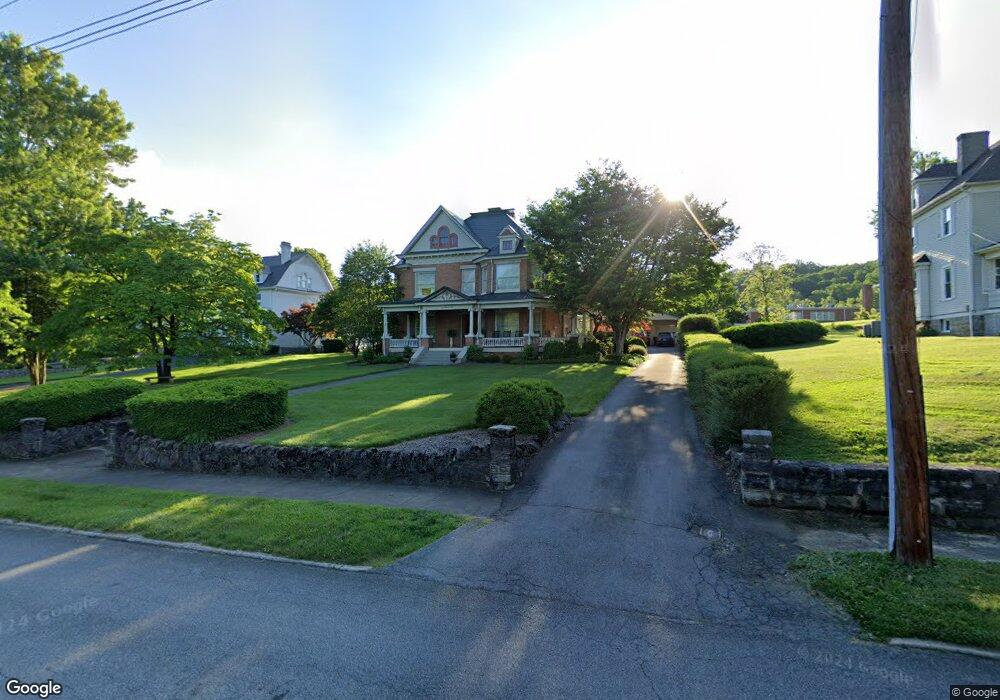
912 Holston Ave Bristol, TN 37620
Estimated Value: $534,000 - $680,000
4
Beds
4
Baths
4,108
Sq Ft
$149/Sq Ft
Est. Value
About This Home
This home is located at 912 Holston Ave, Bristol, TN 37620 and is currently estimated at $610,939, approximately $148 per square foot. 912 Holston Ave is a home located in Sullivan County with nearby schools including Anderson Elementary School, Vance Middle School, and Tennessee High School.
Ownership History
Date
Name
Owned For
Owner Type
Purchase Details
Closed on
Aug 24, 2005
Sold by
Jack Robinette E
Bought by
Lisle Whitman Thomas C
Current Estimated Value
Create a Home Valuation Report for This Property
The Home Valuation Report is an in-depth analysis detailing your home's value as well as a comparison with similar homes in the area
Home Values in the Area
Average Home Value in this Area
Purchase History
| Date | Buyer | Sale Price | Title Company |
|---|---|---|---|
| Lisle Whitman Thomas C | $290,000 | -- |
Source: Public Records
Tax History Compared to Growth
Tax History
| Year | Tax Paid | Tax Assessment Tax Assessment Total Assessment is a certain percentage of the fair market value that is determined by local assessors to be the total taxable value of land and additions on the property. | Land | Improvement |
|---|---|---|---|---|
| 2024 | -- | $75,700 | $6,125 | $69,575 |
| 2023 | $3,325 | $75,700 | $6,125 | $69,575 |
| 2022 | $3,325 | $75,700 | $6,125 | $69,575 |
| 2021 | $3,325 | $75,700 | $6,125 | $69,575 |
| 2020 | $1,787 | $75,700 | $6,125 | $69,575 |
| 2019 | $3,290 | $69,550 | $6,125 | $63,425 |
| 2018 | $3,277 | $69,550 | $6,125 | $63,425 |
| 2017 | $3,277 | $69,550 | $6,125 | $63,425 |
| 2016 | $3,566 | $73,900 | $6,125 | $67,775 |
| 2014 | $3,367 | $73,908 | $0 | $0 |
Source: Public Records
Map
Nearby Homes
- 904 Holston Ave
- 920 Holston Ave
- 905 Holston Ave
- 915 Holston Ave
- 925 Holston Ave
- 901 Holston Ave
- 808 Holston Ave
- 929 Holston Ave
- 929 Holston Ave Unit 2
- 929 Holston Ave Unit 4
- 817 Holston Ave
- 1006 Holston Ave
- 924 9th St
- 813 Holston Ave
- 804 Holston Ave
- 914 7th Ave
- 908 7th Ave
- 700 Reynolds St
- 916 7th Ave
- 804 Holston Ave