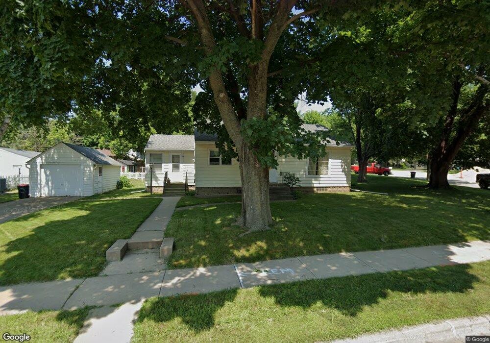
912 Maple St Red Wing, MN 55066
Estimated Value: $208,000 - $223,000
About This Home
This home is located at 912 Maple St, Red Wing, MN 55066 and is currently estimated at $218,750, approximately $210 per square foot. 912 Maple St is a home located in Goodhue County with nearby schools including Sunnyside Elementary School, Burnside Elementary School, and Twin Bluff Middle School.
Ownership History
We collect this data history from publicly available records. To have your information removed, we recommend requesting removal directly through your county’s website.
Purchase Details
Home Financials for this Owner
Home Financials are based on the most recent Mortgage that was taken out on this home.Home Values in the Area
Average Home Value in this Area
Purchase History
We collect this data history from publicly available records. To have your information removed, we recommend requesting removal directly through your county’s website.
| Date | Buyer | Sale Price | Title Company |
|---|---|---|---|
| $180,000 | Knight Barry Ttl United Llc | ||
| $180,000 | -- |
Mortgage History
We collect this data history from publicly available records. To have your information removed, we recommend requesting removal directly through your county’s website.
| Date | Status | Borrower | Loan Amount |
|---|---|---|---|
| Open | $184,140 | ||
| Closed | $180,000 |
Tax History
We collect this data history from publicly available records. To have your information removed, we recommend requesting removal directly through your county’s website.
| Year | Tax Paid | Tax Assessment Tax Assessment Total Assessment is a certain percentage of the fair market value that is determined by local assessors to be the total taxable value of land and additions on the property. | Land | Improvement |
|---|---|---|---|---|
| 2025 | $2,264 | $194,300 | $60,800 | $133,500 |
| 2024 | $2,250 | $191,500 | $60,800 | $130,700 |
| 2023 | $1,147 | $181,900 | $60,700 | $121,200 |
| 2022 | $1,784 | $161,300 | $41,000 | $120,300 |
| 2021 | $1,666 | $140,100 | $41,000 | $99,100 |
| 2020 | $1,654 | $133,800 | $41,000 | $92,800 |
| 2019 | $1,654 | $125,800 | $41,000 | $84,800 |
| 2018 | $1,314 | $127,000 | $39,500 | $87,500 |
| 2017 | $1,278 | $113,100 | $39,500 | $73,600 |
| 2016 | $1,184 | $111,700 | $39,500 | $72,200 |
| 2015 | $1,134 | $109,300 | $39,500 | $69,800 |
| 2014 | -- | $105,300 | $39,500 | $65,800 |
Map
- 1422 Roosevelt Ave
- 920 Maple St
- 1416 Roosevelt Ave
- 1415 West Ave
- 1502 Roosevelt Ave
- 1409 West Ave
- 1410 Roosevelt Ave
- 1508 Roosevelt Ave
- 826 Maple St
- 1403 West Ave
- 905 Hawthorne St
- 1417 Roosevelt Ave
- 1514 Roosevelt Ave
- 1004 Maple St
- 1005 Maple St
- 827 Hawthorne St
- 1518 Roosevelt Ave
- 820 Maple St
- 1004 Watson St
- 1012 Maple St
Ask me questions while you tour the home.