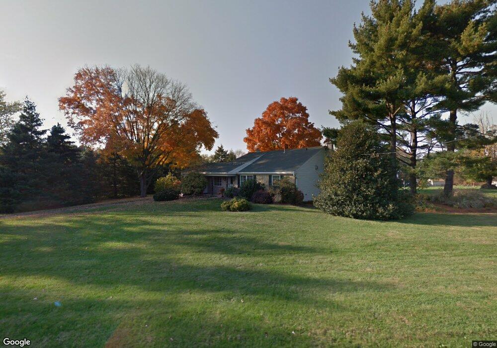
912 Sandy Ridge Rd Doylestown, PA 18901
Estimated Value: $683,000 - $767,000
3
Beds
3
Baths
2,515
Sq Ft
$286/Sq Ft
Est. Value
About This Home
This home is located at 912 Sandy Ridge Rd, Doylestown, PA 18901 and is currently estimated at $719,685, approximately $286 per square foot. 912 Sandy Ridge Rd is a home located in Bucks County with nearby schools including Doyle El School, Lenape Middle School, and Central Bucks High School-West.
Ownership History
Date
Name
Owned For
Owner Type
Purchase Details
Closed on
Jul 14, 2000
Sold by
Vanhouten Antonett I and Howard Lori
Bought by
Smith Andrew R and Fuller Smith Elizabeth
Current Estimated Value
Home Financials for this Owner
Home Financials are based on the most recent Mortgage that was taken out on this home.
Original Mortgage
$237,900
Outstanding Balance
$84,344
Interest Rate
8.1%
Estimated Equity
$635,341
Purchase Details
Closed on
Nov 12, 1993
Bought by
Vanhouten Stephen T Iii and Vanhouten Antonet
Create a Home Valuation Report for This Property
The Home Valuation Report is an in-depth analysis detailing your home's value as well as a comparison with similar homes in the area
Home Values in the Area
Average Home Value in this Area
Purchase History
| Date | Buyer | Sale Price | Title Company |
|---|---|---|---|
| Smith Andrew R | $227,000 | -- | |
| Vanhouten Stephen T Iii | $162,000 | -- |
Source: Public Records
Mortgage History
| Date | Status | Borrower | Loan Amount |
|---|---|---|---|
| Open | Smith Andrew R | $237,900 |
Source: Public Records
Tax History Compared to Growth
Tax History
| Year | Tax Paid | Tax Assessment Tax Assessment Total Assessment is a certain percentage of the fair market value that is determined by local assessors to be the total taxable value of land and additions on the property. | Land | Improvement |
|---|---|---|---|---|
| 2025 | $6,595 | $37,270 | $7,600 | $29,670 |
| 2024 | $6,595 | $37,270 | $7,600 | $29,670 |
| 2023 | $6,289 | $37,270 | $7,600 | $29,670 |
| 2022 | $5,273 | $31,600 | $7,600 | $24,000 |
| 2021 | $5,164 | $31,600 | $7,600 | $24,000 |
| 2020 | $5,141 | $31,600 | $7,600 | $24,000 |
| 2019 | $5,085 | $31,600 | $7,600 | $24,000 |
| 2018 | $5,069 | $31,600 | $7,600 | $24,000 |
| 2017 | $5,030 | $31,600 | $7,600 | $24,000 |
| 2016 | $4,998 | $31,600 | $7,600 | $24,000 |
| 2015 | -- | $31,600 | $7,600 | $24,000 |
| 2014 | -- | $31,600 | $7,600 | $24,000 |
Source: Public Records
Map
Nearby Homes
- 1 Gatehouse Ln
- 62 Constitution Ave
- 4 Old Colonial Dr Unit 254
- 333 Dorset Ct Unit 333
- 215 N Franklin St
- 100 Bishops Gate Ln Unit 67
- 114 Blackfriars Cir
- 418 North St
- 157 Pine Run Rd
- 169 N Main St
- 37 N Clinton St
- 146 N Church St
- 121 Conestoga Dr
- 432 Ford Hook Rd
- 20 E Court St
- 197 Spring Ln
- 450 Ford Hook Rd
- 90 Chapman Ave
- 146 E Court St
- 422 Fordhook Rd
- 928 Sandy Ridge Rd
- 21 Maple Leaf Ln
- 892 Sandy Ridge Rd
- 33 Maple Leaf Ln
- 990 Sandy Ridge Rd
- 34 Oak Leaf Ln
- 878 E Sandy Ridge Rd
- 878 Sandy Ridge Rd
- 39 Oak Leaf Ln
- 881 Sandy Ridge Rd
- 20 Hickory Ln
- 30 Hickory Ln
- 925 Sandy Ridge Rd
- 992 Sandy Ridge Rd
- 15 Twin Oaks Dr
- 35 Sterling Crest Ct
- 864 Sandy Ridge Rd
- 42 Oak Leaf Ln
- Lot 4 Foxtail Ln
- 33 Sterling Crest Ct