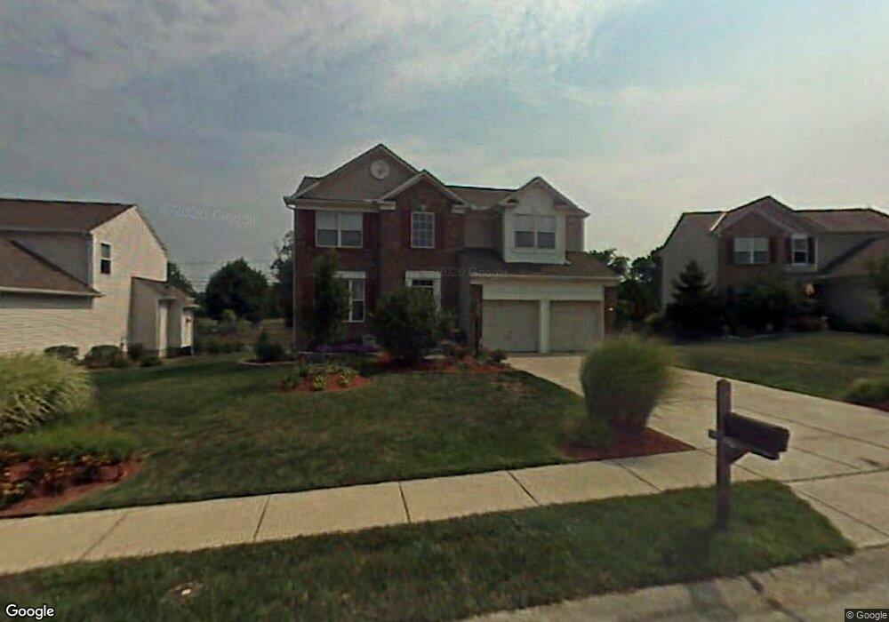
912 Surfridge Dr Hebron, KY 41048
Estimated Value: $360,295 - $405,000
4
Beds
3
Baths
2,002
Sq Ft
$190/Sq Ft
Est. Value
About This Home
This home is located at 912 Surfridge Dr, Hebron, KY 41048 and is currently estimated at $381,074, approximately $190 per square foot. 912 Surfridge Dr is a home located in Boone County with nearby schools including North Pointe Elementary School, Conner Middle School, and Conner High School.
Ownership History
Date
Name
Owned For
Owner Type
Purchase Details
Closed on
Jun 11, 2018
Sold by
Lange Christopher T and Lange Bridget M
Bought by
Lankenau Humberto Gonzalez
Current Estimated Value
Home Financials for this Owner
Home Financials are based on the most recent Mortgage that was taken out on this home.
Original Mortgage
$188,000
Outstanding Balance
$162,589
Interest Rate
4.5%
Mortgage Type
New Conventional
Estimated Equity
$218,486
Purchase Details
Closed on
Jun 19, 2000
Sold by
Ryland Group Inc
Bought by
Lange Christopher T and Lange Bridget M
Home Financials for this Owner
Home Financials are based on the most recent Mortgage that was taken out on this home.
Original Mortgage
$118,000
Interest Rate
8.5%
Mortgage Type
New Conventional
Purchase Details
Closed on
Jan 12, 1999
Sold by
Wyndemere Dev Llc
Bought by
Ryland Group Inc
Create a Home Valuation Report for This Property
The Home Valuation Report is an in-depth analysis detailing your home's value as well as a comparison with similar homes in the area
Home Values in the Area
Average Home Value in this Area
Purchase History
| Date | Buyer | Sale Price | Title Company |
|---|---|---|---|
| Lankenau Humberto Gonzalez | $235,000 | American Homeland Title Agen | |
| Lange Christopher T | $163,805 | -- | |
| Ryland Group Inc | $26,000 | -- |
Source: Public Records
Mortgage History
| Date | Status | Borrower | Loan Amount |
|---|---|---|---|
| Open | Lankenau Humberto Gonzalez | $188,000 | |
| Previous Owner | Lange Christopher T | $118,000 |
Source: Public Records
Tax History Compared to Growth
Tax History
| Year | Tax Paid | Tax Assessment Tax Assessment Total Assessment is a certain percentage of the fair market value that is determined by local assessors to be the total taxable value of land and additions on the property. | Land | Improvement |
|---|---|---|---|---|
| 2024 | $2,740 | $256,600 | $35,000 | $221,600 |
| 2023 | $2,510 | $235,000 | $25,000 | $210,000 |
| 2022 | $2,521 | $235,000 | $25,000 | $210,000 |
| 2021 | $2,592 | $235,000 | $25,000 | $210,000 |
| 2020 | $2,563 | $235,000 | $25,000 | $210,000 |
| 2019 | $2,583 | $235,000 | $25,000 | $210,000 |
| 2018 | $1,920 | $170,500 | $25,000 | $145,500 |
| 2017 | $1,858 | $170,500 | $25,000 | $145,500 |
| 2015 | $1,845 | $170,500 | $25,000 | $145,500 |
| 2013 | -- | $170,500 | $25,000 | $145,500 |
Source: Public Records
Map
Nearby Homes
- 1033 Bloomfield Ct
- 1012 Meadowbrook Ct
- 1770 Marshview Ct
- 1079 Glenhurst Ct
- 1975 Wedgewood Ln
- 803 Lot 6 N Bend Rd Unit 6
- 803 N Bend Rd Unit 6
- 765 N Bend Rd
- 2013 Wyndemere Ct
- 1748 Ledgestone Way
- 1 Rivers Pointe Dr
- 2236 Silver Peak Dr
- Crestwood Plan at Rivers Pointe Estates - Rivers Pointe Estates - 100'
- Oak Hill Plan at Rivers Pointe Estates - Rivers Pointe Estates - 100'
- Champlain Plan at Rivers Pointe Estates - Rivers Pointe Estates - 100'
- Bedford Plan at Rivers Pointe Estates - Rivers Pointe Estates - 100'
- Sebastian Plan at Rivers Pointe Estates - Rivers Pointe Estates - 100'
- Brennan Plan at Rivers Pointe Estates - Rivers Pointe Estates - 100'
- 2305 Bentwood Ct
- 2453 Rivers Pointe Dr
- 916 Surfridge Dr
- 916 Surfridge Dr Unit L 13
- 906 Surfridge Dr
- 920 Surfridge Dr
- 900 Surfridge Dr
- 900 Surfridge Dr Unit L16
- 913 Surfridge Dr
- 913 Surfridge Dr Unit 19
- 924 Surfridge Dr
- 905 Surfridge Dr
- 1009 Bloomfield Ct
- 909 Surfridge Dr
- 1005 Bloomfield Ct
- 2018 Westborough Dr
- 2022 Westborough Dr
- 2000 Westborough Dr
- 2014 Westborough Dr
- 1013 Bloomfield Ct
- 2026 Westborough Dr
- 2006 Westborough Dr