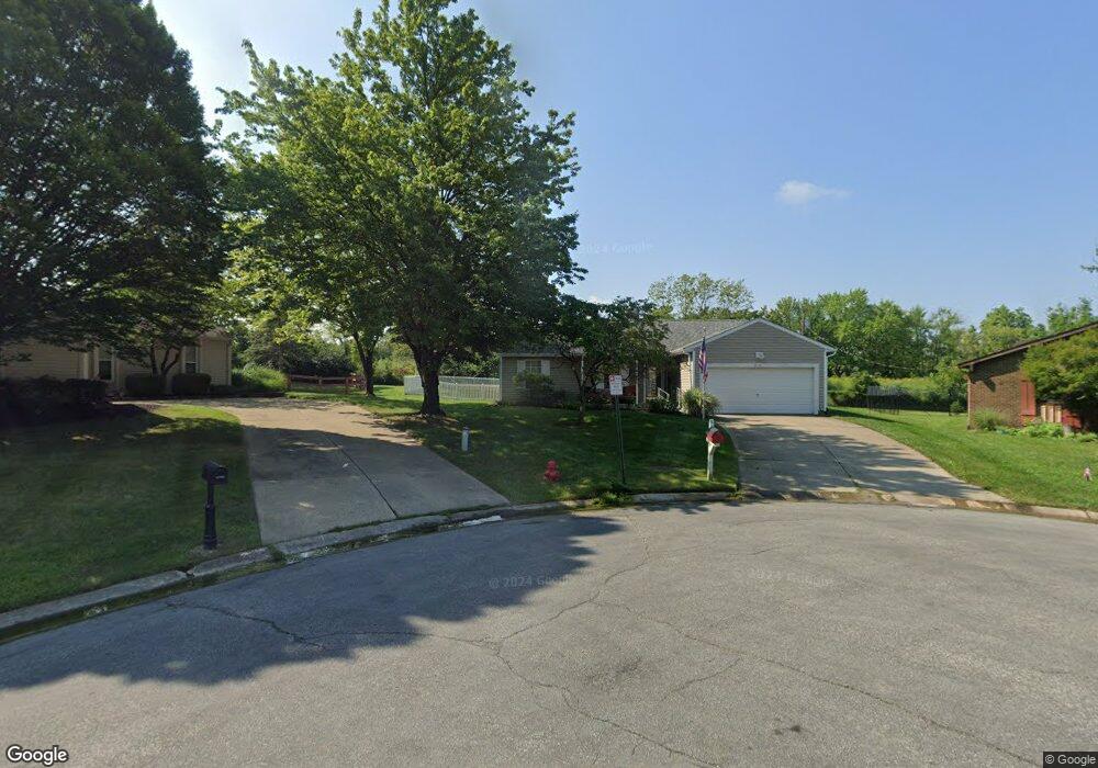
912 Trails End Dr Monroe, OH 45050
Estimated Value: $282,856 - $314,000
3
Beds
2
Baths
1,400
Sq Ft
$211/Sq Ft
Est. Value
About This Home
This home is located at 912 Trails End Dr, Monroe, OH 45050 and is currently estimated at $295,214, approximately $210 per square foot. 912 Trails End Dr is a home located in Butler County with nearby schools including Independence Elementary School, Liberty Junior School, and Lakota East High School.
Ownership History
Date
Name
Owned For
Owner Type
Purchase Details
Closed on
Feb 13, 1998
Sold by
Swift Daniel C and Swift Kimberly D
Bought by
Curtis Melvin S and Curtis Peggy A
Current Estimated Value
Home Financials for this Owner
Home Financials are based on the most recent Mortgage that was taken out on this home.
Original Mortgage
$118,450
Outstanding Balance
$19,165
Interest Rate
7.12%
Mortgage Type
VA
Estimated Equity
$276,049
Purchase Details
Closed on
Oct 1, 1990
Purchase Details
Closed on
Jul 1, 1988
Create a Home Valuation Report for This Property
The Home Valuation Report is an in-depth analysis detailing your home's value as well as a comparison with similar homes in the area
Home Values in the Area
Average Home Value in this Area
Purchase History
| Date | Buyer | Sale Price | Title Company |
|---|---|---|---|
| Curtis Melvin S | $115,000 | -- | |
| -- | $88,000 | -- | |
| -- | $79,900 | -- |
Source: Public Records
Mortgage History
| Date | Status | Borrower | Loan Amount |
|---|---|---|---|
| Open | Curtis Melvin S | $118,450 |
Source: Public Records
Tax History
| Year | Tax Paid | Tax Assessment Tax Assessment Total Assessment is a certain percentage of the fair market value that is determined by local assessors to be the total taxable value of land and additions on the property. | Land | Improvement |
|---|---|---|---|---|
| 2025 | $2,005 | $72,780 | $11,750 | $61,030 |
| 2024 | $2,005 | $72,780 | $11,750 | $61,030 |
| 2023 | $2,172 | $72,780 | $11,750 | $61,030 |
| 2022 | $1,952 | $54,230 | $11,750 | $42,480 |
| 2021 | $1,939 | $54,230 | $11,750 | $42,480 |
| 2020 | $1,995 | $54,230 | $11,750 | $42,480 |
| 2019 | $3,943 | $43,890 | $11,900 | $31,990 |
| 2018 | $1,726 | $43,890 | $11,900 | $31,990 |
| 2017 | $1,761 | $43,890 | $11,900 | $31,990 |
| 2016 | $1,607 | $38,950 | $11,900 | $27,050 |
| 2015 | $1,609 | $38,950 | $11,900 | $27,050 |
| 2014 | $1,828 | $38,950 | $11,900 | $27,050 |
| 2013 | $1,828 | $41,930 | $10,350 | $31,580 |
Source: Public Records
Map
Nearby Homes
- 965 Rustic Ct
- 160 Gorman Ct
- 850 Sands Ave
- 5392 Sunrise View Cir
- 5512 Sunrise View Cir
- 7943 Peaceful Way
- 8031 Paradise Cove
- 7891 Celestial Cir
- 125 Dobbin Ct
- 7574 Woodmere Ct
- 5326 Elmwood Ln
- 1 Kyles Station Rd
- 145 Trotter Ln
- 856 Hocking Meadow Cir
- 5019 Yankee Rd
- 852 Willowbrook Dr
- 7221 Kyles Station Rd
- 329 Ridgeview Ln
- 75 Teil Tree Ct
- 7025 Welney Run
- 913 Trails End Dr
- 910 Trails End Dr
- 908 Trails End Dr
- 909 Trails End Dr
- 904 Trails End Dr
- 905 Trails End Dr
- 916 S Main St
- 0 Cincinnati Dayton Rd
- 912 S Main St
- 908 S Main St
- 55 Stillpass Way
- 65 Stillpass Way
- 85 Stillpass Way
- 901 Trails End Dr
- 105 Stillpass Way
- 5 Stillpass Way
- 4936 Cincinnati Dayton Rd
- 95 Stillpass Way
- 115 Stillpass Way
- 896 Trails End Dr
Your Personal Tour Guide
Ask me questions while you tour the home.