Estimated Value: $46,000 - $99,000
2
Beds
1
Bath
1,056
Sq Ft
$69/Sq Ft
Est. Value
About This Home
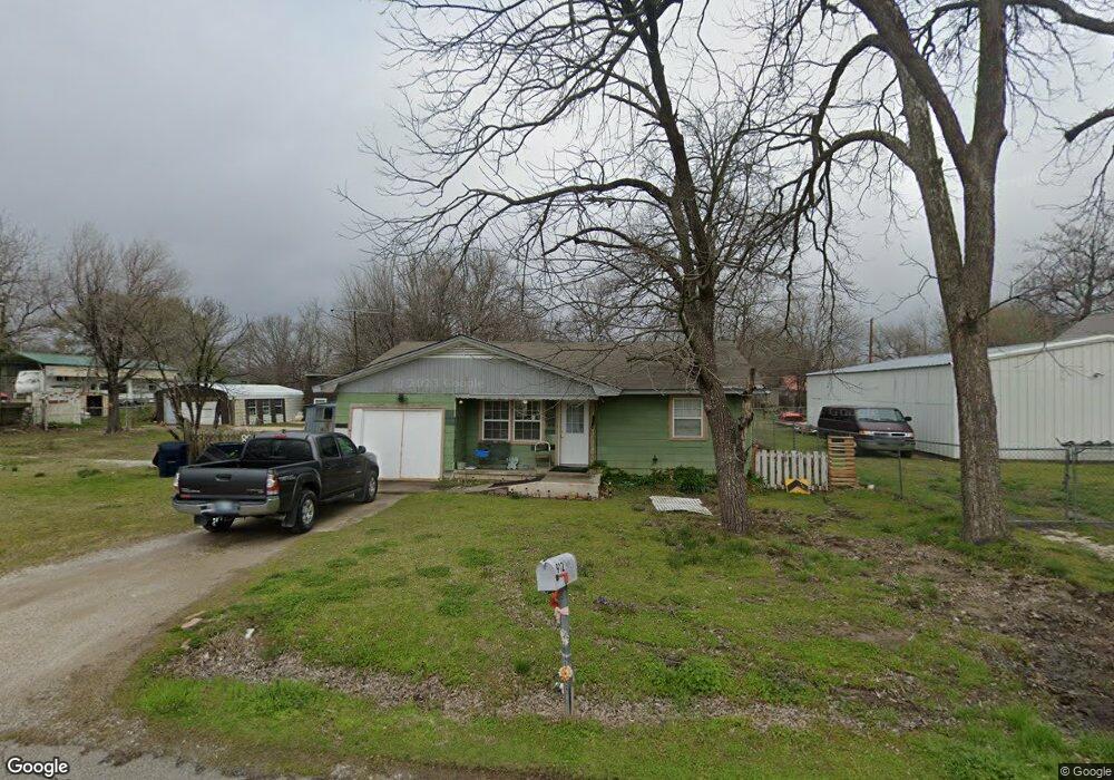
This home is located at 912 W 7th St, Ada, OK 74820 and is currently estimated at $72,799, approximately $68 per square foot. 912 W 7th St is a home located in Pontotoc County with nearby schools including ADA Early Childhood Center, Washington Elementary School, and Hayes Elementary School.
Ownership History
Date
Name
Owned For
Owner Type
Purchase Details
Closed on
Mar 1, 2022
Sold by
Bell and Helen
Bought by
Humble Wacy Jo and Humble Jordan Leigh
Current Estimated Value
Home Financials for this Owner
Home Financials are based on the most recent Mortgage that was taken out on this home.
Original Mortgage
$235,653
Outstanding Balance
$219,189
Interest Rate
3.69%
Mortgage Type
FHA
Estimated Equity
-$146,390
Purchase Details
Closed on
Sep 29, 2011
Sold by
Younts Robert Dillion
Bought by
Younts Melinda Silva
Purchase Details
Closed on
Sep 5, 2011
Sold by
Younts Whitney L
Bought by
Younts Melinda Silva
Purchase Details
Closed on
May 16, 1996
Sold by
Ronnie Ronnie J and Ronnie Grove
Bought by
Robert Lynn Younts
Create a Home Valuation Report for This Property
The Home Valuation Report is an in-depth analysis detailing your home's value as well as a comparison with similar homes in the area
Home Values in the Area
Average Home Value in this Area
Purchase History
| Date | Buyer | Sale Price | Title Company |
|---|---|---|---|
| Humble Wacy Jo | -- | None Listed On Document | |
| Humble Wacy Jo | $240,000 | New Title Company Name | |
| Younts Melinda Silva | -- | None Available | |
| Younts Melinda Silva | -- | None Available | |
| Robert Lynn Younts | $17,000 | -- |
Source: Public Records
Mortgage History
| Date | Status | Borrower | Loan Amount |
|---|---|---|---|
| Open | Humble Wacy Jo | $235,653 |
Source: Public Records
Tax History Compared to Growth
Tax History
| Year | Tax Paid | Tax Assessment Tax Assessment Total Assessment is a certain percentage of the fair market value that is determined by local assessors to be the total taxable value of land and additions on the property. | Land | Improvement |
|---|---|---|---|---|
| 2025 | $162 | $2,630 | $206 | $2,424 |
| 2024 | $162 | $2,553 | $200 | $2,353 |
| 2023 | $162 | $2,479 | $200 | $2,279 |
| 2022 | $147 | $2,479 | $200 | $2,279 |
| 2021 | $124 | $2,336 | $200 | $2,136 |
| 2020 | $122 | $2,268 | $200 | $2,068 |
| 2019 | $116 | $2,202 | $200 | $2,002 |
| 2018 | $105 | $2,138 | $200 | $1,938 |
| 2017 | $93 | $2,076 | $200 | $1,876 |
| 2016 | $88 | $2,016 | $200 | $1,816 |
| 2015 | $84 | $1,957 | $200 | $1,757 |
| 2014 | $74 | $1,900 | $200 | $1,700 |
Source: Public Records
Map
Nearby Homes