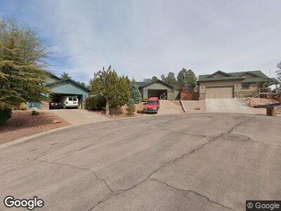
912 W Boulder Ridge Cir Payson, AZ 85541
Estimated Value: $417,366 - $554,000
--
Bed
--
Bath
1,530
Sq Ft
$318/Sq Ft
Est. Value
About This Home
This home is located at 912 W Boulder Ridge Cir, Payson, AZ 85541 and is currently estimated at $486,092, approximately $317 per square foot. 912 W Boulder Ridge Cir is a home located in Gila County with nearby schools including Julia Randall Elementary School, Payson Elementary School, and Rim Country Middle School.
Ownership History
Date
Name
Owned For
Owner Type
Purchase Details
Closed on
Feb 16, 2005
Sold by
Tidwell Kasey and Tidwell Kathleen
Bought by
Hoffman Billy and Hoffman Yvette
Current Estimated Value
Home Financials for this Owner
Home Financials are based on the most recent Mortgage that was taken out on this home.
Original Mortgage
$50,000
Interest Rate
5.66%
Mortgage Type
Future Advance Clause Open End Mortgage
Create a Home Valuation Report for This Property
The Home Valuation Report is an in-depth analysis detailing your home's value as well as a comparison with similar homes in the area
Home Values in the Area
Average Home Value in this Area
Purchase History
| Date | Buyer | Sale Price | Title Company |
|---|---|---|---|
| Hoffman Billy | $245,000 | First Americna Title |
Source: Public Records
Mortgage History
| Date | Status | Borrower | Loan Amount |
|---|---|---|---|
| Open | Hoffman Billy | $258,250 | |
| Closed | Hoffman Billy | $183,500 | |
| Closed | Hoffman Billy | $107,000 | |
| Closed | Hoffman Billy | $50,000 | |
| Closed | Hoffman Billy | $195,900 |
Source: Public Records
Tax History Compared to Growth
Tax History
| Year | Tax Paid | Tax Assessment Tax Assessment Total Assessment is a certain percentage of the fair market value that is determined by local assessors to be the total taxable value of land and additions on the property. | Land | Improvement |
|---|---|---|---|---|
| 2025 | $2,369 | -- | -- | -- |
| 2024 | $2,369 | $33,282 | $6,356 | $26,926 |
| 2023 | $2,369 | $30,133 | $5,570 | $24,563 |
| 2022 | $2,290 | $21,493 | $4,544 | $16,949 |
| 2021 | $2,153 | $21,493 | $4,544 | $16,949 |
| 2020 | $2,060 | $0 | $0 | $0 |
| 2019 | $1,996 | $0 | $0 | $0 |
| 2018 | $1,867 | $0 | $0 | $0 |
| 2017 | $1,737 | $0 | $0 | $0 |
| 2016 | $1,709 | $0 | $0 | $0 |
| 2015 | $1,658 | $0 | $0 | $0 |
Source: Public Records
Map
Nearby Homes
- 919 W Landmark Trail
- 906 W Wilderness Trail
- 910 W Sundance Cir
- 606 N Boulder Ridge Rd
- 608 N Wilderness Trail
- 1005 W Rock Spring Cir
- 908 W Sherwood Dr
- 807 N Oak Point Cir
- 507 N Blue Spruce Rd
- 1005 W Rock Springs Cir
- 603 N Blue Spruce Rd
- 804 N Wilderness Cir
- 807 N Thunder Ridge Cir
- 802 N Falconcrest Dr
- 802 N Falconcrest Dr Unit 14
- 825 W Sierra Cir
- 815 N Blue Spruce Cir
- 819 N Blue Spruce Cir
- 1005 W Falcon Lookout Ln Unit 10
- 804 N Falconcrest Dr Unit 13
- 912 W Boulder Ridge Cir
- 914 W Boulder Ridge Cir
- 907 W Antler Cir
- 910 W Boulder Ridge Cir
- 906 W Antler Cir
- 916 W Boulder Ridge Cir
- 911 W Boulder Ridge Cir
- 907 W Sundance Cir
- 909 W Sundance Cir
- 904 W Antler Cir
- 913 W Boulder Ridge Cir
- 905 W Sundance Cir
- 915 W Boulder Ridge Cir
- 911 W Sundance Cir
- 912 W Landmark Trail
- 910 W Landmark Trail Unit 2
- 914 W Landmark Trail
- 908 W Landmark Trail
- 903 W Antler Cir Unit 255
- 903 W Antler Cir