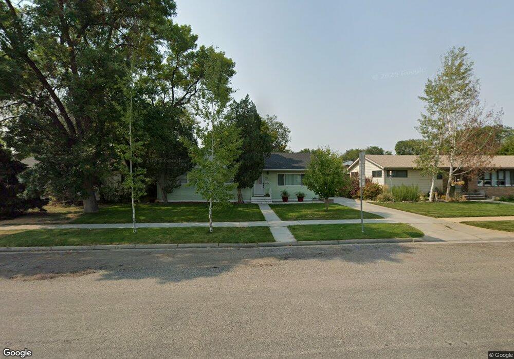
912 Washington Ave Laurel, MT 59044
Estimated Value: $296,000 - $344,000
3
Beds
1
Bath
1,329
Sq Ft
$238/Sq Ft
Est. Value
About This Home
This home is located at 912 Washington Ave, Laurel, MT 59044 and is currently estimated at $315,753, approximately $237 per square foot. 912 Washington Ave is a home located in Yellowstone County with nearby schools including Fred W. Graff School, West School, and Laurel Middle School.
Ownership History
Date
Name
Owned For
Owner Type
Purchase Details
Closed on
Jul 6, 2021
Sold by
Lee Barbara Lee
Bought by
Merrifield Brett and Merrifield Sarah
Current Estimated Value
Home Financials for this Owner
Home Financials are based on the most recent Mortgage that was taken out on this home.
Original Mortgage
$207,000
Outstanding Balance
$187,820
Interest Rate
2.9%
Mortgage Type
New Conventional
Estimated Equity
$127,933
Purchase Details
Closed on
Jul 24, 2014
Sold by
Zaparynuk Lance L and Zaparynuk Danielle
Bought by
Lee Barbara Lee
Purchase Details
Closed on
Sep 25, 2012
Sold by
Estate Of Virginia Gauthier
Bought by
Zaparynuk Lance L and Zaparynuk Danielle
Home Financials for this Owner
Home Financials are based on the most recent Mortgage that was taken out on this home.
Original Mortgage
$151,020
Interest Rate
3.63%
Mortgage Type
New Conventional
Create a Home Valuation Report for This Property
The Home Valuation Report is an in-depth analysis detailing your home's value as well as a comparison with similar homes in the area
Home Values in the Area
Average Home Value in this Area
Purchase History
| Date | Buyer | Sale Price | Title Company |
|---|---|---|---|
| Merrifield Brett | -- | Stewart Title Company | |
| Lee Barbara Lee | -- | None Available | |
| Zaparynuk Lance L | -- | None Available |
Source: Public Records
Mortgage History
| Date | Status | Borrower | Loan Amount |
|---|---|---|---|
| Open | Merrifield Brett | $207,000 | |
| Previous Owner | Zaparynuk Lance L | $151,020 |
Source: Public Records
Tax History
| Year | Tax Paid | Tax Assessment Tax Assessment Total Assessment is a certain percentage of the fair market value that is determined by local assessors to be the total taxable value of land and additions on the property. | Land | Improvement |
|---|---|---|---|---|
| 2025 | $2,522 | $319,900 | $63,078 | $256,822 |
| 2024 | $2,522 | $247,800 | $41,117 | $206,683 |
| 2023 | $2,332 | $247,800 | $41,117 | $206,683 |
| 2022 | $2,043 | $203,900 | $0 | $0 |
| 2021 | $1,893 | $183,900 | $0 | $0 |
| 2020 | $1,874 | $182,800 | $0 | $0 |
| 2019 | $1,906 | $182,800 | $0 | $0 |
| 2018 | $1,836 | $170,500 | $0 | $0 |
| 2017 | $1,706 | $170,500 | $0 | $0 |
| 2016 | $1,523 | $151,500 | $0 | $0 |
| 2015 | $1,506 | $151,500 | $0 | $0 |
| 2014 | $1,437 | $75,525 | $0 | $0 |
Source: Public Records
Map
Nearby Homes
- 1003 Montana Ave
- 516 Pennsylvania Ave
- 601 E 5th St
- 109 E 12th St
- 717 E 5th, 506 Alder Ave
- 717 E 5th St
- 1008 Sunhaven Dr
- 1104 E 8th St
- 110 E 5th St
- 1108 E 8th St
- 801 E 4th St
- 1106 Sunhaven Dr
- 605 Date Ave
- 1031 Fir Ave
- 611 Elm Ave
- 1319 Valley Dr
- 116 4th Ave
- 1109 10th Ave
- 310 (and 814 w 4) 8th Ave
- 1013 W 12th St
- 916 Washington Ave
- 908 Washington Ave
- 520 E Maryland Ln
- 902 Washington Ave
- 911 Wyoming Ave
- 913 Wyoming Ave
- 907 Wyoming Ave
- 919 Wyoming Ave
- 901 Wyoming Ave
- 000 E 9th St
- 820 Washington Ave
- 819 Wyoming Ave
- 1002 Golden Spike Dr
- 814 Washington Ave
- 1001 Golden Spike Cir
- 1003 Golden Spike Cir
- 1003 Golden Spike Cir
- 1002 Golden Spike Cir
- 1004 Golden Spike Dr
- 912 Wyoming Ave
Your Personal Tour Guide
Ask me questions while you tour the home.