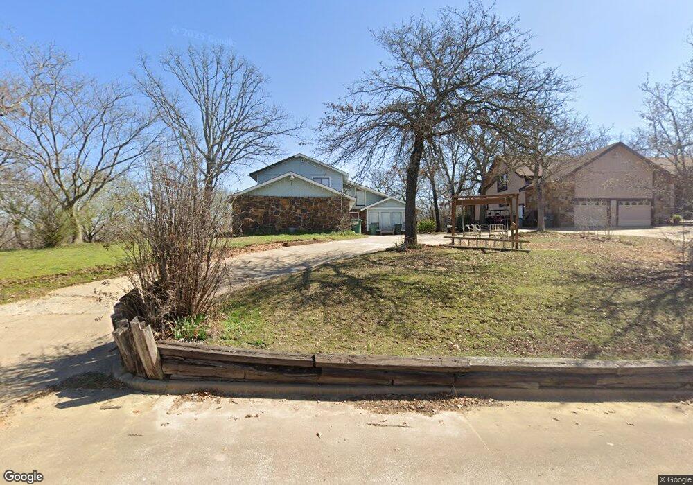
9123 Eisenhower St Sapulpa, OK 74066
Estimated Value: $338,000 - $382,000
3
Beds
3
Baths
2,667
Sq Ft
$132/Sq Ft
Est. Value
About This Home
This home is located at 9123 Eisenhower St, Sapulpa, OK 74066 and is currently estimated at $351,982, approximately $131 per square foot. 9123 Eisenhower St is a home located in Creek County with nearby schools including Sapulpa Junior High School, Sapulpa Middle School, and Sapulpa High School.
Ownership History
Date
Name
Owned For
Owner Type
Purchase Details
Closed on
Nov 19, 2019
Sold by
Graham Lary D
Bought by
Reynolds Cody
Current Estimated Value
Purchase Details
Closed on
Aug 18, 2008
Sold by
Fritz Paul
Bought by
Mills Michelle
Purchase Details
Closed on
Aug 14, 2008
Sold by
Fritz Paul
Bought by
Fritz Paul
Purchase Details
Closed on
Aug 13, 2008
Sold by
Fritz Paul
Bought by
Mills Michelle A
Create a Home Valuation Report for This Property
The Home Valuation Report is an in-depth analysis detailing your home's value as well as a comparison with similar homes in the area
Home Values in the Area
Average Home Value in this Area
Purchase History
| Date | Buyer | Sale Price | Title Company |
|---|---|---|---|
| Reynolds Cody | -- | None Available | |
| Mills Michelle | $20,000 | None Available | |
| Fritz Paul | -- | None Available | |
| Mills Michelle A | -- | None Available |
Source: Public Records
Tax History Compared to Growth
Tax History
| Year | Tax Paid | Tax Assessment Tax Assessment Total Assessment is a certain percentage of the fair market value that is determined by local assessors to be the total taxable value of land and additions on the property. | Land | Improvement |
|---|---|---|---|---|
| 2025 | $2,983 | $29,976 | $5,400 | $24,576 |
| 2024 | $2,983 | $28,549 | $5,400 | $23,149 |
| 2023 | $2,983 | $27,189 | $5,400 | $21,789 |
| 2022 | $2,578 | $25,894 | $5,400 | $20,494 |
| 2021 | $2,510 | $24,661 | $5,400 | $19,261 |
| 2020 | $2,418 | $23,487 | $5,400 | $18,087 |
| 2019 | $2,620 | $24,969 | $5,400 | $19,569 |
| 2018 | $2,733 | $25,617 | $5,400 | $20,217 |
| 2017 | $2,680 | $25,066 | $5,330 | $19,736 |
| 2016 | $2,277 | $23,873 | $5,178 | $18,695 |
| 2015 | -- | $23,178 | $5,090 | $18,088 |
| 2014 | -- | $22,503 | $5,004 | $17,499 |
Source: Public Records
Map
Nearby Homes
- 12466 W 91st Place S
- 0 S 113th West Ave
- 0 Tracie Ln
- 8 E Carriage Rd
- 6 E Carriage Rd
- 114 Sherlyn Ln
- 10541 Sahoma Lake Rd
- 1124 N 9th St
- 8420 S 145th West Ave
- 720 N Main St
- 8228 S 145th Ave W Unit Tract 2
- 8228 S 145th Ave W
- 716 N 10th St
- 00 Sahoma Lake Rd
- 0 N Johannes St Unit 2546940
- 115 W Anderson St
- 912 N Linden St
- 0 N Mann St
- 0 N 13th St
- 0 N Gray St
- 9133 Eisenhower St
- 9133 E Eisenhower
- 9109 Eisenhower St
- 9108 Custer St
- 9174 Eisenhower St
- 9280 Eisenhower St
- 9120 Eisenhower St
- 0 Eisenhower St
- 9277 Eisenhower St
- 9106 Eisenhower St
- 9205 Eisenhower St
- 9104 Custer St
- 9100 Custer St
- 9230 Custer St
- 9180 Custer St
- 9109 Grant St
- 9133 Custer St
- 9200 Custer St
- 9173 Custer St
- 9203 Grant St